
Crestwood, Missouri facts for kids
Quick facts for kids
Crestwood, Missouri
|
||
|---|---|---|
|
||

Location of Crestwood, Missouri
|
||
| Country | United States | |
| State | Missouri | |
| County | St. Louis | |
| Area | ||
| • Total | 3.59 sq mi (9.29 km2) | |
| • Land | 3.59 sq mi (9.29 km2) | |
| • Water | 0.00 sq mi (0.00 km2) | |
| Elevation | 614 ft (187 m) | |
| Population
(2020)
|
||
| • Total | 12,404 | |
| • Density | 3,459.01/sq mi (1,335.55/km2) | |
| Time zone | UTC-6 (Central (CST)) | |
| • Summer (DST) | UTC-5 (CDT) | |
| ZIP code | ||
| FIPS code | 29-17218 | |
| GNIS feature ID | 2393672 | |
| Website | http://www.cityofcrestwood.org | |

Crestwood is a friendly city located in St. Louis County, Missouri, in the United States. It's part of the larger Greater St. Louis area. In 2010, about 11,912 people lived here. A cool fact: in 2011, Bloomberg Businessweek magazine called Crestwood the "Best Place to Raise Kids in Missouri"! This was because of its great schools and excellent city services.
Contents
Exploring Crestwood's Geography
Crestwood covers an area of about 3.60 square miles (9.29 square kilometers). All of this land is dry, with no large bodies of water inside the city limits.
Parks and Outdoor Fun
Crestwood is known for its awesome public parks.
- Crestwood Park has fields for baseball and soccer. It also has a fun playground and tennis courts.
- Whitecliff Park is home to the Crestwood Community Center. It also has the Crestwood Aquatic Center, which is a public water park!
Right next to Whitecliff Park, you'll find Grant's Farm. This animal reserve is owned by Anheuser-Busch. It's free to visit during the summer. At Grant's Farm, you can see animals like buffalo, zebras, and deer roaming freely. This land used to belong to former U.S. president Ulysses S. Grant a long time ago.
Historical Connections
Crestwood has some interesting history. It's the burial place of Sgt. John Sappington. He was a soldier in the American Revolutionary War. He even served as a personal bodyguard to Gen. George Washington! The Sappington family owned a lot of land in this area. You can still see some of their old homes nearby. The Sappington Cemetery is looked after by the City of Crestwood.
Another important historical figure buried here is Reverend Moses Dickson. He is buried in Father Dickson Cemetery. Crestwood is also a stop along Grant's Trail, a popular path for biking and walking in St. Louis County, Missouri.
Who Lives in Crestwood?
| Historical population | |||
|---|---|---|---|
| Census | Pop. | %± | |
| 1950 | 1,645 | — | |
| 1960 | 11,106 | 575.1% | |
| 1970 | 15,123 | 36.2% | |
| 1980 | 12,815 | −15.3% | |
| 1990 | 11,234 | −12.3% | |
| 2000 | 11,863 | 5.6% | |
| 2010 | 11,912 | 0.4% | |
| 2020 | 12,404 | 4.1% | |
| U.S. Decennial Census | |||
Crestwood's Population in 2020
The 2020 United States census counted 12,404 people living in Crestwood. Most people in Crestwood are white (about 89%). There are also people of Black, Asian, Native American, and Pacific Islander backgrounds. About 2.8% of the population is Hispanic or Latino.
Many households (about 28.7%) have children under 18. Most households (61.1%) are married couples living together. The average household has about 2.5 people. The average family has about 2.9 people.
The median age in Crestwood was about 41.9 years old. This means half the people are younger than 41.9 and half are older. About 18.8% of the people are under 18 years old.
Crestwood's Population in 2010
As of the census in 2010, there were 11,912 people living in Crestwood. The population density was about 3,308.9 people per square mile. Most residents (93.8%) were White. Other groups included African American (1.6%), Asian (2.4%), and Native American (0.2%). About 1.9% of the population was Hispanic or Latino.
About 25.4% of households had children under 18. The average household size was 2.29 people. The average family size was 2.87 people. The median age in the city was 46 years.
How Crestwood is Governed
The city of Crestwood is run by a mayor and a board of aldermen. The board has eight aldermen, with two from each of the city's four areas, called wards. Both the mayor and the aldermen are elected for three-year terms. The current mayor is Scott Shipley.
The current aldermen are:
- Ward 1: James Zavist (elected April 2022) and Jesse Morrison (elected April 2021)
- Ward 2: Mike Balles (elected April 2022) and Justin Charbonneau (re-elected April 2021)
- Ward 3: Greg Hall (re-elected in 2022) and Grant Mabie (appointed April 2023)
- Ward 4: Tony Kennedy (re-elected April 2022) and John Sebben (elected April 2021)
Schools in Crestwood
Most of Crestwood is served by Lindbergh Schools. A smaller part of the city is served by the Affton School District. The high schools for these districts are Lindbergh High School and Affton High School.
Public Schools in Crestwood
Here are some public schools from the Lindbergh District that are located within Crestwood:
- Crestwood Elementary School
- Long Elementary School
- Truman Middle School (this school is partly in Crestwood and partly in Sunset Hills)
Private Schools in Crestwood
Holy Cross Academy is a private school located in Crestwood.
Nearby Schools
There are also several schools close to Crestwood:
- Senior High Schools:
- Grade Schools:
- Christ Community Lutheran School (in Webster Groves)
- Queen of Holy Rosary School (in Webster Groves)
- St. Justin The Martyr School (in Sunset Hills)
Crestwood Police Department
Crestwood has its own police department. It has a total of 27 employees who work to keep the city safe.
Images for kids
-
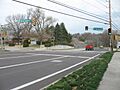
Sappington Road, Crestwood, MO
-
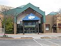
Crestwood Court, a shopping mall on Watson Road that was taken down in 2017.


See also
 In Spanish: Crestwood (Misuri) para niños
