Danville, New Hampshire facts for kids
Quick facts for kids
Danville, New Hampshire
|
|
|---|---|

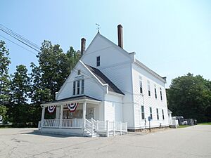
Town hall
|
|

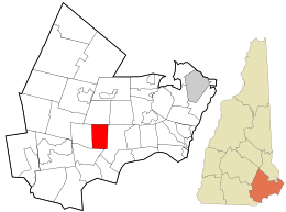
Location in Rockingham County and the state of New Hampshire.
|
|
| Country | United States |
| State | New Hampshire |
| County | Rockingham |
| Incorporated | 1760 |
| Villages |
|
| Government | |
| • Type | Town Meeting (SB2) |
| Area | |
| • Total | 11.83 sq mi (30.64 km2) |
| • Land | 11.65 sq mi (30.17 km2) |
| • Water | 0.18 sq mi (0.47 km2) 1.53% |
| Elevation | 203 ft (62 m) |
| Population
(2020)
|
|
| • Total | 4,408 |
| • Density | 378/sq mi (146.1/km2) |
| Time zone | UTC-5 (Eastern) |
| • Summer (DST) | UTC-4 (Eastern) |
| ZIP code |
03819
|
| Area code(s) | 603 |
| FIPS code | 33-17140 |
| GNIS feature ID | 0873575 |
Danville is a small town in Rockingham County, New Hampshire, United States. In 2020, about 4,408 people lived here. Danville is part of the Timberlane Regional School District. Students attend Danville Elementary, Timberlane Regional Middle, and Timberlane Regional High School.
Contents
History of Danville

Danville started as part of a larger area called Kingstown in 1694. This western part of Kingstown was known as "Hawke." Some families lived in this area as early as the mid-1600s. The first official settlements began around 1735.
Traveling to the main meeting house in Kingstown was difficult for people in Hawke. The roads were mostly just footpaths. So, in 1755, the people of Hawke built their own meeting house. It is now called the Old Meeting House.
On January 2, 1760, they asked the Governor to become their own town. Their request was approved on February 22, 1760, and Hawke officially became a town.
Early Challenges and Changes
A sad event in Hawke's history was the Tuckertown smallpox outbreak. This happened in the winter of 1781–1782. Reverend John Page bravely helped those who were sick. Sadly, he also became ill and passed away.
After the American Revolution, farming was still the main way people made a living. However, new industries were slowly starting to appear. By 1828–1829, there were eight mills in town for different purposes.
Travel became more important. From 1790 to the mid-1800s, the town spent a lot of money on building and fixing roads. Back then, a road builder could tax people who would benefit from the road. People could even work off their tax by helping build the roads.
In 1836, the town decided to change its name from "Hawke" to "Danville." The original name "Hawke" was after a British Admiral. No one knows for sure why they changed it or why they also thought about the name "China."
Life Before the Civil War
In the years before the Civil War, Danville was a typical New England farming town. Most people were farmers. However, home industries and small businesses became more common.
Places like Sawmills (for cutting wood), cooperages (for making barrels), and blacksmith shops (for working with metal) helped farmers earn extra money. People also made shoes at home. These shoes were then sent to bigger towns like Haverhill, Massachusetts.
Religion was very important to the people of Danville. The town's two main churches were built during this time. The Baptist Church started in 1820. The Free Will Baptist Society built their church in 1832. It is now next to the Town Hall. In 1850, another church was built on Beach Plain Road.
Geography of Danville
Danville covers about 30.6 square kilometers (about 11.8 square miles). Most of this area is land (30.2 square kilometers), and a small part is water (0.5 square kilometers).
The highest point in Danville is Rock Rimmon Hill. It is over 350 feet (107 meters) above sea level. Most of Danville's water flows into the Merrimack River. The northern part of town drains into the Piscataqua River.
Neighboring Towns
Danville shares borders with these towns:
Population Information
| Historical population | |||
|---|---|---|---|
| Census | Pop. | %± | |
| 1840 | 538 | — | |
| 1850 | 614 | 14.1% | |
| 1860 | 629 | 2.4% | |
| 1870 | 548 | −12.9% | |
| 1880 | 613 | 11.9% | |
| 1890 | 666 | 8.6% | |
| 1900 | 615 | −7.7% | |
| 1910 | 517 | −15.9% | |
| 1920 | 463 | −10.4% | |
| 1930 | 406 | −12.3% | |
| 1940 | 457 | 12.6% | |
| 1950 | 508 | 11.2% | |
| 1960 | 605 | 19.1% | |
| 1970 | 924 | 52.7% | |
| 1980 | 1,318 | 42.6% | |
| 1990 | 2,534 | 92.3% | |
| 2000 | 4,023 | 58.8% | |
| 2010 | 4,387 | 9.0% | |
| 2020 | 4,408 | 0.5% | |
| U.S. Decennial Census | |||
In 2000, about 4,023 people lived in Danville. There were 1,428 households, and 1,122 families. The town's population density was about 133 people per square kilometer. Most residents were White (97.59%).
About 42.3% of households had children under 18 living with them. The average household had 2.82 people. The average family had 3.18 people.
The population was spread out by age. About 29.2% were under 18. About 37.0% were between 25 and 44 years old. The median age was 35 years. This means half the people were younger than 35, and half were older.
Transportation in Danville
Two main roads in New Hampshire pass through Danville:
- NH 111 goes through southern Danville. It connects to Hampstead and Kingston.
- NH 111A starts in southern Danville where NH 111 enters town. It goes north along Main Street and leaves at the border with Fremont.
See also
 In Spanish: Danville (Nuevo Hampshire) para niños
 | Claudette Colvin |
 | Myrlie Evers-Williams |
 | Alberta Odell Jones |

