Sandown, New Hampshire facts for kids
Quick facts for kids
Sandown, New Hampshire
|
|
|---|---|
|
Town
|
|

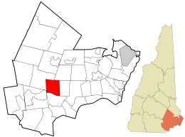
Location in Rockingham County and the state of New Hampshire.
|
|
| Country | United States |
| State | New Hampshire |
| County | Rockingham |
| Incorporated | 1756 |
| Area | |
| • Total | 14.4 sq mi (37.4 km2) |
| • Land | 13.9 sq mi (36.1 km2) |
| • Water | 0.5 sq mi (1.3 km2) 3.39% |
| Elevation | 232 ft (71 m) |
| Population
(2020)
|
|
| • Total | 6,548 |
| • Density | 470/sq mi (181.4/km2) |
| Time zone | UTC-5 (Eastern) |
| • Summer (DST) | UTC-4 (Eastern) |
| ZIP code |
03873
|
| Area code(s) | 603 |
| FIPS code | 33-67620 |
| GNIS feature ID | 0873716 |
Sandown is a small town located in Rockingham County, New Hampshire, in the United States. In 2020, about 6,548 people lived there. This was an increase from 5,986 people counted in 2010.
Contents
History of Sandown

Sandown was once part of a larger town called Kingston. In 1756, it became its own separate town. This happened thanks to the colonial governor, Benning Wentworth. The town was named after a beautiful place called Sandown on the Isle of Wight in England.
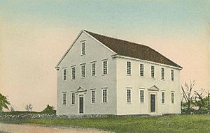
The first minister in Sandown was Reverend Josiah Cotton. He helped build the Sandown Meeting House in 1774. This building is a great example of early New England church design. It had a tall pulpit and marble columns that supported a gallery.
Geography of Sandown
Sandown covers a total area of about 37.4 square kilometers (about 14.4 square miles). Most of this area, about 36.1 square kilometers (13.9 square miles), is land. The remaining 1.3 square kilometers (0.5 square miles) is water, which makes up about 3.39% of the town.
Most of Sandown's water flows into the Exeter River. This river is part of the larger Great Bay and Piscataqua River system. Phillips Pond and Showell Pond are two water bodies that drain north into the Exeter River. Angle Pond and Cub Pond, located in the eastern part of town, drain east towards the Powwow River. These ponds are part of the Merrimack River system.
The highest point in Sandown is the top of Hoyt Hill. It stands about 505 feet (154 meters) above sea level. You can find it near the southwestern corner of the town.
Neighboring Towns
Sandown shares its borders with several other towns:
- Fremont (to the northeast)
- Danville (to the east)
- Hampstead (to the south)
- Derry (to the southwest)
- Chester (to the northwest)
Population Changes in Sandown
| Historical population | |||
|---|---|---|---|
| Census | Pop. | %± | |
| 1790 | 561 | — | |
| 1800 | 501 | −10.7% | |
| 1810 | 504 | 0.6% | |
| 1820 | 527 | 4.6% | |
| 1830 | 553 | 4.9% | |
| 1840 | 525 | −5.1% | |
| 1850 | 566 | 7.8% | |
| 1860 | 553 | −2.3% | |
| 1870 | 496 | −10.3% | |
| 1880 | 500 | 0.8% | |
| 1890 | 475 | −5.0% | |
| 1900 | 400 | −15.8% | |
| 1910 | 380 | −5.0% | |
| 1920 | 280 | −26.3% | |
| 1930 | 229 | −18.2% | |
| 1940 | 292 | 27.5% | |
| 1950 | 315 | 7.9% | |
| 1960 | 366 | 16.2% | |
| 1970 | 741 | 102.5% | |
| 1980 | 2,057 | 177.6% | |
| 1990 | 4,060 | 97.4% | |
| 2000 | 5,143 | 26.7% | |
| 2010 | 5,986 | 16.4% | |
| 2020 | 6,548 | 9.4% | |
| U.S. Decennial Census | |||
The population of Sandown has changed a lot over the years. In 1790, there were 561 people. The population slowly grew, then saw a big increase starting in the 1970s. By 2020, the town had 6,548 residents.
In 2000, the average household in Sandown had about 3 people. Many households, around 48.7%, had children under 18 living with them. The median age of people in Sandown was 35 years old.
Education in Sandown
Students in Sandown attend schools within the Timberlane Regional School District. Here are the schools:
- Timberlane Regional High School: This school is for students in Grades 9–12. It is located in Plaistow.
- Timberlane Regional Middle School: This school serves Grades 6–8 and is also in Plaistow.
- Sandown North Elementary School: This school is for Grades 1–5 and is located right in Sandown.
- Sandown Central School: This school is for Pre-Kindergarten students and is also in Sandown.
Transportation in Sandown
Two main state roads pass through Sandown, helping people travel around the area.
- NH 121: This route goes through the very southwestern part of town. It connects Chester (passing through a small part of Derry) to Hampstead.
- NH 121A: This is the main road that runs through the center of Sandown. It stretches from Chester in the west to the village of East Hampstead in the southeast. Locally, people know this road as Main Street.
See also
 In Spanish: Sandown (Nuevo Hampshire) para niños
 | DeHart Hubbard |
 | Wilma Rudolph |
 | Jesse Owens |
 | Jackie Joyner-Kersee |
 | Major Taylor |

