Deertrap Mountain facts for kids
Quick facts for kids Deertrap Mountain |
|
|---|---|

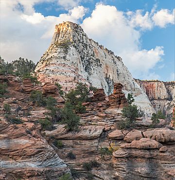
South aspect, from Zion – Mount Carmel Highway
|
|
| Highest point | |
| Elevation | 6,837 ft (2,084 m) |
| Prominence | 80 ft (24 m) |
| Isolation | 0.68 mi (1.09 km) |
| Parent peak | Twin Brothers (6,863 ft) |
| Geography | |
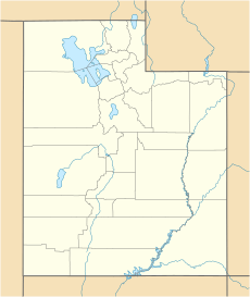
| Location | Zion National Park Washington County, Utah United States |
| Parent range | Colorado Plateau |
| Topo map | USGS Springdale East |
| Geology | |
| Age of rock | Jurassic |
| Type of rock | Navajo sandstone |
| Climbing | |
| Easiest route | Hiking class 1 Trail |
Deertrap Mountain is a tall peak, 6,837 feet (2,084 meters) high. It's located in Zion National Park, in southwest Utah, United States. This mountain is made of white Navajo Sandstone. It sits on the eastern edge of Zion Canyon.
You can find Deertrap Mountain about one mile southeast of Zion Lodge. It's also three miles northeast of the park's main office. Nearby peaks include Mountain of the Sun to the west. The Twin Brothers peak is a bit taller and southwest of Deertrap. The East Temple is to the south-southwest, and Ant Hill is to the southeast.
Pine Creek starts at Deertrap Mountain. Rainwater from the mountain flows into the North Fork of the Virgin River. The name "Deertrap Mountain" became official on April 4, 1934. It's believed that the Southern Paiute people used to guide mule deer onto this flat-topped mountain. They would trap the deer here for food.
What's the Weather Like?
The best times to visit Deertrap Mountain are spring and fall. The area has a "cold semi-arid climate." This means winters are cold, with average temperatures below freezing (0°C or 32°F). Most of the rain and snow falls during spring and summer.
This desert climate gets less than 10 inches (250 mm) of rain each year. Snowfall is usually light during the winter months.
 | Shirley Ann Jackson |
 | Garett Morgan |
 | J. Ernest Wilkins Jr. |
 | Elijah McCoy |


