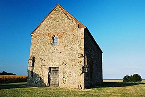
Dengie Peninsula facts for kids
Dengie is a special piece of land in Essex, England. It is called a peninsula because it is almost completely surrounded by water. Long ago, it was also known as a 'hundred,' which was a type of old district. Sometimes people spelled its name Dengy.
The Dengie peninsula has water on three sides. To the south is the River Crouch. To the north is the River Blackwater. Both of these rivers have tides, meaning their water levels change with the sea. The North Sea is to the east. The eastern part of Dengie is very wet and marshy. This area is a special place called the Dengie Marshes, which is a nature reserve.
The western edge of the old Dengie 'hundred' stretched from North Fambridge to just west of Maldon. Today, the Dengie peninsula makes up about half of the Maldon district, which is a local government area.
Here are some of the towns and villages you can find on the Dengie peninsula:

- Althorne
- Asheldham
- Bradwell-on-Sea
- Bradwell Waterside
- Burnham-on-Crouch
- Cold Norton
- Creeksea
- Dengie (village)
- Hazeleigh
- Langford
- Latchingdon
- Maldon
- Mayland
- Maylandsea
- Mundon
- North Fambridge
- Ostend
- Purleigh
- Ramsey Island
- Snoreham
- Southminster
- Steeple
- Stow Maries
- St Lawrence Bay
- Tillingham
- Woodham Mortimer
- Woodham Walter
Farming on the Dengie Peninsula
The soil on the Dengie Peninsula is very rich. This makes it a great place for growing crops. The area also usually has mild winters, which helps plants grow well.
The Dengie Peninsula is home to some of the oldest and largest vineyards in the UK. Vineyards are places where grapes are grown to make wine. Some of these vineyards include:
- Clayhill Vineyard
- New Hall Vineyard
 | Frances Mary Albrier |
 | Whitney Young |
 | Muhammad Ali |

