Desatoya Peak facts for kids
Quick facts for kids Desatoya Peak (South) |
|
|---|---|
| Highest point | |
| Elevation | 9,977 ft (3,041 m) NAVD 88 |
| Prominence | 3,545 ft (1,081 m) |
| Listing | Nevada County High Points 12th |
| Geography | |
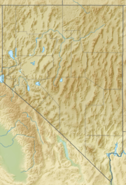
| Location | Churchill / Lander, counties, Nevada, U.S. |
| Parent range | Desatoya Mountains |
| Topo map | USGS Desatoya Peak |
Desatoya Peak is a really tall mountain located in Nevada, United States. It's the highest point in the Desatoya Mountains and also in Churchill County. This mountain actually has two main tops! The south peak is the tallest, reaching about 9,977 feet (3,041 m) high. The north peak is just a little bit shorter, at 9,970 feet (3,039 m).
Desatoya Peak sits right on the border between Churchill County and Lander County. It's about 38 miles (61 km) west of Austin and 55 miles (89 km) east of Fallon. The land around the peak is public, managed by the Bureau of Land Management, so people can visit it.
Wildlife and Nature
The area around Desatoya Peak is a special place for nature. About 51,402 acres (20,802 ha) of land here is part of the Desatoya Mountains Wilderness Study Area. This area is protected and managed by the Bureau of Land Management.
Many different animals live here. You might spot a mountain lion, mule deer, or a gray fox. Birds like the sage grouse, red-tailed hawk, and golden eagle also call this place home. Small, furry animals called pika live among the rocks.
Some of the streams flowing down Desatoya Peak have water all year round. These streams are home to different kinds of fish, including brook trout and Humboldt cutthroat trout. It's a great example of how different animals and plants can live together in one natural space.
 | Chris Smalls |
 | Fred Hampton |
 | Ralph Abernathy |


