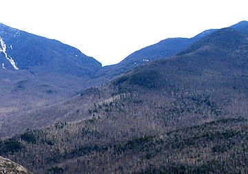
Dial Mountain facts for kids
Quick facts for kids Dial Mountain |
|
|---|---|

Dial Mtn (near right) from Noonmark, showing Mount Dix (left), Hunter Pass, (center)
|
|
| Highest point | |
| Elevation | 4003+ feet (1220+ m) NGVD 29 |
| Prominence | 164 ft (50 m) |
| Listing | Adirondack High Peaks 41st |
| Geography | |
| Location | Keene, Essex County, New York |
| Parent range | Colvin Range |
| Topo map | USGS Mount Marcy |
Dial Mountain is a cool mountain located in Essex County, New York. It is part of the Colvin Range. This mountain is also one of the famous Adirondack High Peaks. It stands next to another mountain called Nippletop to its southwest.
Contents
Exploring Dial Mountain
Dial Mountain is a special place in the Adirondack Park. It's a great spot for hiking and enjoying nature. Many people visit the Adirondacks to explore its beautiful mountains and forests.
How Tall is Dial Mountain?
Dial Mountain is quite tall! It reaches an elevation of over 4,003 feet (or 1,220 meters) above sea level. This makes it one of the higher peaks in the area. Its height offers amazing views from the top.
Water Around the Mountain
Mountains like Dial Mountain play a big role in how water moves across the land. Dial Mountain is part of the watershed of Lake Champlain. A watershed is like a giant bowl where all the rain and snowmelt collect. This water then flows into a main river or lake.
- Water from Dial Mountain eventually flows into Lake Champlain.
- From Lake Champlain, the water travels north into Canada.
- It then enters the Richelieu River.
- After that, it joins the mighty Saint Lawrence River.
- Finally, the water reaches the Gulf of Saint Lawrence and flows into the Atlantic Ocean.
Water Flow on Each Side
Different sides of Dial Mountain send their water in different directions:
- The west side of the mountain drains into a stream called Gill Brook. This brook then flows into the East Branch of the Ausable River.
- The southeast side of Dial Mountain sends its water into the North Fork of the Boquet River.
- The northeast side of the mountain drains into Gravestone Brook, which also joins the North Fork of the Boquet River.
All these streams and rivers eventually carry water to Lake Champlain.
 | Aaron Henry |
 | T. R. M. Howard |
 | Jesse Jackson |


