Dorothee Island facts for kids
| Geography | |
|---|---|
| Location | Great Australian Bight |
| Coordinates | 33°44′34″S 134°17′05″E / 33.742752°S 134.284829°E |
| Area | 56 ha (140 acres) |
| Highest elevation | 140 m (460 ft) |
| Administration | |
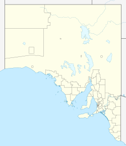
Dorothee Island (also known as Ile Dorothee in French) is a small island in South Australia. It's part of a group called the Pearson Isles, which are themselves part of a larger collection known as the Investigator Group. You can find Dorothee Island about 69 kilometers (about 43 miles) west-southwest of Cape Finniss on the Eyre Peninsula.
A famous explorer named Matthew Flinders first saw this island on February 13, 1802. The island got its name in 1969 to remember a name used by another exploring group, the Baudin expedition. Dorothee Island has been a protected area since 1972. Since 2011, it has been part of the Investigator Group Wilderness Protection Area, which helps keep its nature safe.
Contents
What Dorothee Island Looks Like
Dorothee Island is located about 4 kilometers (about 2.5 miles) south of Pearson Island. It's about 69 kilometers (about 43 miles) west-southwest of Cape Finniss. The island covers an area of about 56 hectares (about 138 acres).
The island has been worn down a lot by nature. A large crack runs through the middle of the island from east to west. This crack divides the island into two peaks. The peak on the north side is about 140 meters (about 459 feet) tall. The peak on the south side is about 102 meters (about 335 feet) tall. Both peaks have some soil, which is mostly coarse and rocky. The east coast of the island offers some shelter, making it possible to land there when the ocean isn't too rough.
How Dorothee Island Was Made
Dorothee Island, along with the other Pearson Isles, formed about 10,500 years ago. This happened when sea levels rose at the beginning of the Holocene period.
Geologically, Dorothee Island is actually the top of a large rock formation called an inselberg. Most of this rock is hidden underwater because the sea level rose. The southern and western sides of Dorothee Island drop quickly into the ocean. The water gets deeper than 50 meters (about 164 feet) within 500 meters (about 1,640 feet) of the shore.
Plants and Animals on Dorothee Island
Plants on Dorothee Island
In 1996, Dorothee Island still had a good amount of soil around its two peaks. This soil, along with the island's sheltered spots, allowed five different types of plant groups to grow there. These plant groups depend on the soil and how much they are exposed to the wind and weather.
- In the deepest, most sheltered rocky soils, you can find a type of heath dominated by Twiggy daisy-bush. Other heath plants like Common correa, black-anther flax lily, and Coast beard-heath also grow here. There are also small patches of Cape Leeuwin wattle.
- A sandy soil type, found near the central crack on the northern part of the island, supports a grey saltbush heath.
- The rocky soils on the southern peak support a shrubland of Marsh saltbush. This plant forms a circle around the twiggy daisy-bush that grows right on the peak.
- In areas with very thin soil, you'll find herbfields. These are mostly covered by rosy stork's bill.
- On top of the granite ridges closest to the sea, you'll see herblands of Round-leaved pigface.
Animals on Dorothee Island
Many different animals have been seen on Dorothee Island, including mammals, birds, and reptiles.
- Mammals: New Zealand fur seals and Australian sea lions use the island as a place to rest. Recent observations show that mostly fur seals have been using the island as a breeding colony.
- Birds: Many bird species have been seen on the island. Some common ones include the Australian kestrel, Australian raven, barn owl, black cormorant, Cape Barren geese, common starling, crested tern, fork-tailed swift, house sparrow, masked lapwing, Pacific gull, rock parrot, ruddy turnstone, short-tailed shearwater, silvereye, silver gull, welcome swallow, white-faced heron, and white-faced storm petrel. Some birds also breed on the island, such as the little penguin, sooty oystercatcher, white-faced storm petrel, and short-tailed shearwater.
- Reptiles: Reptiles found on the island include the peninsula dragon and the four-toed earless skink.
History of Dorothee Island
European Discovery
Dorothee Island is part of the island group that Matthew Flinders first saw on February 13, 1802. He later named this group the Pearson Isles.
Scientific Research
Dorothee Island is one of several islands in South Australia where scientists have set up special "photopoints." These are specific spots where they take pictures of the plants at regular times. This helps them see how the plants change over time, especially since there are no people living on the island or pests like rabbits.
How Dorothee Island Got Its Name
The island was officially named Dorothee Island in August 1969 by the South Australian government. This name is the English version of "Ile Dorothee." The name was chosen to keep alive a name that had been used in the area by the Baudin expedition from France.
Protected Status
Dorothee Island first received protected area status in 1972. It became part of the Investigator Group Conservation Park. This was done to protect the island's delicate environment and the resting areas for Australian sea lions and New Zealand fur seals. On August 25, 2011, Dorothee Island became part of the Investigator Group Wilderness Protection Area. Since 2012, the waters around Dorothee Island have also been part of a sanctuary zone in the Investigator Marine Park, which means they are also protected.
 | James B. Knighten |
 | Azellia White |
 | Willa Brown |


