
East River Greenway facts for kids
.jpg)
The East River Greenway is a special path along the East River on the east side of Manhattan island in New York City. It's also known as the East River Esplanade. This path is about 9.44 miles (15.19 kilometers) long. It's a great place for walking and cycling.
The Greenway is part of a bigger system called the Manhattan Waterfront Greenway. Most of it is managed by the New York City Department of Parks and Recreation. It's designed to keep people safe by separating them from cars. Many parts even have separate lanes for walkers and cyclists. For most of its length, the Greenway runs next to the FDR Drive, a big highway.
Different parts of the Greenway were built at different times:
- Most of the path was built between the 1930s and 1950s, around the same time as the FDR Drive.
- The section near Waterside Plaza was finished in 1973.
- The East River Waterfront part was completed in the late 1990s.
- Stuyvesant Cove Park opened in 2002.
- The section near the United Nations Headquarters has been under construction from 2015 and is expected to be finished by 2024.
Exploring the East River Greenway

The East River Greenway stretches along the East Side of Manhattan. It starts at Battery Park and goes past South Street Seaport. It ends at 125th Street in East Harlem. There's a small gap of about 1.0 mile (1.6 kilometers) between 41st and 60th streets in Midtown. In this area, people have to use busy streets like First Avenue and Second Avenue to get around the United Nations Headquarters.
Some parts of the Greenway can be narrow. For example, some areas have sinkholes blocked off by fences. One spot is very tight, squeezing between the highway and a power plant, so you need to go slower there. Other parts are shared with cars that need to access places like Waterside Plaza. About 1 mile (1.6 kilometers) of the path near the southern end is under the elevated FDR Drive, which can be a bit dark. There are plans to improve this section. In 2019, the city set aside $75 million to finish improving the path in East Harlem, East Midtown, and the Lower East Side.
In the summer of 2008, the East River Greenway was a great spot to see the amazing New York City Waterfalls art project.
Parts of the Greenway
East Harlem Section

The East Harlem part of the Greenway runs from the Triborough Bridge ramp at 124th Street down to Gracie Mansion at 90th Street. This section has four footbridges that cross over the FDR Drive. There's also a footbridge, the Wards Island Bridge, that connects to Randalls and Wards Islands at 103rd Street. A new connection to the Harlem River Greenway is planned to be built between 2021 and 2024.
Even though this area has many small parks, the Greenway section in East Harlem doesn't have many facilities. It's an older part of the path with limited open space. In 2019, the city put $25 million towards fixing the Greenway between 114th and 117th Streets. At that time, the section between 107th and 114th Streets was closed. In 2021, the city set aside $284 million for more repairs, including this part of the Greenway.
Upper East Side Section

At 90th Street, the Greenway goes up to a walkway that is above the FDR Drive. This part of the path goes past Carl Schurz Park near Gracie Mansion. From here, you can see the waters of Hell Gate and Wards Island. This walkway is also the park's waterfront promenade, built over the highway.
The Greenway then goes down to ground level using a 452-foot (138-meter) long ramp at 81st Street. This ramp, which is 9 feet (2.7 meters) wide, opened in late 2017 and replaced an old staircase. The path continues to the Queensboro Bridge, with more footbridges at 78th, 71st, and 63rd Streets.
Plans for the Greenway near the Queensboro Bridge have been discussed for a while. Ideas included using an old building at 59th Street, improving nearby parks like Andrew Haswell Green Park, and connecting the Greenway to York Avenue. These improvements were funded by a development project at 73rd Street. Also, $23 million from NYC Parks and $15 million from Rockefeller University were used to finish renovations between 62nd and 63rd Streets, which started in 2015.
United Nations Section
South of 60th Street, down to 38th Street, the Greenway has a section that is still being developed. There is a small part you can reach by a footbridge at 50th Street. In 2011, the city and state agreed to use part of Robert Moses Playground at 41st Street to expand the United Nations Headquarters. In return, the United Nations Development Corporation would provide $73 million to build the missing part of the Greenway between 38th and 60th streets.
Designs for this new section were shown in 2013. The plan includes an amphitheater (an outdoor stage) and a floating pier. It's being built in three stages, with the last part expected to open by 2024. These parts are between 38th, 41st, 53rd, and 60th Streets, with places for people to gather along the way. In 2017, the city promised $100 million for this section. Construction on the part between 53rd and 60th Streets began in 2019 and is expected to be finished in 2022. It will include a bridge at 54th Street that is easy for everyone to use.
Kips Bay/Waterside Section
This part of the Greenway is about 0.75 miles (1.2 kilometers) long. You can get to it by a crosswalk at 37th Street. This section includes the East 34th Street Ferry Landing and the East 34th Street Heliport (a place where helicopters land).
The Greenway here, along with the apartment buildings of Waterside Plaza and the United Nations International School, were built on platforms. These platforms are supported by over 2,000 concrete piles (long poles) sunk into the East River. The first apartment buildings opened in 1973, and this section of the Greenway was completed the next year.
Stuyvesant Cove Park Section

The Greenway enters Stuyvesant Cove Park, a 1.9-acre (0.77-hectare) public park. It runs from 23rd Street to 18th Street, east of Avenue C. It connects to the Captain Patrick J. Brown Walk at its southern end.

This park was built on land that used to be a cement plant and a parking lot. A plan to build homes, offices, a hotel, and a marina here was dropped in 1992. A new plan in 1997 led to the park we see today. Cement that was dumped into the East River created a small beach in the middle of the park near 20th Street.
The park was finished in 2002 and cost $8.3 million. Solar 1, an environmental learning center with a small outdoor stage, is located at the north end of the park.
Captain Patrick J. Brown Walk Section

The next part of the Greenway is the Captain Patrick J. Brown Walk. This brick-paved path connects Stuyvesant Cove Park to the north with East River Park to the south. It's for both walkers and cyclists and runs between 15th and 18th streets. It was named in 2002 after Captain Patrick J. Brown, a firefighter who died while serving his community.

There's a plan called the East River Blueway that would raise this walkway above the FDR Drive. This would create a gradual pedestrian bridge where the narrow 15th Street section is now.
East River Park Section
The Greenway then goes into East River Park, a 57.5-acre (23.3-hectare) public park on the Lower East Side. This park stretches from East 12th Street down to Montgomery Street. From the southern entrance, you can get great views of the Manhattan Bridge and Brooklyn Bridge. The park has an amphitheater (an outdoor stage) that was rebuilt and is often used for public shows. It also has fields for football, baseball, and soccer, courts for tennis, basketball, and handball, a running track, and bike paths. Fishing is also a popular activity here. The park is divided by the Williamsburg Bridge.
East River Waterfront Project

The final part of the Greenway is the East River Waterfront Project, also called the "East River Esplanade." This section is about 2 miles (3.2 kilometers) long. It runs along the East River waterfront between Montgomery Street and the Battery Maritime Building near Battery Park. A bike lane on Pike Street connects to the Manhattan Bridge. This project aims to improve the waterfront and connect it to Battery Park and East River Park. When it was completed in 2015, the East River Esplanade was planned to have three rebuilt piers (14, 15, and 35), new glass buildings under the elevated FDR Drive, new bike lanes, places for fun activities, and seating along the water.
Why the Waterfront Changed
The East River waterfront in Lower Manhattan used to be a very busy place with over 40 piers in the 1950s. It was easy to reach New York Harbor and the Atlantic Ocean from here. However, as trucks became more common and port activities moved to Port Newark–Elizabeth Marine Terminal, there was much less ship traffic on the river. With many piers no longer in use, there were big plans to reuse the space. The FDR Drive highway was moved to an elevated position to allow easier access to the piers.
In the 1970s, a plan was made to expand the Financial District eastward. In the 1980s, another plan called East Side Landing wanted to add more businesses and offices along the waterfront, similar to Battery Park City. This plan never happened.
In 1982, there was a plan to expand the Seaport Museum of New York and attract tourists. Parts of the area were used for shops, including the main building of the Fulton Fish Market. A modern shopping mall was built on Pier 17 and opened in 1985. The Fulton Fish Market later moved to Hunts Point, Bronx in 2005 because of plans to redevelop the Manhattan waterfront.
The walking and bike path was first created in the late 1990s. Benches were also added. People generally liked the path, but there were some challenges:
- The walking and bike paths were not separate; walkers and bikers shared one lane in each direction.
- The path curved around the pillars of the FDR Drive.
- The path was narrow, and the rest of the space under the highway was often used for parking.
- There were not many places to rest or get food.
- City services, like the New York City Department of Sanitation, used the waterfront for their equipment.
During Mayor Michael Bloomberg's time, he started the PlaNYC 2030 project, which aimed to improve the city by 2030. A big part of this plan focused on the waterfront. Bloomberg also emphasized using ferries as an alternative to land transportation. A ferry service to piers on Brooklyn's waterfront started in 2011.
-
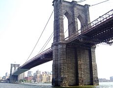
The Brooklyn Bridge as seen from the East River Esplanade
-
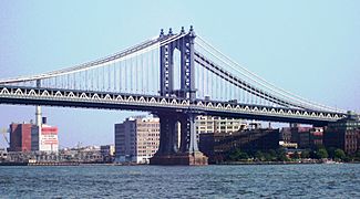
The Manhattan Bridge as seen from the East River Esplanade
-
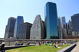
Pier 15


Waterfront Renovation
SHoP Architects led the design for the East River Esplanade, working with community members between 2002 and 2006. A study in 2004 helped designers find ways to "improve waterfront access." Other groups involved included the New York City Department of Transportation and the Department of Parks and Recreation. $137 million was secured, and work began on a "pilot section" in 2009 between John Street and Wall Street.
The overall plan for the Esplanade includes:
- The Esplanade itself: This new path has a recreation area along the water with seating and plants, buildings under the FDR Drive for outdoor activities, and a bikeway along South Street that connects to the Manhattan Greenway. It uses consistent paving, seating, railings, and lighting.
- Pavilions and "get-downs": New buildings help connect the city to the river. At Peck Slip and Rutgers Slip, steps are carved into the waterfront, allowing people to "get down" to the water.
- Archipelago: To create a continuous path between Battery Park and the new East River Waterfront, the path between the Battery Maritime Building and Old Slip extends over the water, offering views of the city.
- Pier 15: This pier has its main recreation area on a second level, giving new views of historic ships that might dock there.
- Pier 35: This large pier is open to the public with a second level that works like an amphitheater, facing towards Governors Island, Brooklyn, Battery Park, and New York Harbor. It's connected to the Greenway by a bridge.
- Sustainability: The project aims to be environmentally friendly, following the city's PlaNYC initiatives. It seeks LEED certification for its buildings and park uses. Plans focus on reducing energy use, saving natural resources, improving air quality, and collecting and reusing rainwater.
The FDR Drive highway will be covered, and South Street will be made narrower in many places to create more sidewalk space. Glass buildings will be located under the highway, and bike lanes will be moved to the side of these buildings, also under the FDR Drive. The piers will be rebuilt to encourage marine life, using "reef balls" to attract fish.
Access to the Esplanade from nearby areas will be improved by redeveloping "slips" – wedge-shaped road areas that used to allow ships to dock. Some of these slips are now used for parking. The plans for these slips in the Financial District, the Lower East Side, and Chinatown will include bikeways and landscaped areas.
Renovation Stages
The project is being built in phases. The first phase, including Pier 15, is complete. Construction on the second phase (from Old Slip to the Battery Maritime Building) started in summer 2011. The third phase (from Pike Slip to Pier 35, and Montgomery Slip) began in fall 2011 and was completed in 2014. This phase involved improving the area under the FDR Drive. Phase 4, between Catherine and Pike Slips, was completed in 2015.
U-shaped Storm Barrier
There are plans for a new storm barrier along the southern part of the Greenway, between West 57th and East 42nd Streets. This barrier will be U-shaped and include many features. Under the elevated FDR Drive highway structure above South Street, there will be storm barriers that can drop down from the ceiling in case of a storm. A "Battery Berm" (a raised mound) will be built at Battery Park, and a maritime museum will open in a former Coast Guard building there.
The first part of this barrier, called "The Bridging Berm," will be 2.19 miles (3.52 kilometers) long on the Lower East Side between Montgomery and East 13th Streets. It will cost $335 million. Besides protecting against storms, this berm will also have a path for walkers and bikers on top, docks for boating and fishing, a slope down to sports fields, and improved ramps for bridges across the FDR Drive that are easy for everyone to use. The total cost of the entire project is over $3.5 billion.
