
Randalls and Wards Islands facts for kids

Looking southwest; Randalls Island is in the foreground and Wards Island is behind it. Roosevelt Island and Manhattan can be seen in the background.
|
|

Randall's and Wards Islands
Location in New York City

Randall's and Wards Islands
Location in New York

Randall's and Wards Islands
Location in the United States
Location of Randall's and Wards Islands
|
|
| Geography | |
|---|---|
| Location | East River, Manhattan, NY, U.S. |
| Coordinates | 40°47′48″N 73°55′19″W / 40.79667°N 73.92194°W |
| Area | 2.09 km2 (0.81 sq mi) |
| Administration | |
|
United States
|
|
| State | New York |
| City | New York City |
| Borough | Manhattan |
| Demographics | |
| Population | 1,648 (2010) |
| Pop. density | 788.5 /km2 (2,042.2 /sq mi) |
Randall's Island and Wards Island are two islands in New York City that are now connected. Together, they are called Randall's and Wards Islands. They are located between Manhattan, Queens, and The Bronx.
These islands were once separate, with Randall's Island to the north of Wards Island. A small waterway called Little Hell Gate used to run between them. But by the early 1960s, this waterway was filled in, connecting the two islands. Another smaller island, Sunken Meadow Island, was also connected to Randall's Island in 1955.
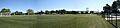
In 2010, about 1,648 people lived on the islands, which cover 2.09 square kilometers (520 acres). Most of the islands are covered by a large park, spanning 432.69 acres (175.10 ha). This park is managed by the Randall's Island Park Alliance. It has many sports fields, a driving range for golf, walking and biking paths, playgrounds, and picnic areas.
The islands also have a long history of being used for hospitals and shelters. Today, they are home to several public facilities. These include two hospitals for mental health, a state police station, a fire academy, a water treatment plant, and several homeless shelters. There are no regular homes for the public on the islands.
You can reach the islands by crossing the Triborough Bridge or the Hell Gate Bridge. Pedestrians and cyclists can also use the Wards Island Bridge from Manhattan or the Randall's Island Connector from the Bronx. Randall's Island is also famous for hosting three big music festivals: Governors Ball Music Festival, Panorama Music Festival, and Electric Zoo Festival.
Contents
Island History: From Wild Lands to Modern Parks
Early Days and Changing Names


Long ago, Native Americans lived in this area. They called Wards Island Tenkenas, which meant "Wild Lands" or "uninhabited place." Randall's Island was known as Minnehanonck.
In 1637, a Dutch leader named Wouter Van Twiller bought the islands. They were first named Great Barent Island (Wards) and Little Barent Island (Randalls) after a Danish cowherd. Over time, the names changed many times. Randall's Island was sometimes called "Buchanan's Island" or "Great Barn Island."
In 1772, a British army engineer named Captain John Montresor bought Randall's Island. He renamed it Montresor's Island. During the American Revolutionary War, both islands were used by the British military. Montresor's house was burned in 1777. After the war, in 1783, the British left, and the island was taken by the new American government.
The islands got their current names from new owners after the war. In 1784, Jonathan Randell bought Randall's Island. Around the same time, Jaspar Ward and Bartholomew Ward bought Wards Island.
Nineteenth Century: Hospitals and Institutions

People had lived on Wards Island since the 1600s. In the early 1800s, the Ward brothers built a cotton mill and, in 1807, the first bridge across the East River. This wooden bridge connected Wards Island to Manhattan at 114th Street. However, a storm destroyed it in 1821, and Wards Island became mostly empty until 1840.
In 1835, Jonathan Randell's family sold Randall's Island to New York City for $60,000.
In the mid-1800s, both islands became home to many public facilities. Randall's Island had an orphanage, a home for the poor, and a burial ground for those who couldn't afford a proper burial. It also housed a hospital and a rest home for American Civil War veterans. The New York House of Refuge, a school for young people who had broken the law, opened there in 1854.
Between 1840 and 1930, Wards Island was used for:
- Burying hundreds of thousands of bodies moved from old graveyards in Manhattan.
- The State Emigrant Refuge, a hospital for sick immigrants, which opened in 1847. It was the largest hospital in the world in the 1850s.
- The New York City Asylum for the Insane, which opened around 1863.
- The Manhattan Psychiatric Center, which took over the asylum buildings in 1899. With 4,400 patients, it was the largest mental health institution in the world at one point.
Connecting the Islands and Creating Parkland
When the Triborough Bridge opened in 1936, it led to the islands being turned into parks. At that time, Little Hell Gate still separated Randall's and Wards Islands. In the late 1930s, the city began filling in Little Hell Gate to make more space for the parks. By the early 1960s, the islands were fully connected.
There was also a small island called Sunken Meadow Island to the east of Randall's Island. Starting in 1955, the city allowed construction companies to dump dirt and debris there for free. This filled in the area, and Sunken Meadow Island became part of Randall's Island. The Sunken Meadow section of Randall's Island Park was finished by 1965. It covers 85 acres (34 ha) and has many sports fields.
Scylla Point: A Name Change Story
In 1984, the tip of the southeastern part of the island was officially named "Negro Point." This name came from riverboat workers who used it unofficially. However, in 2001, the Parks Commissioner, Henry Stern, found the name offensive. He changed it to "Scylla Point."
This new name was chosen to go with Charybdis Playground in Astoria Park. These two spots are on opposite sides of Hell Gate, just like the mythical monsters Scylla and Charybdis were on opposite sides of a narrow sea passage. Even with the official name change, some tugboat captains still use the old name.
Randall's Island Park: A Place for Sports and Nature

Ideas for adding parks to the islands were discussed as early as 1916. But the real push for park development came in 1930. Today, Randall's Island Park is run by the Randall's Island Park Alliance (RIPA). This group was started in 1992 to help manage and improve the park.
RIPA works with the city to offer sports, cultural events, and nature exploration. They run free programs for kids, bringing thousands of children to the park each year. These programs include field trips to the park’s urban farm and saltmarsh, environmental tours, and outdoor arts and crafts. RIPA also hosts a free summer camp for children from nearby communities. For everyone, there are movie nights, historical tours, outdoor yoga, and big festivals like the Cherry Blossom and music festivals.
Randall's Island Park has over 8 miles of paths for walking and biking. Most of these paths run along the beautiful waterfront. The island connects Manhattan, the Bronx, and Queens, making it a great place to travel between boroughs without a car. There are plans to add more paths and restore natural areas along the waterfront. These paths are part of the East Coast Greenway, a huge trail system connecting Maine to Florida.
A newly renovated golf center opened in 2008. This 25-acre (100,000 m2) center has a two-level driving range with 82 stalls, a mini-golf course, and batting cages. In 2009, a tennis center opened with 20 courts, both indoor and outdoor. It also has a cafe, pro shop, and fitness areas. The center is home to the John McEnroe Tennis Academy.

In 2010, RIPA and the New York City Department of Parks and Recreation finished building over 60 athletic fields. These fields are used for many sports, including football, lacrosse, field hockey, rugby, soccer, baseball, and softball. Randall's Island Park has more athletic fields than any other single park in New York City.
The island also has three natural environments: two saltmarshes and a freshwater wetland. About 4 acres (16,000 m2) of saltmarsh was created around the Little Hell Gate Inlet. Another 4 acres (16,000 m2) of freshwater wetlands was also created. These areas are home to many birds, making the park a great spot for birdwatching.
These natural areas help filter stormwater from the sports fields and paths before it reaches the East River. This helps keep the water clean. The city also approved a project to generate renewable energy in the park. This project aims to use solar, wind, and tidal energy to power the island's facilities.
Little Hell Gate: A Vanished Waterway

Little Hell Gate was once a natural waterway that separated Randall's Island and Wards Island. Its eastern end opened into the Hell Gate passage of the East River, across from Astoria. The western end met the Harlem River across from East 116th Street in Manhattan. Near the Hell Gate Bridge, Little Hell Gate was over 1,000-foot (300 m) wide, and the currents were very strong.
After the Triborough Bridge opened in 1936, the city began filling in most of Little Hell Gate. This was done to expand and connect the parks on both islands. By the 1960s, the waterway was mostly filled in.
Today, what is called "Little Hell Gate Inlet" is just the western part of the old waterway. Few signs of the eastern end remain, only a small curve in the shoreline. Parkland and part of the New York City Fire Department Academy now cover the area where the eastern part of Little Hell Gate used to be.
Island Facilities and Bridges
Key Facilities on the Islands

- Icahn Stadium: This stadium has an Olympic-standard track used for track and field events. It hosts competitions for youth groups and is open to the public for "Open Run" nights. Next to the track is a field for soccer and rugby. The first stadium here, Downing Stadium, opened in 1936. Famous athlete Jesse Owens competed there. Downing Stadium was torn down in 2002 and replaced by Icahn Stadium, which opened in 2005. In 2008, Usain Bolt, a Jamaican sprinter, broke the world record for the men's 100-meter dash at this stadium.
- Sports Fields: Randall's Island Park has over 60 sports fields. This makes up about 40% of all athletic fields in Manhattan. Public schools and local community groups get first choice to use the fields.
- Hospitals: The island is home to the Manhattan Psychiatric Center and the Kirby Forensic Psychiatric Center. These hospitals are run by the state and provide care for people with mental health conditions.
- Shelters: The island has several shelters for people experiencing homelessness. These include the Charles Gay Assessment Shelter, Schwartz Men's Shelter, and the Clarke Thomas Next Step Employment Center. They are run by the New York City Department of Homeless Services.
- Police: The New York State Police have a station on the island. They provide investigative services and support state police operations in New York City.
- Fire Academy: The FDNY (New York City Fire Department) has a training academy on Randall's Island. It has classrooms, a large water tank, a subway tunnel with cars, a training course for fire truck drivers, a helicopter pad, a replica ship, and buildings that look like different types of city structures.
- Parks Enforcement Academy: The New York City Parks Enforcement Patrol also has a training academy here. Their training includes physical fitness, ethics, customer service, and learning about laws and park rules.
- Water Treatment: A wastewater treatment plant, called the Wards Island Water Pollution Control Plant, is on the island. It started in 1937 and cleans water for over one million people in the Bronx and Manhattan. The city plans to add solar power to the plant.
Bridges Connecting the Islands


- Hell Gate Bridge: In 1917, the Hell Gate Bridge, a railroad bridge, was built across both islands. It connects Queens to the Bronx. This bridge was planned in the early 1900s to link New York with New England. It is known for being extremely strong. Experts believe it would be the last New York City bridge to fall if humans disappeared, lasting at least a thousand years.
- Triborough Bridge (Robert F. Kennedy Bridge): In 1936, the islands became a central point for the Triborough Bridge. This bridge connects Manhattan, Queens, and the Bronx. The American Society of Civil Engineers recognized it as a National Historic Civil Engineering Landmark in 1986. In 2008, it was officially renamed the Robert F. Kennedy Bridge. The building that was once the main office for managing this bridge still stands on the island.
- Wards Island Bridge (103rd Street Footbridge): In 1937, plans were made for a pedestrian bridge from East Harlem to Wards Island Park. This bridge, also known as the 103rd Street Footbridge, opened in 1951. It cost $2.1 million to build and gives people from East Harlem easy access to the park.
- Randall's Island Connector: In November 2015, a new footbridge opened over the Bronx Kill. This bridge, called the Randall's Island Connector, provides a second link from Randall's Island to the Bronx.
Images for kids
-
East River Fields, 2008
See also
 In Spanish: Islas Randalls y Wards para niños
