East Side, Providence, Rhode Island facts for kids
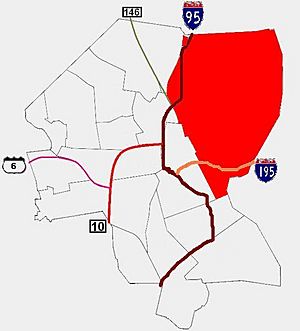
The East Side is a group of neighborhoods in the eastern part of Providence, Rhode Island. It includes areas like Blackstone, Hope (also called Summit), Mount Hope, College Hill, Wayland, and Fox Point.
The Seekonk River separates the East Side from East Providence, Rhode Island to the east. To the west, the Providence River and Interstate 95 separate it from the rest of Providence. To the north, it borders Pawtucket, Rhode Island. To the south, it meets Narragansett Bay. This bay forms where the Seekonk and Providence Rivers meet.
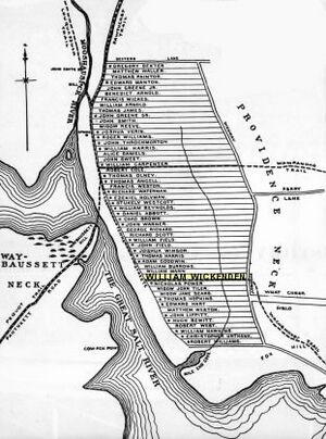
Roger Williams founded Providence along College Hill. This means the East Side has some of the oldest parts of the city. A small park in Fox Point marks the spot where Williams first landed.
Contents
Schools and Universities on the East Side
The East Side is home to many important schools and universities.
Brown University and RISD
Most of Brown University's buildings are here. These include the Main Green, the Rockefeller Library, and the Erickson Athletic Complex. The Rhode Island School of Design (RISD) also has many buildings on College Hill. The RISD Museum is on Benefit Street.
Private and Public Schools
Several private schools are located on the East Side. These include the Moses Brown School, the Wheeler School, and Lincoln School. School One, Providence Hebrew Day School, and the French-American School are also here.
Hope High School is one of Providence's public high schools. It is found at the corner of Hope and Olney Streets.
Places to Eat and Shop
The East Side has many fun places to eat and shop.
Thayer Street and Wickenden Street
You can find many cafes, restaurants, and shops on Thayer Street. This street is right next to Brown University. Wickenden Street and South Water Street also have many small, local shops. Thayer Street has a few larger chain stores too. Brown University's bookstore is on Thayer Street. The Avon Cinema, a movie theater from the early 1900s, is a famous spot on Thayer Street.
Wayland Square
Wayland Square is another shopping area. It is located where Wayland Avenue and Angell Street meet.
Parks and Green Spaces
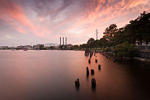
The East Side has many parks and green areas.
India Point Park
India Point Park is the largest park. It is located along the northern shore of Narragansett Bay. This park is the only big public space along the bay in Providence.
Interstate 195 used to separate the park from Fox Point. Now, a new pedestrian bridge connects Fox Point to India Point Park.
Other East Side Parks
- Blackstone Boulevard Park is a long green space. It runs between the lanes of Blackstone Boulevard. It has 19.3 acres of parkland. There is a 1.7-mile path for walking and jogging.
- Blackstone Park is a 40-acre city park. It has 2,400 feet of shore along the Seekonk River.
- Brown Street Park is behind Hope High School. It has play areas for kids and fitness equipment for adults. The park also hosts concerts and classes.
- Constance Witherby Park is in Wayland.
- Gano Street Park is along the Seekonk River. It has sports fields and a dog park. It is also called Engineer's Field.
- Lippitt Memorial Park is a 6-acre park. It is at the corner of Hope Street and Blackstone Boulevard. It is named after a former Rhode Island governor.
- Market Square is a small park near Downtown.
- Mary Sharpe Park is a small park between Benefit and Pratt Avenue.
- Paterson Park is a small park in Wayland. It is next to Blackstone Park.
- Gladys Potter Park is a small park in Wayland. It is at the corner of Elton Street and Humboldt Avenue.
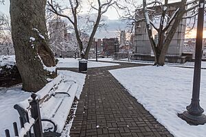
- Prospect Terrace Park is on top of College Hill.
- Roger William's Landing is in Fox Point.
- Roger Williams National Memorial is at the bottom of College Hill.
- Riverwalk is along the Providence River. Part of the WaterFire event is held here.
- Veterans' Memorial Park is near Downtown. It has a memorial for war veterans.
Who Lives on the East Side?
The East Side is mostly a residential area. This means many families live here. It is known for having nice homes and good income levels compared to the rest of the city. About 20% of Providence's nearly 191,000 people live on the East Side. The Mount Hope area has historically been home to a large community of Jewish people from Russia.
Hospitals on the East Side
The East Side has two important hospitals.
Miriam Hospital
Miriam Hospital is a private hospital. It is located on Summit Avenue in the Hope (Summit) area. Jewish organizations in the community founded this hospital in 1926.
Butler Hospital
Butler Hospital is Rhode Island's only private mental health hospital. It is located off Blackstone Boulevard. Founded in 1844, the hospital helps people with mental health and certain health challenges.
Famous Landmarks
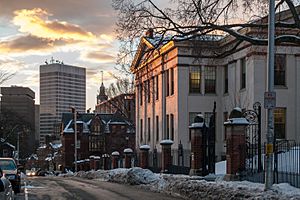
The East Side has the oldest parts of Providence. Groups like the Providence Preservation Society work to protect its many historic buildings. This is especially true in the College Hill area.
Historic Buildings and Sites
- The Providence Athenaeum: This is the fourth oldest library in America. It is located on Benefit Street.
- The Central Congregational Church: This church was designed in 1893. It is on Angell Street.
- The First Baptist Church in America: This is the oldest Baptist church in the United States. Roger Williams founded it in 1638. It is on North Main Street.
- The First Christian Science Church: This church has a dome and is on Meeting Street.
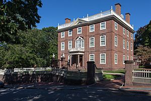
- The John Brown House: This was the home of John Brown (1736–1803). He was a wealthy businessman who helped start Brown University. His house is at the corner of Benefit and Power Street.
- The Marine Armory: This building was used during the American Civil War. It was also the first headquarters for the Rhode Island State Police.
- The Old State House: This building used to be the statehouse for Rhode Island.
- H.P. Lovecraft Memorial Square: A memorial dedicated to the famous writer H.P. Lovecraft.
 | William Lucy |
 | Charles Hayes |
 | Cleveland Robinson |


