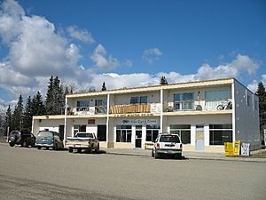
Entwistle, Alberta facts for kids
Quick facts for kids
Entwistle
|
|
|---|---|
|
Hamlet
|
|
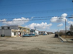
Main Street
|
|
| Motto(s):
Diamond Capital of Canada
|
|
| Country | Canada |
| Province | Alberta |
| Region | Central Alberta |
| Census Division | No. 11 |
| Municipal district | Parkland County |
| Founded | 1908 |
| Incorporated | March 18, 1909 (village) |
| Dissolved | December 31, 2000 |
| Government | |
| • Type | Unincorporated |
| Area
(2021)
|
|
| • Land | 1.96 km2 (0.76 sq mi) |
| Elevation | 778 m (2,552 ft) |
| Population
(2021)
|
|
| • Total | 429 |
| • Density | 219.4/km2 (568/sq mi) |
| Time zone | UTC−7 (MST) |
| • Summer (DST) | UTC−6 (MDT) |
| Postal code span |
T0E 0S0
|
| Area code(s) | 780 |
| Highways | |
| Waterways | Pembina River |
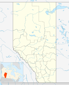
Entwistle is a small community called a hamlet in Alberta, Canada. It is part of Parkland County. Entwistle is located about 95 kilometers (59 miles) west of Edmonton.
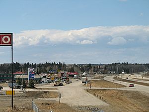
It sits on the east banks of the Pembina River. The community is found where the Yellowhead Highway meets Highway 22. Entwistle is known for its yearly rodeo and the nearby Pembina River Provincial Park. It also proudly calls itself the "Diamond Capital of Canada."
Contents
History of Entwistle
Entwistle was founded by James Entwistle in 1908. He worked for the Canadian Northern Railway (CNoR). James knew the railway construction would stop at the Pembina River. This was because a bridge needed to be built.
He guessed that a new town would quickly grow there. So, in 1907, James claimed land near the river. In 1908, as the railway workers got closer, he built a general store. His wife and children took care of the store. Soon, the railway arrived, and the town grew around his store.
Naming the Town
The new town needed a post office, but it needed an official name. People first called it "Pembina" after the river. However, the government said that name was already used. Other names like "Burke" and "Harmer" were also suggested but rejected for the same reason.
People then started suggesting James Entwistle name the town after himself. James was a bit embarrassed because he thought "Entwistle" was already a town name in England. But his wife, Mary, sent in the name "Entwistle," and it was accepted! For many years, people joked with James about putting his name on the map. He would always say, "It wasn't me who put it there—it was Mary."
Entwistle officially became a village on March 26, 1909. James Entwistle was elected its first mayor in April 1909.
Growth and Changes
The railway trestle bridge was finished in 1910. Another railway, the Canadian Northern Railway, built its own bridge from 1910 to 1912. The railway construction then moved further west in 1912. However, many people stayed in Entwistle.
In its early years, Entwistle had a strong farming industry. It also benefited from timber and the coal mines in nearby Evansburg.
Entwistle's status changed a few times. It stopped being a village and became a hamlet in 1942. Then, it became a village again in 1955. Finally, on December 31, 2000, it became a hamlet in Parkland County once more.
Entwistle's Climate
Entwistle has a humid continental climate. This means it has warm summers with cool nights. The winters are long and cold, with a moderate amount of snow. Most of the rain falls in June and July.
| Climate data for Entwistle, Alberta | |||||||||||||
|---|---|---|---|---|---|---|---|---|---|---|---|---|---|
| Month | Jan | Feb | Mar | Apr | May | Jun | Jul | Aug | Sep | Oct | Nov | Dec | Year |
| Record high °C (°F) | 14.0 (57.2) |
17.5 (63.5) |
22.0 (71.6) |
25.0 (77.0) |
32.0 (89.6) |
33.5 (92.3) |
35.5 (95.9) |
34.8 (94.6) |
30.5 (86.9) |
30.0 (86.0) |
19.0 (66.2) |
16.5 (61.7) |
35.5 (95.9) |
| Mean daily maximum °C (°F) | −6.1 (21.0) |
−1.3 (29.7) |
3.3 (37.9) |
11.7 (53.1) |
17.2 (63.0) |
20.6 (69.1) |
23.0 (73.4) |
22.0 (71.6) |
17.6 (63.7) |
10.3 (50.5) |
0.7 (33.3) |
−4.0 (24.8) |
9.6 (49.3) |
| Daily mean °C (°F) | −11.3 (11.7) |
−7.5 (18.5) |
−2.8 (27.0) |
5.0 (41.0) |
10.3 (50.5) |
14.3 (57.7) |
16.5 (61.7) |
15.4 (59.7) |
10.8 (51.4) |
4.4 (39.9) |
−4.1 (24.6) |
−9.1 (15.6) |
3.5 (38.3) |
| Mean daily minimum °C (°F) | −16.5 (2.3) |
−13.6 (7.5) |
−8.8 (16.2) |
−1.9 (28.6) |
3.4 (38.1) |
8.0 (46.4) |
10.0 (50.0) |
8.9 (48.0) |
4.0 (39.2) |
−1.6 (29.1) |
−8.9 (16.0) |
−14.0 (6.8) |
−2.6 (27.3) |
| Record low °C (°F) | −43.0 (−45.4) |
−41.0 (−41.8) |
−37.0 (−34.6) |
−22.0 (−7.6) |
−9.0 (15.8) |
−2.0 (28.4) |
1.5 (34.7) |
−4.0 (24.8) |
−5.5 (22.1) |
−22.0 (−7.6) |
−33.0 (−27.4) |
−45.0 (−49.0) |
−45.0 (−49.0) |
| Average precipitation mm (inches) | 28.1 (1.11) |
15.8 (0.62) |
16.4 (0.65) |
29.2 (1.15) |
61.0 (2.40) |
101.9 (4.01) |
103.4 (4.07) |
76.3 (3.00) |
44.8 (1.76) |
32.0 (1.26) |
24.9 (0.98) |
16.8 (0.66) |
550.6 (21.68) |
| Average rainfall mm (inches) | 1.0 (0.04) |
0.3 (0.01) |
0.4 (0.02) |
20.0 (0.79) |
55.1 (2.17) |
101.9 (4.01) |
103.4 (4.07) |
76.3 (3.00) |
43.8 (1.72) |
17.9 (0.70) |
2.8 (0.11) |
1.7 (0.07) |
424.5 (16.71) |
| Average snowfall cm (inches) | 27.1 (10.7) |
15.5 (6.1) |
16.0 (6.3) |
9.3 (3.7) |
5.9 (2.3) |
0.0 (0.0) |
0.0 (0.0) |
0.0 (0.0) |
1.0 (0.4) |
14.1 (5.6) |
22.1 (8.7) |
15.1 (5.9) |
126.1 (49.6) |
| Average precipitation days (≥ 0.2 mm) | 7.1 | 5.6 | 4.7 | 6.8 | 11.1 | 16.3 | 15.0 | 13.6 | 11.0 | 7.1 | 6.8 | 6.1 | 111.0 |
| Average rainy days (≥ 0.2 mm) | 0.35 | 0.11 | 0.35 | 5.2 | 10.4 | 16.3 | 15.0 | 13.6 | 11.0 | 5.1 | 0.90 | 0.60 | 78.9 |
| Average snowy days (≥ 0.2 cm) | 6.9 | 5.4 | 4.4 | 2.3 | 0.95 | 0.0 | 0.0 | 0.0 | 0.25 | 2.3 | 6.0 | 5.5 | 33.8 |
| Source: Environment Canada | |||||||||||||
Entwistle's Economy
Entwistle's economy gets help from the nearby oil and gas industries. Tourism is also important because Entwistle is located between Edmonton and Edson. It sits where the Yellowhead Highway and Highway 22 meet.
Tourism gets a boost in summer from the Pembina River Provincial Park. The yearly Entwistle Rodeo also brings visitors. This rodeo happens every Canada Day weekend.
River Tubing and Community Concerns
Entwistle is seeing a rise in tourism because the Pembina River is great for tubing. Many people are discovering this fun activity. However, this increase in visitors has some local residents worried.
They are concerned about the river possibly getting polluted. They also worry that the community is becoming too crowded. Another concern is that the local cemetery is being damaged. This is because a popular path to the river goes right through it. To help with this, Parkland County is building a new path around the cemetery. This new route should ease some of the pressure.
Entwistle: Diamond Capital of Canada
In 1958, a resident named Einar Opdahl found a diamond in the banks of the Pembina River. The diamond weighed 0.83 carats. It was described as a "perfect octahedron with eight faces; a clear, colorless stone." Opdahl sold the diamond for $500.
Later, in 1990, De Beers started looking for diamonds in Alberta's Peace River area. This reminded people of the diamond found near Entwistle. Because of this, several companies began searching for diamonds near Entwistle and the Pembina River in 1992.
The discovery by Opdahl and the new diamond search led Entwistle to declare itself the "Diamond Capital of Canada" in 1994.
Entwistle Landmarks
Pembina River Bridge
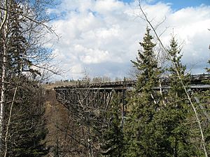
The Grand Trunk Pacific (GTP) railway bridge is still in use today. Its construction is what caused Entwistle to grow. This bridge is a key part of the Canadian National Railway main line. About 20 trains cross it every day.
The bridge is 277 meters (910 feet) long and 65 meters (214 feet) high. It is the fifth-highest railway bridge in Western Canada. Building started in 1908. A huge temporary bridge and scaffolding were made of wood because there were no cranes big enough for the steel.
The steel parts of the bridge were made in Scotland. Scottish engineers put the bridge together there, tested it, and then carefully took it apart. The pieces were shipped across the Atlantic Ocean. They arrived in Entwistle by railway in 1909. The steel bridge was slowly put together. The engineers' measurements were so exact that no changes were needed on site.
As the steel structure was put in place, the wooden scaffolding was removed. Construction finished in 1910. After more than 100 years, the bridge has only needed regular upkeep, not major repairs.
Yellowhead Highway Bridge
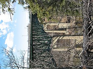
The Yellowhead Highway Bridge runs next to the Pembina River Viaduct. It was built between 1961 and 1962. Even though it opened to traffic in 1962, a big opening ceremony wasn't held until July 24, 1963. About 1500 people came to the event.
Many important people gave speeches. These included the chief bridge engineer and the Minister of Highways. The mayors of Entwistle and Evansburg also spoke. The ribbon was cut by Gordon Taylor, who was the Minister of Highways.
This bridge is 63 meters (207 feet) high and about 274 meters (900 feet) long. It cost $1.7 million to build. When it was finished in 1962, it was the highest highway bridge in Alberta.
J.D. Read Memorial Building
John Davis Read was one of the first people to live in Entwistle. He moved there in 1908. In 1910, he opened Entwistle's first lumber yard. Then, in 1912, he started a successful feed business. This business did very well through the 1940s.
Read was also very involved in village matters. He served on the Entwistle Village Council from 1913 to 1942. He was the mayor of Entwistle from 1925 to 1930, and again from 1935 to 1942.
Read sold his business and retired in 1946. When he passed away in 1965, he left most of his money to the Village of Entwistle. He asked that the money be used "to build something that will be used by the whole community." In 1973, the J.D. Read Memorial Building was built.
Until the early 2000s, this building held Entwistle's bank, post office, and public library. As of 2023, it has an expanded post office and two small businesses.
Entwistle vs. Old Entwistle
About 1.6 kilometers (1 mile) east of Entwistle is a small community called Old Entwistle. Old Entwistle has about 20 people living there. The people of Old Entwistle have always said that their hamlet is what's left of the original village of Entwistle. They often use their hamlet's name as proof.
When the railway bridge was finished in 1910, the GTP railway decided that Entwistle and Evansburg could share one train station in Evansburg. The people of Entwistle were very upset and demanded their own train station.
The GTP finally agreed. Entwistle's train station had to be built one mile east of Entwistle. This was the shortest distance allowed so it wouldn't interfere with Evansburg's station. The GTP then bought all the land around this new train station. They sold this land, saying it was "the future site of Entwistle." This area became known as the Grand Trunk Pacific subdivision, or just Grand Trunk. Even with the railway's efforts, the people of Entwistle chose to walk one mile to the train station instead of moving their town.
It is not known exactly when Grand Trunk started being called Old Entwistle. However, the name became common in the late 1980s. Old Entwistle is the original spot of Entwistle's train station, not the entire original community.
 | May Edward Chinn |
 | Rebecca Cole |
 | Alexa Canady |
 | Dorothy Lavinia Brown |


