Evans Butte (Grand Canyon) facts for kids
Quick facts for kids Evans Butte |
|
|---|---|

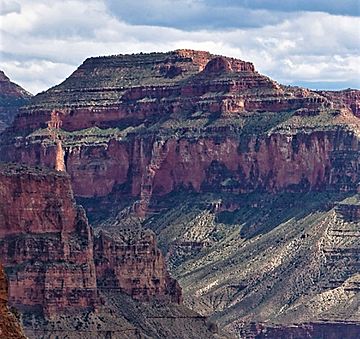
Northwest aspect
|
|
| Highest point | |
| Elevation | 6,379 ft (1,944 m) |
| Prominence | 599 ft (183 m) |
| Isolation | 2.54 mi (4.09 km) |
| Parent peak | Guinevere Castle (7,281 ft) |
| Geography | |
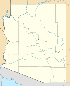
| Location | Grand Canyon National Park Coconino County, Arizona, US |
| Parent range | Kaibab Plateau Colorado Plateau |
| Topo map | USGS Havasupai Point |
| Type of rock | sandstone. limestone, shale |
| Climbing | |
| First ascent | 1963 |
| Easiest route | scrambling |
Evans Butte is a tall peak in the Grand Canyon. It stands 6,379 feet (1,944 meters) high. You can find it in Coconino County, Arizona, USA. This butte is at the north end of Sagittarius Ridge. It is about three miles south-southwest of King Arthur Castle. It is also two miles southeast of Dox Castle.
Evans Butte rises very steeply. It soars over 4,100 feet (1,250 meters) above the Colorado River. This huge rise happens in just 2.5 miles (4 km). The north side of the butte is also very steep. It goes up 2,700 feet above Flint Creek in only one mile. The weather here is a cold semi-arid climate. This means it's usually dry and cool. Rainwater flows west from the butte into the Colorado River. It goes through Shinumo Creek, Hotauta Canyon, and Monadnock Amphitheater.
The butte is made of different kinds of rock. These include sandstone, limestone, and shale. These layers of rock were formed over millions of years. A climber named Harvey Butchart climbed Evans Butte by himself. This happened on October 11, 1976. It was the 76th peak he climbed in the Grand Canyon. He climbed a total of 83 peaks there.
Who Was Richard Tranter Evans?
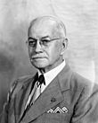
Evans Butte is named after a man called Richard Tranter Evans. He lived from 1881 to 1966. Richard Evans was a senior engineer for the U.S. Geological Survey. He worked there from 1899 to 1951. In 1904, he surveyed and mapped this part of the Grand Canyon.
Richard Evans was a Welsh mapmaker. While mapping, he gave many nearby places names from the Arthurian legends. For example, he named King Arthur Castle and Guinevere Castle. Other names include Elaine Castle, Merlin Abyss, and Gawain Abyss. He also named Bedivere Point, Lancelot Point, and Galahad Point.
Richard T. Evans worked on 107 mapping projects. These included several national parks. He created the first maps of Pikes Peak, the Grand Canyon, and Salt Lake City. He also worked as a superintendent for national parks. He was in charge of Zion National Park from 1925 to 1926. Then he led Hawaii National Park from 1927 to 1928. The name Evans Butte was officially accepted in 1969. This was done by the U.S. Board on Geographic Names.
 | Dorothy Vaughan |
 | Charles Henry Turner |
 | Hildrus Poindexter |
 | Henry Cecil McBay |


