Farlington, Hampshire facts for kids
Quick facts for kids Farlington |
|
|---|---|
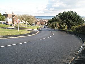
 Farlington Avenue |
|
| Unitary authority | |
| Ceremonial county | |
| Region | |
| Country | England |
| Sovereign state | United Kingdom |
| Post town | PORTSMOUTH |
| Postcode district | PO6 |
| Dialling code | 023 |
| Police | Hampshire |
| Fire | Hampshire |
| Ambulance | South Central |
| EU Parliament | South East England |
| UK Parliament |
|
Farlington is a neighbourhood in the city of Portsmouth, England. It's mostly a place where people live. Farlington is special because it's in the very north-east of Portsmouth, on the mainland. Most of Portsmouth is on an island called Portsea Island.
Farlington became part of Portsmouth in 1932. Now, it's connected to nearby areas like Cosham and Drayton. To the north is Widley, and to the east is Havant. South of Farlington is Langstone Harbour, a large natural harbour.
Contents
History of Farlington
For a long time, Farlington was a small farming community. It was part of an old "manor" (a large estate) and "parish" (a church area). In 1320, the land was given to Hugh Despenser the Elder. But later, King Edward II took his lands away. The King then gave the Farlington manor to Alice, the wife of Edmund Earl of Arundel.
Alice only owned the land for a short time. By 1330, it was back with the King. King Edward III then gave it to Southwick Priory, a religious house nearby. In 1540, Farlington was sold to William Pound. The land changed owners many times. Later, in the 1800s and 1900s, it was divided up for houses.
The Racecourse and Ammunition Dump
In 1891, a horse racecourse called 'Portsmouth Park' was built in Farlington. It was located between the Havant road and the sea. This racecourse had all the best facilities of its time. It even had its own train station, Farlington Halt. The idea was to make it one of the best race tracks.
However, during World War I, horse races stopped. The War Office (a government department for the army) took over the racecourse. They turned it into one of the country's biggest ammunition dumps. This is where weapons and explosives were stored.
After the war, the War Office kept control until 1929. Then, Portsmouth City Council bought the land. The council later sold it for building new homes. This led to Farlington becoming a continuous part of the city.
Waterworks and Forts
Farlington is also home to the Portsmouth Water Company's water treatment area. In 1812, Thomas Smith built a reservoir to hold spring water from Farlington Marshes. The main waterworks were built in 1908. By 1924, there were five reservoirs and eight sand filters to clean the water. Many local roads are named after important people from the water company, like Grant Road and Gillman Road.
Farlington also had a fort called Farlington Redoubt. This was part of a ring of forts built around Portsmouth. These forts are sometimes called ""Palmerston's Folly"". They were built to protect the city from a possible French invasion. The redoubt was finished by 1891 and had seven large guns.
After the Second World War, the redoubt was taken down. The area became a quarry (where stone is dug out) and later a place for gas storage. Nothing of the fort remains today. But some other forts from that time, like Fort Purbrook and Fort Widley, can still be seen.
How Farlington is Governed
Farlington is part of the Drayton and Farlington local area. This area elects three city councillors to the Portsmouth City Council. This council is in charge of local services like parks and rubbish collection.
Farlington is also part of the Portsmouth North area for national elections. This area sends one person to the House of Commons in London. Currently, Penny Mordaunt represents Portsmouth North.
In 1931, Farlington was a "civil parish" with 5,672 people. On April 1, 1932, it became part of Portsmouth and Havant. Now, it's an "unparished area" of Portsmouth, meaning it doesn't have its own local parish council.
Places for the Community
Farlington has several parks and open spaces for people to enjoy. Most of these are owned by Portsmouth City Council. These include:
- Farlington Playing Fields: A large area with pitches for football and cricket.
- East Lodge Play Area: An open space with a playground for children and a ball court.
- Zetland Field: A small park with a children's play area.
- Waterworks Field Play Area: A local park with a play area and ball court.
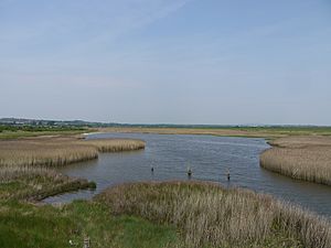
Farlington Marshes is also open to the public. It's a great place for walking and watching birds. There are no doctors' surgeries in Farlington itself. The closest one is in Drayton. The nearest public library is in Cosham.
Getting Around Farlington
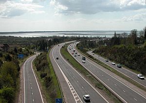
Farlington is surrounded by important roads. The A27 road is to the south and the A3 road is to the east. The A2030 road, also known as Havant Road, runs through the middle of Farlington from east to west. The M27 motorway is about 1 kilometre (0.6 miles) to the west.
Farlington doesn't have its own train station anymore. The closest stations are Cosham railway station to the west and Bedhampton railway station to the east. Farlington used to have its own station, Farlington Halt. It closed on July 4, 1937. This station was built for the Farlington racecourse. Later, it was used for carrying ammunition and other goods. In 1894, there was a train accident at the station where one person died and seven were hurt.
Important Buildings and Churches
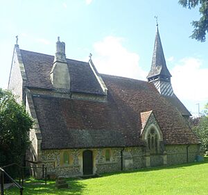
Farlington has two churches: the old parish church of St. Andrew and the Church of the Resurrection. St. Andrew's is at the eastern end of the area on Havant Road. The church was first mentioned in 1200. Most of the church you see today was rebuilt between 1872 and 1875 by an architect named George Edmund Street. His parents were married there. His work made it a "delightful small Victorian village church."
Next to St. Andrew's Church is a memorial for the First World War. It lists 84 names of people from the area who died in the war.
The Church of the Resurrection was built in 1930 because more people were moving to Farlington. It was designed by Randoll Blacking. Because of changes to the area's boundaries, this church is now technically in Drayton.
The Farlington Marshes are south of Farlington and are part of Langstone Harbour. These marshes are a special Local Nature Reserve (119.7 hectares or 295.8 acres). They are owned by Portsmouth City Council and looked after by the Hampshire and Isle of Wight Wildlife Trust. The marshes are a very important place for nature. Many birds, like Brent Geese and Avocets, come here in winter. The marshes were created from the harbour in 1770 and became a Nature Reserve in 1974.
The road called A2030 Eastern Road opened in 1942. It now marks the boundary between Farlington (on its east side) and Drayton (on its west side).
Famous People from Farlington
Several well-known people have connections to Farlington:
- Thomas Pounde (1539–1614) was an English Jesuit lay brother. He spent many years in prison for his Catholic faith.
- Thomas Atkinson was a naval officer who served under Nelson. He is buried in Farlington.
- Rear Admiral John Hayes, who fought in the French Revolutionary and Napoleonic Wars, is also buried here.
- Ken Ellcome was a local councillor and lived in Farlington. He was the Lord Mayor of Portsmouth from 2017 to 2018.
- James Ward-Prowse, a football player for Southampton F.C. and the England national football team, was born and grew up in Farlington. He played for a local youth team called East Lodge.
- Jim Fox, who won an Olympic gold medal in Modern Pentathlon at the 1976 Summer Olympics, lived in Farlington when he won his medal.
 | Bessie Coleman |
 | Spann Watson |
 | Jill E. Brown |
 | Sherman W. White |


