Felsted facts for kids
Quick facts for kids Felsted |
|
|---|---|
 Felsted village |
|
| Population | 3,051 (2011) |
| OS grid reference | TL677203 |
| District |
|
| Shire county | |
| Region | |
| Country | England |
| Sovereign state | United Kingdom |
| Post town | DUNMOW |
| Postcode district | CM6 |
| Dialling code | 01371 |
| Police | Essex |
| Fire | Essex |
| Ambulance | East of England |
| EU Parliament | East of England |
| UK Parliament |
|
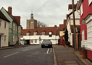
Felsted (sometimes spelled Felstead) is a lovely village and civil parish located in the Uttlesford area of Essex, England. A civil parish is like a small local government area. The Felsted parish includes many smaller places called hamlets. Some of these are Bannister Green, Bartholomew Green, Causeway End, and Hartford End.
History of Felsted
Felsted has a very old history! It was first mentioned in a famous book called the Domesday Book in 1086. Back then, it was known by names like Felesteda and Felstede. It was part of a larger area called the Hinckford Hundred.
In 1086, a church in France, La Trinité of Caen, owned most of the land in Felsted. But some land was given away by King William to other people.
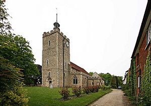
The village has special connections to Richard Rich, 1st Baron Rich. He was an important person who started the famous Felsted School in 1564. He is also buried in the Holy Cross Church in the village. Lord Rich gave a lot of support to the Felsted Church.
The school also has links to Oliver Cromwell, a very important figure in English history. He sent his own sons to study at Felsted School. Long ago, the valley between Little Dunmow and Felsted had the only sugar beet factory in Essex. This area has now been turned into homes, creating a new community called Flitch Green.
Geography of Felsted
Felsted is located south of the A120 main road. It is close to bigger towns like Braintree, Great Dunmow, and Chelmsford. The village sits on the north side of the River Chelmer. This river flows from Great Dunmow and then turns south towards Chelmsford.
- The exact location of Felsted can be described using coordinates: 51.85656 degrees North and 0.43327 degrees East.
- This means it is 51 degrees, 51 minutes, and 24 seconds North, and 0 degrees, 26 minutes, and 60 seconds East.
- Felsted is about 76 meters (or 249 feet) above sea level.
Community Life in Felsted
Felsted is connected to Little Dunmow by the Flitch Way Country Park. This park used to be a railway line, but now it's a lovely path for walking and cycling.
The village has many useful places for people who live there. You can find a village store, a coffee shop, and a tea room. There's also an antiques shop and a ladies' clothes shop. For homes, there's an estate agent. If you're hungry or want to relax, there are two pubs: the Chequers and the Swan. The Felsted Sports Injury Clinic helps people with sports-related injuries.
Felsted is also home to the Felsted Rovers Football Club. They play their home matches behind the Memorial Hall. In 2011, the Felsted electoral ward, which is a voting area, had a population of 5,525 people.
See also
 In Spanish: Felsted para niños
 | George Robert Carruthers |
 | Patricia Bath |
 | Jan Ernst Matzeliger |
 | Alexander Miles |


