Fort Covington, New York facts for kids
Quick facts for kids
Fort Covington
|
|
|---|---|
 |
|
| Country | United States |
| State | New York |
| County | Franklin |
| Named for | Leonard Covington |
| Government | |
| • Type | Town Council |
| Area | |
| • Total | 36.73 sq mi (95.14 km2) |
| • Land | 36.73 sq mi (95.14 km2) |
| • Water | 0.00 sq mi (0.00 km2) |
| Elevation | 187 ft (57 m) |
| Population
(2020)
|
|
| • Total | 1,531 |
| Time zone | UTC−5 (Eastern (EST)) |
| • Summer (DST) | UTC−4 (EDT) |
| ZIP Code |
12937
|
| Area code(s) | 518 |
| FIPS code | 36-033-26737 |
| GNIS feature ID | 0978966 |
| Highways |
|
Fort Covington is a town in Franklin County, New York, United States. In 2020, about 1,531 people lived there. The town got its name from a fort used during the War of 1812. It was first called French Mills.
Fort Covington is located on the northern edge of Franklin County. This border is also the official Canada–United States border.
Contents
History of Fort Covington
The area that is now Fort Covington was settled in the 1790s. People from southern Canada and Vermont moved here. They came to work at the mills along the Salmon River. The first name for the village was French Mills.
In July 1813, a blockhouse was built in French Mills. This building helped shelter injured soldiers. It also served as a winter base during the War of 1812.
In 1817, French Mills was renamed Fort Covington. It was named after Brigadier General Leonard Covington. He was badly hurt during the Battle of Chrysler's Farm. This battle happened on November 11, 1813. In 1833, the western part of Fort Covington became the town of Bombay.
The Fort Covington–Dundee Border Crossing is an important historical site. It was added to the National Register of Historic Places in 2014.
Where is Fort Covington?
Fort Covington is in the northwest part of Franklin County, New York. To its west is the St. Regis Mohawk Reservation. The town's northern border is the international line with Canada. Specifically, it borders the province of Quebec.
The town covers about 95.1 square kilometers (36.7 square miles) of land. There is no water area within the town limits.
New York State Route 37 goes through the middle of the town. This road leads west to Massena. It also goes southeast to Malone.
Quebec Route 132 connects to the area. You can reach it via Dundee Road and Water Street.
People Living in Fort Covington
| Historical population | |||
|---|---|---|---|
| Census | Pop. | %± | |
| 1820 | 979 | — | |
| 1830 | 2,901 | 196.3% | |
| 1840 | 2,094 | −27.8% | |
| 1850 | 2,641 | 26.1% | |
| 1860 | 2,757 | 4.4% | |
| 1870 | 2,436 | −11.6% | |
| 1880 | 2,424 | −0.5% | |
| 1890 | 2,207 | −9.0% | |
| 1900 | 2,043 | −7.4% | |
| 1910 | 2,028 | −0.7% | |
| 1920 | 1,966 | −3.1% | |
| 1930 | 1,728 | −12.1% | |
| 1940 | 1,767 | 2.3% | |
| 1950 | 1,764 | −0.2% | |
| 1960 | 1,905 | 8.0% | |
| 1970 | 1,963 | 3.0% | |
| 1980 | 1,804 | −8.1% | |
| 1990 | 1,676 | −7.1% | |
| 2000 | 1,645 | −1.8% | |
| 2010 | 1,676 | 1.9% | |
| 2020 | 1,531 | −8.7% | |
| U.S. Decennial Census | |||
In 2000, there were 1,645 people living in Fort Covington. These people made up 621 households. About 466 of these were families.
Most people living in the town were White (87.13%). About 10.81% were Native American. A small number were African American or Asian. Some people were from other backgrounds.
About 34% of households had children under 18. Many households (59.4%) were married couples. The average household had 2.65 people. The average family had 3.03 people.
The median age in the town was 39 years old. About 26.7% of the population was under 18. About 14.7% were 65 or older.
The median income for a household was $31,532. For families, it was $39,205. About 14.7% of the population lived below the poverty line.
Places in Fort Covington
- Cooks Corner – This is a small community or hamlet. It is located near the southern border of the town. You can find it where County Roads 3 and 32 meet.
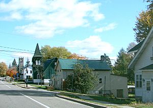
- Fort Covington (Hamlet) – This is the main community within the town. It used to be a village until 1976. The hamlet is where NY-37 and County Road 42 cross. It is also a place where people can enter the country. The northern part of the town is now called the Fort Covington Hamlet census-designated place.
- Fort Covington Center – Another small community or hamlet. It is located near the southern town line. You can find it on County Road 42.
- Pike Creek – This is a stream that flows north. It goes through the town towards the St. Lawrence River.
- Salmon River – This is another stream that flows through the town.
Famous People from Fort Covington
- George Hyer – A Wisconsin newspaper writer, farmer, and politician.
- A. Warren Phelps – A Wisconsin businessman and politician.
See also
 In Spanish: Fort Covington (Nueva York) para niños
 | Aaron Henry |
 | T. R. M. Howard |
 | Jesse Jackson |


