Four Mile Run facts for kids
Quick facts for kids Four Mile Run |
|
|---|---|
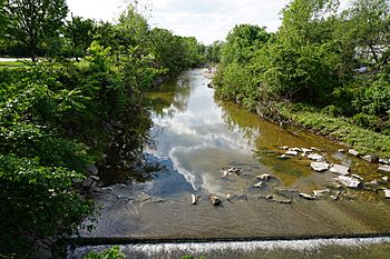
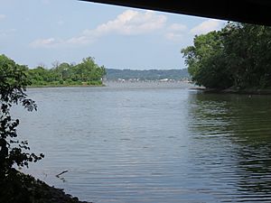
Four Mile Run near Arlington's Jennie Dean Park
|
|
| Country | United States |
| Physical characteristics | |
| Main source | Fairfax County, Virginia (paved over) 339 feet (103 m) |
| River mouth | Potomac River in Arlington County, Virginia |
| Length | 9.35 miles (15 km) |
| Basin features | |
| Basin size | 19.7 square miles (51 km2), 17 square miles (44 km2) in the non-tidal area |
| GNIS feature ID | 1478084 |
Four Mile Run is a stream in Northern Virginia. It's about 9.4 miles (15.1 km) long. The stream starts in Fairfax County near Interstate 66. It then flows southeast through Falls Church and into Arlington County, Virginia.
Much of the stream runs through parkland. Two paved trails follow it: the Washington & Old Dominion Railroad Trail and the Four Mile Run Trail. These trails are great for walking, running, and biking.
In Arlington, the stream flows from a hilly area called the Piedmont. It then crosses a natural boundary called the Fall Line. Finally, it reaches the flatter Atlantic Coastal Plain in a deep, wooded valley. The eastern part of the stream forms the border between Arlington County and the City of Alexandria. Four Mile Run eventually empties into the Potomac River, right next to Reagan National Airport.
The name "Four Mile Run" doesn't mean the stream is four miles long. Some people thought it came from a faded map that said "Flour Mill Run." A more likely idea is that its mouth is about four miles upriver from another stream called Hunting Creek.
Contents
Where Does Four Mile Run Flow?
Four Mile Run begins in Fairfax County. It quickly moves into Arlington County. Here, parts of the stream flow openly, while other parts go through underground tunnels called culverts. These tunnels take it under Interstate 66 and a neighborhood called East Falls Church.
The stream briefly enters the City of Falls Church before returning to Arlington. At this point, the Washington & Old Dominion Trail starts to follow the stream. It passes through several local parks like Isaac Crossman Park and Benjamin Banneker Park.
At Madison Manor Park, the older Four Mile Run Trail separates from the Washington & Old Dominion Trail. They usually run on opposite sides of the stream from here on. The stream then flows next to Interstate 66 for a while. It moves away from the highway at Bon Air Park.
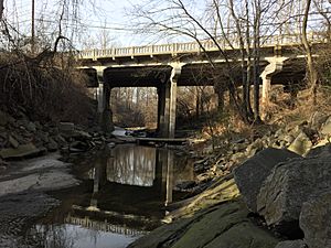
South of Bon Air Park, the stream goes into a deep, narrow, wooded gorge. This part of the stream is within Bluemont Park and Glencarlyn Park. It crosses under Arlington Boulevard (U.S. 50). The stream leaves the gorge and enters flatter land just south of the Columbia Pike crossing.
The stream then flows through Barcroft Park and Shirlington Park. It also runs between Jennie Dean Park and the Shirlington business area. At Shirlington, the Washington & Old Dominion Trail ends. The Four Mile Run Trail continues along the stream's north bank. Here, the stream becomes the border between Arlington and Alexandria.
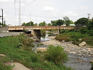
Further downstream from Shirlington, the stream has been straightened. This was done to help control floods. However, people are working to restore the stream to a more natural state. The stream goes under Interstate 395. It then becomes a tidal creek near the Mt. Vernon Avenue crossing. At this point, its name changes to Four Mile Creek. The creek flows through Four Mile Run Park. It then passes under Richmond Highway (U.S. 1), the WMATA Yellow and Blue Lines, and the George Washington Memorial Parkway. Finally, it reaches the Potomac River at the south end of Ronald Reagan Washington National Airport.
A Look Back in Time
During the colonial period and the 1800s, there were several watermills along the stream. These mills used the stream's water power. One mill, Arlington Mill, was built in 1836. It was later rebuilt as Barcroft Mill in 1880 after being damaged during the Civil War. The mill helped local farmers grind corn and wheat into flour. Today, the foundation of this mill supports an automobile repair shop.
General George Washington owned a large piece of land near the stream. In 1785, after the Revolutionary War, he surveyed his property. He even cut a mark into an oak tree to show a corner of his land. A piece of this tree trunk is now kept in the Glencarlyn Library. A monument marks where the tree once stood.
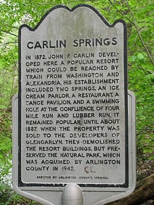
From about 1860 to 1968, the Washington and Old Dominion Railroad ran along most of the stream in Arlington. Now, the Washington and Old Dominion Railroad Trail follows this old railway path. In the late 1800s, a small resort called Carlin Springs was popular. People from Washington, D.C., would take the train there to swim and dance. Carlin Springs was located in what is now Glencarlyn Park.
From 1906 to 1915, an amusement park called Luna Park was located near where Four Mile Run meets the Potomac. It was a fancy place with ballrooms, restaurants, roller coasters, and circus shows. Early residents used to swim in the deeper parts of Four Mile Run. Later, in the 1930s, a sewage treatment plant was built on the site of the old Luna Park.
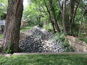
In June 1972, heavy rains from Hurricane Agnes caused the stream to flood. This caused a lot of damage in nearby neighborhoods. Because of this, the Army Corps of Engineers straightened parts of the stream. They also covered its banks with rocks to help control future floods.
Four Mile Run Crossings
For a full list of bridges and roads that cross Four Mile Run, you can check out the main article:
Tributaries
Smaller streams that flow into Four Mile Run are called tributaries. Here are some of them, listed from the start of Four Mile Run to its end:
| Tributary | Side of Main Stream | Location (near where it joins Four Mile Run) |
|---|---|---|
| Lubber Run | Northeast | 38°51′57″N 77°07′12″W / 38.865847°N 77.11992°W |
| Long Branch (upper) | Southwest | 38°51′43″N 77°07′07″W / 38.861845°N 77.118544°W |
| Doctors Run (Doctors Branch) | Northeast | 38°51′00″N 77°06′11″W / 38.849969°N 77.103006°W |
| Lucky Run | Southwest | 38°50′46″N 77°05′48″W / 38.845996°N 77.096751°W |
| Long Branch (lower) | North | 38°50′41″N 77°04′17″W / 38.844861°N 77.071321°W |
Parks Along the Stream
Many parks are located along or next to Four Mile Run. They are listed here from the stream's beginning to its end:
- Washington & Old Dominion Railroad Regional Park, Arlington
- Crossman Park, Falls Church
- Benjamin Banneker Park, Arlington
- Madison Manor Park, Arlington
- Bon Air Park, Arlington
- Bluemont Junction Park, Arlington (a narrow trail connecting to Bluemont Park)
- Bluemont Park, Arlington
- Glencarlyn Park, Arlington
- Barcroft Park, Arlington
- Shirlington Park, Arlington
- Jennie Dean Park, Arlington
- Four Mile Run Park, Alexandria
- George Washington Memorial Parkway (a national park), Arlington and Alexandria
Trails for Exploring
Several paved trails run near Four Mile Run, perfect for outdoor activities:
- Washington & Old Dominion Railroad Trail, Arlington
- Four Mile Run Trail, Arlington
- Wayne F. Anderson Bikeway, Arlington and Alexandria
You can also connect to other trails:
- Mount Vernon Trail
- Bluemont Junction Trail, Arlington
- Custis Trail (along I-66), Arlington
It's even possible to bike or hike a triangle route using all three of these trails!
 | Misty Copeland |
 | Raven Wilkinson |
 | Debra Austin |
 | Aesha Ash |


