
Gadsden County, Florida facts for kids
Quick facts for kids
Gadsden County
|
||
|---|---|---|
.jpg)
Gadsden County Courthouse
|
||
|
||

Location within the U.S. state of Florida
|
||
 Florida's location within the U.S. |
||
| Country | ||
| State | ||
| Founded | June 24, 1823 | |
| Named for | James Gadsden | |
| Seat | Quincy | |
| Largest city | Quincy | |
| Area | ||
| • Total | 529 sq mi (1,370 km2) | |
| • Land | 516 sq mi (1,340 km2) | |
| • Water | 12 sq mi (30 km2) 2.3%% | |
| Population
(2020)
|
||
| • Total | 43,826 |
|
| • Density | 83/sq mi (32/km2) | |
| Time zone | UTC−5 (Eastern) | |
| • Summer (DST) | UTC−4 (EDT) | |
| Congressional district | 2nd | |

Gadsden County is a county in the U.S. state of Florida. It's located in the "panhandle" part of Florida. In 2020, about 43,826 people lived there. The main town, or county seat, is Quincy. Gadsden County is special because it's the only county in Florida where most of the people are African American.
Contents
History of Gadsden County
Gadsden County was created a long time ago, in 1823. It was named after James Gadsden. He was from South Carolina and helped Andrew Jackson in Florida in 1818. For many years, Gadsden County was known for growing tobacco. However, tobacco farming is not common there anymore.
Geography and Location
Gadsden County covers about 529 square miles. Most of this area, about 516 square miles, is land. The rest, about 12 square miles, is water.
The county is part of the larger Tallahassee area. Gadsden County is in the Eastern Time Zone. Its western edge, next to Jackson County, is where the Eastern and Central Time Zones meet.
Neighboring Counties
Gadsden County shares borders with several other counties:
- Decatur County, Georgia - to the north
- Seminole County, Georgia - to the north
- Grady County, Georgia - to the northeast
- Leon County, Florida - to the east
- Liberty County, Florida - to the southwest
- Calhoun County, Florida - to the southwest (in the Central Time Zone)
- Jackson County, Florida - to the northwest (in the Central Time Zone)
Population and People
In 2020, the population of Gadsden County was 43,826 people. This county is unique in Florida because it's the only one where most of the people are African American.
Here's a quick look at the population in 2020:
- About 32% of the people were White (not Hispanic or Latino).
- About 53% were Black or African American (not Hispanic or Latino).
- About 12% were Hispanic or Latino (they can be of any race).
- A smaller number of people were Native American, Asian, Pacific Islander, or of other races. Some people were also of mixed races.
In 2000, there were about 15,867 households in the county. About 32.6% of these households had children under 18 living there. The average household had about 2.69 people.
The median age in the county was 36 years old. This means half the people were younger than 36, and half were older.
Education in Gadsden County

The Gadsden County School District runs all the public schools in the county.
Gadsden County has one public high school called Gadsden County High School. This school was formed in 2017 when two other high schools, East Gadsden High and West Gadsden High, combined. The old West Gadsden High building is now a middle school.
There are also private schools in the county, such as Robert F. Munroe Day School and Tallavanna Christian School.
Libraries in the County
The Gadsden County Public Library System has three library branches:
- William A. McGill Library
- Havana Branch
- Chattahoochee Branch
Getting Around: Transportation
Airports
- Quincy Municipal Airport is the local airport.
Main Roads

 Interstate 10 is the main highway that goes from west to east through the county. It has four exits in Gadsden County.
 US 90 used to be the main east-west highway before I-10 was built. It goes through towns like Gretna, Douglas City, and Quincy.
 US 27 is a highway that runs north to south in the northeastern part of the county.
 State Road 12 is a state highway that goes from west to east.
 State Road 65
 State Road 159 is a shorter road connecting US 27 to SR 12 in Havana.
 State Road 267
Railroads
Gadsden County has several railroad lines. Most of them are owned by CSX. These lines connect different towns and were once used by Amtrak's Sunset Limited train. Another line is the Apalachicola Northern Railroad, which goes south to Port St. Joe.
Public Transportation
Big Bend Transit provides bus services in Gadsden County, with three different bus routes.
Communities in Gadsden County
Cities
Towns
Unincorporated Areas

These are areas that are not part of a city or town:
- Dogtown
- Hinson
- Jamieson
- Lake Tallavana
- Mount Pleasant
- Oak Grove
- Reston
- St. Hebron
- St. John
- Scotland
- Scottown
- Wetumpka
Gallery
-
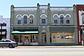
Gadsden County Board of Commissioners
-
Gadsden County Sheriff's Office
-
Gadsden County Emergency Medical Services and Gadsden County Fire Services


See also
 In Spanish: Condado de Gadsden para niños
