
Port St. Joe, Florida facts for kids
Quick facts for kids
Port St. Joe, Florida
|
|
|---|---|
| City of Port St. Joe | |

Port St. Joe City Hall
|
|
| Nickname(s):
St. Joe
|
|
| Motto(s):
"The Constitution City"
"Birthplace of the Florida Constitution" "In God We Trust" |
|

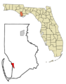
Location in Gulf County and the state of Florida
|
|
| Country | |
| State | |
| County | Gulf |
| Settled | 1835-1862 |
| Incorporated | 1913 |
| Named for | St. Joseph Bay |
| Government | |
| • Type | Commission–Manager |
| Area | |
| • Total | 11.97 sq mi (30.99 km2) |
| • Land | 9.37 sq mi (24.26 km2) |
| • Water | 2.60 sq mi (6.73 km2) |
| Elevation | 2 ft (0.6 m) |
| Population
(2020)
|
|
| • Total | 3,357 |
| • Density | 358.39/sq mi (138.38/km2) |
| Time zone | UTC−5 (Eastern (EST)) |
| • Summer (DST) | UTC−4 (EDT) |
| ZIP codes |
32456, 32457
|
| Area code(s) | 850 |
| FIPS code | 12-58675 |
| GNIS feature ID | 2404557 |
Port St. Joe is a city in Florida, located in Gulf County. It's the main city, or county seat, of Gulf County. You can find it where U.S. Highway 98 and State Road 71 meet. In 2020, about 3,357 people lived there.
Contents
A Look at Port St. Joe's Past
.jpg)
The original town, called St. Joseph, was started in 1835. Business people from nearby Apalachicola founded it. They were having problems with land ownership in their old town.
However, St. Joseph was mostly left empty by 1841. This happened after many people got sick during a yellow fever outbreak. Then, a big storm surge from a hurricane in 1844 destroyed what was left.
Port St. Joe During the Civil War
During the American Civil War, Florida was very important for making salt. Salt was needed to preserve food for the Confederate army. On September 15, 1862, a Union army officer from the ship USS Kingfisher sent a message. He told the large salt factories in St. Joseph to stop working.
When they didn't stop, the Kingfisher sailed into St. Joseph Bay. About 50 soldiers went ashore and destroyed the salt factories.
How Port St. Joe Was Rebuilt
In the early 1900s, a new town was built close to the old one. This happened after the Apalachicola Northern Railroad arrived in 1909. Around this time, the name "Port St. Joe" became the official name.
On October 10, 2018, Hurricane Michael caused a lot of damage to the community.
Where is Port St. Joe Located?

Port St. Joe is in the southern part of Gulf County, Florida. It's located in the Florida Panhandle along the beautiful Emerald Coast. The city covers about 11.97 square miles (30.99 square kilometers). A good part of this area, about 21.86%, is water.
The city limits reach into St. Joseph Bay, which is a part of the Gulf of Mexico.
Main Roads in Port St. Joe
U.S. Route 98 goes through Port St. Joe. It's called Monument Drive in the north and Constitution Drive in the south. This highway leads northwest about 36 miles (58 km) to Panama City. It also goes southeast about 23 miles (37 km) to Apalachicola.
Florida State Road 71 (Cecil G. Costin Sr. Boulevard) heads northeast. It goes about 24 miles (39 km) to Wewahitchka.
How High is Port St. Joe Above Sea Level?
Port St. Joe is very close to sea level, averaging only 3 feet (0.9 meters) high. Its highest point, called "Highland View," is only 8 feet (2.4 meters) above sea level.
Port St. Joe's Weather
Port St. Joe has a humid subtropical climate. This means it has mild temperatures and plenty of rain all year. Summers are usually hot.
Who Lives in Port St. Joe?
| Historical population | |||
|---|---|---|---|
| Census | Pop. | %± | |
| 1930 | 851 | — | |
| 1940 | 2,393 | 181.2% | |
| 1950 | 2,752 | 15.0% | |
| 1960 | 4,217 | 53.2% | |
| 1970 | 4,401 | 4.4% | |
| 1980 | 4,027 | −8.5% | |
| 1990 | 4,044 | 0.4% | |
| 2000 | 3,644 | −9.9% | |
| 2010 | 3,445 | −5.5% | |
| 2020 | 3,357 | −2.6% | |
| U.S. Decennial Census | |||
As of the 2020 United States census, there were 3,357 people living in Port St. Joe. There were 1,494 households and 999 families.
Learning and Libraries in Port St. Joe
Port St. Joe has schools that are part of Gulf County Schools.
Schools in the Area
- Port St. Joe Elementary School
- Port St. Joe High School
- Faith Christian School
Colleges Near Port St. Joe
- Gulf Coast State College, Gulf/Franklin Campus. This college is part of the Florida College System.
The Public Library
The Corinne Costin Gibson Memorial Public Library serves the community. It is part of the Northwest Regional Library System. The library shares a building with the senior citizens center, the sheriff's office, the courthouse, and the animal shelter. You can find it off State Road 71.
Fun Places to Visit in Port St. Joe
- Constitution Convention Museum State Park
- Centennial Building
- Port Theatre Art and Culture Center
- St. Joseph Catholic Mission Church
Local Media in Port St. Joe

Radio Stations
- WEBZ 99.3 FM (Urban music)
- W216BT 91.1 FM (repeats WFSW-FM from Panama City)
- WDBW-LP, 97.3 FM (from Long Avenue Baptist Church, repeats Bible Broadcasting Network)
- WOYS 106.5 FM (Classic Rock/Blues/Beach Music)
- WFCX 100.5 FM (Tropical Rock)
Newspaper
- The Star
Getting Around Port St. Joe

Waterways
The Gulf Intracoastal Waterway (GIWW) is a canal maintained by the government. It is 12 feet (3.7 meters) deep and 125 feet (38 meters) wide. This waterway connects Port St. Joe to Panama City and Apalachicola.
The Port of Port St. Joe has a shipping channel that is 35 feet (10.7 meters) deep. It connects to the shipping lanes of the Gulf of Mexico. The port has facilities for making chemical lime from dolomite. There is also a chemical plant, a large terminal for moving dry goods from barges to trains, and a company that builds dive-cruise ships.
Highways
U.S. Route 98 runs along the coast and through Port St. Joe. It provides a route west to Panama City and east to Apalachicola. State Road 71 connects Port St. Joe northward. It leads toward Alabama and Georgia. It also gives access to Interstate 10, which is 72 miles (116 km) away.
Famous People From Port St. Joe
- Greg Lewis, a retired professional football player (running back)
- Calvin Pryor, a former professional football player (strong safety)
- Roman Quinn, a professional baseball player (MLB)
- Jason Shoaf, a member of the Florida House of Representatives
- Clifford Chester Sims, a United States Army soldier who received the Medal of Honor
Images for kids
-
Location in Gulf County and the state of Florida
See also
 In Spanish: Port St. Joe para niños
