Gaspereau River facts for kids
Quick facts for kids Gaspereau River |
|
|---|---|

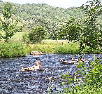
Tubing on the Gaspereau River
|
|
| Country | Canada |
| Province | Nova Scotia |
| Physical characteristics | |
| Main source | Gaspereau Lake |
| River mouth | Minas Basin sea level |
| Length | 24.5 km (15.2 mi) |
| Basin features | |
| Basin size | 1,375 km (854 mi) |
The Gaspereau River is a river located in Kings County, Nova Scotia, Canada. It flows for about 24.5 kilometers (15 miles). The river starts at Gaspereau Lake on the South Mountain. It then flows into the Minas Basin at Hortonville.
The lower part of the river is affected by tides for about 6.5 kilometers (4 miles). This area has many tidal marshes, which are wet, grassy lands. The upper part of the river flows quickly over rocks and boulders. Some parts of the river have been dammed to create deep, narrow channels. These dams help generate hydroelectric power. Because of the dams, twelve large lakes are now connected to the river. This creates a large area of land that drains into the river, called a watershed, which is about 1,375 square kilometers (531 square miles). A smaller river called the Black River also joins the Gaspereau River near White Rock.
Contents
Fish and Wildlife
Even though the Gaspereau River is not very long, it is a very important place for fish. The riverbed and its connected lakes are great breeding grounds. Many types of fish travel here to lay their eggs.
Some of these fish include:
Other fish like Atlantic Tomcod, Atlantic Sturgeon, and Striped Bass also lay their eggs in the tidal parts of the river.
River History and Use
The Gaspereau River has a rich history. Its many fish runs attracted the Mi'kmaq people long ago. They had a large settlement near Melanson. Later, Acadians from Grand-Pre also came to the river in the late 1600s. They named it "Rivière des Gasparots" after the Gaspereau fish. This name first appeared in a census in 1701.
After the Expulsion of the Acadians, New England Planters settled in the area. They also caught fish. But they also cleared the land along the river for farming. They grew many apple orchards. They also built sawmills in the upper parts of the river. At one point, nine sawmills were working on the river system. This created jobs through logging, but it also changed the river's environment.
In 1920, a hydroelectric dam was built at Stivers Falls near White Rock. This was the first of many dams. These dams replaced the old water-powered sawmills. Eventually, eight dams and five hydroelectric stations were built along the Gaspereau River. Some lakes that used to flow into the Avon River were redirected into the Gaspereau. Special "fish ladders" were built to help fish continue their migration past the dams.
Fun on the River
A popular activity on the Gaspereau River is recreational tubing. People float down the river on inner tubes. This tradition has become very popular recently. So many people come that it sometimes causes traffic and parking issues.
Vineyards and Wine
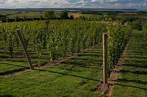
Vineyards cover a large part of the Gaspereau Valley, stretching up to Grand-Pré. These vineyards produce different types of wine. They make white wines from grapes like L'Acadie blanc. They also make red wines from varieties such as Marechal Foch.
Wild vines have grown in this area for a very long time. Around the year 1000, the Vikings, led by Leif Erikson, even named this region Vinland because of the many vines they found.
Communities Along the River
- Gaspereau (including Wallbrook, Melanson, and White Rock)
- Hortonville
- Avonport
 | Charles R. Drew |
 | Benjamin Banneker |
 | Jane C. Wright |
 | Roger Arliner Young |


