
Gers (river) facts for kids
Quick facts for kids Gers |
|
| River | |
_sur_le_chemin_de_St.Jacques.JPG) The Gers river in Auch
|
|
| Country | France |
|---|---|
| Regions | Occitanie, Nouvelle-Aquitaine |
| Department | Hautes-Pyrénées, Gers, Lot-et-Garonne |
| Commune | Lannemezan, Chélan, Panassac, Masseube, Seissan, Pavie, Auch, Preignan, Montestruc-sur-Gers, Fleurance, Lectoure |
| Tributaries | |
| - left | Sousson, Talouch, Lauze, Auchie |
| - right | Cier, Arçon, Aulouste |
| City | Auch |
| Source | |
| - location | Plateau de Lannemezan, Occitanie, France |
| - elevation | 613 m (2,011 ft) |
| - coordinates | 43°05′57″N 0°23′20″E / 43.09917°N 0.38889°E |
| Mouth | Garonne |
| - location | Layrac, Nouvelle-Aquitaine, France |
| - elevation | 45 m (148 ft) |
| - coordinates | 44°08′42″N 0°38′50″E / 44.14500°N 0.64722°E |
| Length | 175.4 km (109 mi) |
| Basin | 1,227 km² (474 sq mi) |
| Discharge | for Layrac |
| - average | 7.06 m³/s (249 cu ft/s) |
The Gers is a river in France. It flows through three different areas called departments: Hautes-Pyrénées, Gers, and Lot-et-Garonne. These departments are part of two larger areas known as regions: Occitanie and Nouvelle-Aquitaine. The Gers department is actually named after this very river!
The river starts high up in the Pyrenees mountains. It flows into the Garonne River as a "left tributary". A tributary is a smaller river or stream that flows into a larger river. The Gers generally flows from south to north.
Contents
About the Gers River
The Gers river is about 175.4 km (109.0 mi) long. The area of land that drains water into the Gers river, called its drainage basin, covers about 1,227 km2 (474 sq mi).
Where the River Starts
The source (or beginning) of the Gers river is on a high area called the Plateau de Lannemezan. This is near the town of Lannemezan in the Hautes-Pyrénées department. It starts at an altitude (height above sea level) of about 613 m (2,011 ft).
Cities and Towns Along the River
As the Gers river flows, it passes through many towns and cities. Here are some of the main ones in each department:
- In Hautes-Pyrénées: Lannemezan and Monléon-Magnoac
- In Gers: Chélan, Panassac, Masseube, Seissan, Pavie, Auch, Preignan, Montestruc-sur-Gers, Fleurance, and Lectoure
- In Lot-et-Garonne: Astaffort and Layrac
The Gers river flows through 48 different local areas called communes.
Where the River Ends
The Gers river eventually flows into the Garonne River. This happens south of the city of Agen, in the Layrac commune. At this point, the river is about 45 m (148 ft) above sea level.
Main Streams Joining the Gers
Many smaller streams and rivers flow into the Gers. These are called its tributaries. They are divided into "left" and "right" tributaries based on which side of the Gers they join from, if you were looking downstream (the direction the river flows).
- Left tributaries:
- Gèze - 11.7 km long
- Cédon - 18.6 km long
- Sousson - 33.8 km long
- Talouch - 14 km long
- Ousse - 10.6 km long
- Lauze - 16.3 km long
- Auchie - 15.7 km long
- Right tributaries:
- Cier - 13.6 km long
- Arçon - 18.1 km long
- Aulouste - 20.6 km long
Gallery
-
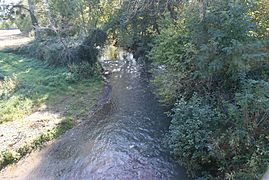
The Gers river in Sariac-Magnoac
-
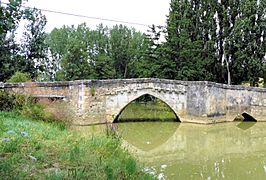
Old bridge on the Gers, Pavie
-
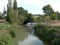
The Gers river in Ornézan


See also
 In Spanish: Río Gers para niños
