
Gungahlin facts for kids
Quick facts for kids GungahlinAustralian Capital Territory |
|||||||||||||||
|---|---|---|---|---|---|---|---|---|---|---|---|---|---|---|---|

Gold Creek was typical of the sheep properties of the Gungahlin region prior to development.
|
|||||||||||||||

Location of Gungahlin in the Australian Capital Territory
|
|||||||||||||||

Gungahlin
Location in Australia
|
|||||||||||||||
| Population | 87,682 (2021 census) | ||||||||||||||
| • Density | 967.8/km2 (2,507/sq mi) | ||||||||||||||
| Gazetted | 12 May 1966 | ||||||||||||||
| Area | 90.6 km2 (35.0 sq mi) | ||||||||||||||
| Location | 10 km (6 mi) N of Canberra | ||||||||||||||
| Territory electorate(s) | Yerrabi | ||||||||||||||
| Federal Division(s) | Fenner | ||||||||||||||
|
|||||||||||||||
Gungahlin is a fast-growing area in the Australian Capital Territory (ACT). It is one of the fastest-growing regions in all of Australia. This area is divided into smaller parts called suburbs.
The name 'Gungahlin' comes from an Aboriginal word. It means either "white man's house" or "little rocky hill".
In 2022, Gungahlin had sixteen suburbs, with some still being built. The idea for Gungahlin as a town was first planned in 1957. It officially became the fourth 'town' in the ACT in 1991. Back then, only 389 people lived there. By 2021, the population had grown to 87,682 people!
Gungahlin is home to the northernmost town centre in the ACT. It is about 10 kilometers (6 miles) north of Canberra City (also known as "Civic"). Gungahlin is one of five satellite cities around Canberra. The others are Woden, Tuggeranong, Weston Creek, and Belconnen.
Contents
History of Gungahlin
The original owners of the land in Gungahlin are the Ngunnawal tribe. They are Indigenous people who have lived here for a very long time.
In 1911, the land was transferred from New South Wales to the Australian Government. Gungahlin was officially set up as a district in 1966.
Before the 1960s, Gungahlin was mostly farmland. It was part of an area called Ginninderra. Villages like Ginninderra and later Hall helped the local farmers. Families like the Rolfes and Shumacks settled here. They started farms for wheat and sheep. Some of their farms were called 'Gold Creek' and 'Horse Park'. The food they grew helped feed the many workers at the goldfields in Braidwood.
Where is Gungahlin?
Gungahlin is the first district you reach when driving to Canberra from Melbourne or Sydney. You would travel along the Barton Highway to get there.
The district has homes and industrial areas. These areas surround the main town centre. There are also undeveloped farmlands that border New South Wales. The main industrial area in Gungahlin is Mitchell.
Gungahlin is separated from other districts by open land. These include Belconnen to the west, Canberra Central to the south, and Majura to the southeast. The town of Hall is to the northwest.
Who Lives in Gungahlin?
In 2021, there were 87,682 people living in Gungahlin. About half were male and half were female.
The average age of people in Gungahlin was 32 years old. This is younger than the national average of 38 years. Children aged 0 to 14 made up 23% of the population. People aged 65 and over made up 7.2%.
Gungahlin has grown very quickly. Its population increased by 35.6% between 2001 and 2006. It grew by another 50% by 2011, and 50.4% by 2016. By 2021, it had grown another 23.2%. This growth is much faster than the rest of Australia.
Many different languages are spoken in homes in Gungahlin. In 2021, about 41.3% of homes spoke a language other than English. This is higher than the national average of 24.8%.
| Selected historical census data for the Gungahlin district (including Hall) | |||||||
|---|---|---|---|---|---|---|---|
| Census year | 2001 | 2006 | 2011 | 2016 | 2021 | ||
| Population | Estimated residents on census night | 23,466 | 31,656 | 47,303 | 71,142 | 87,682 | |
| District rank in terms of size within the Australian Capital Territory | 5th | ||||||
| Percentage of the Australian Capital Territory population | 7.64% | 9.82% | 13.15% | 19.92% | 22.06% | ||
| Percentage of the Australian population | 0.12% | ||||||
| Cultural and language diversity | |||||||
| Ancestry, top responses |
Australian | 25.6% | 21.2% | 27.0% | |||
| English | 21.1% | 20.4% | 24.6% | ||||
| Chinese | 5.2% | 6.7% | 8.8% | ||||
| Indian | n/a | n/a | 8.4% | ||||
| Irish | 7.1% | 7.2% | 7.6% | ||||
| Scottish | 5.6% | 5.7% | n/a | ||||
| Language, top responses (other than English) |
Mandarin | 1.2% | |||||
| Punjabi | n/a | n/a | n/a | n/a | |||
| Hindi | n/a | n/a | |||||
| Urdu | n/a | n/a | n/a | n/a | |||
| Nepali | n/a | n/a | n/a | n/a | |||
| Vietnamese | 2.1% | n/a | |||||
| Cantonese | 1.7% | n/a | |||||
| Croatian | 3.0% | n/a | n/a | ||||
| Korean | n/a | n/a | n/a | n/a | |||
| Religious affiliation | |||||||
| Religious affiliation, top responses |
No Religion | 16.0% | |||||
| Catholic | 33.0% | ||||||
| Hinduism | n/a | n/a | |||||
| Anglican | 17.1% | ||||||
| Islam | n/a | n/a | n/a | n/a | |||
| Buddhism | 3.5% | n/a | n/a | ||||
| Median weekly incomes | |||||||
| Personal income | Median weekly personal income | A$813 | A$1,019 | A$1,052 | A$1,198 | ||
| Percentage of Australian median income | 174.5% | ||||||
| Family income | Median weekly family income | A$1,836 | A$2,355 | A$2,453 | A$2,829 | ||
| Percentage of Australian median income | 156.8% | ||||||
| Household income | Median weekly household income | A$1,676 | A$2,176 | A$2,247 | A$2,537 | ||
| Percentage of Australian median income | 163.2% | ||||||
Suburbs of Gungahlin
Gungahlin is made up of many different suburbs. Here is a list of them:
|
|
|
|
* Some suburbs, like Kenny, were still being developed in 2022.
Getting Around Gungahlin

Most people in Gungahlin use private cars to get around. Even though there's talk about more public transport, the area was built with cars in mind. It has a large network of roads.
Public Transport Options
Bus Services
The ACTION bus service helps people travel throughout Canberra. Buses from different suburbs and town centres connect at Gungahlin Place (35°11′07″S 149°08′06″E / 35.1854°S 149.1351°E) in the town centre. This is also where the light rail starts.
Light Rail System

A light rail system connects the Gungahlin Town Centre to Civic. It opened in April 2019. The goal was to reduce traffic jams during busy times. This encourages more people to use public transport. The light rail station is on Hibberson Street (35°11′08″S 149°08′07″E / 35.1856°S 149.1352°E), close to the bus stop.
Private Car Travel
Driving a car is the most common way for Gungahlin residents to travel. Major roads like Northbourne Avenue (via the Barton Highway), Horse Park Drive, and Flemington Road lead to North Canberra and the city centre. Gundaroo Drive connects Gungahlin to the Belconnen district.
The Gungahlin Drive Extension was finished in 2008. This road allows drivers from Gungahlin to avoid the city centre. They can reach Canberra's southern suburbs using Gungahlin Drive and the Tuggeranong Parkway.
Several projects have made it easier to drive in Gungahlin:
- The Gungahlin Drive Extension was made into a dual lane road (finished in 2011).
- Clarrie Hermes Drive was extended to the Barton Highway (finished in May 2012).
- Flemington Road was upgraded to a dual lane road between Gungahlin Town Centre and Well Station Drive in 2010. The rest of the road to the Federal Highway was also duplicated in 2019.
Community and Sports
The Gungahlin Community Council is a group that represents the people living in the district.
Gungahlin has several local sports teams:
- The Gungahlin Eagles play rugby union.
- The Gungahlin Bulls play rugby league.
- Gungahlin United plays soccer.
- The Gungahlin Jets play Australian rules football.
All these teams play their games at Gungahlin Enclosed Oval. Gungahlin also has the North Canberra Gungahlin Cricket Club for cricket.
Schools in Gungahlin
Gungahlin has many schools for students of all ages:
- John Paul College
- Gold Creek School
- Holy Spirit Primary School
- Good Shepherd Primary School
- Palmerston Primary School
- Amaroo School
- Burgmann Anglican School
- Ngunnawal Primary School
- Harrison School
- Gungahlin College
- Mother Teresa School
Images for kids
-
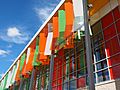
Exterior of the Gungahlin public library.
-
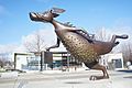
The Alexander Bunyip statue, also known as The Monster that Ate Canberra.


