Hanover, Maine facts for kids
Quick facts for kids
Hanover, Maine
|
|
|---|---|
 |
|
| Country | United States |
| State | Maine |
| County | Oxford |
| Incorporated | 1843 |
| Named for | House of Hanover |
| Area | |
| • Total | 7.56 sq mi (19.58 km2) |
| • Land | 7.04 sq mi (18.23 km2) |
| • Water | 0.52 sq mi (1.35 km2) |
| Elevation | 892 ft (272 m) |
| Population
(2020)
|
|
| • Total | 286 |
| • Density | 41/sq mi (15.7/km2) |
| Time zone | UTC-5 (Eastern (EST)) |
| • Summer (DST) | UTC-4 (EDT) |
| ZIP Code |
04237
|
| Area code(s) | 207 |
| FIPS code | 23-31110 |
| GNIS feature ID | 0582510 |
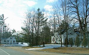
Hanover is a small town located in Oxford County, Maine, in the United States. In 2020, about 286 people lived there. It's a popular spot for vacations and outdoor fun.
| Top - 0-9 A B C D E F G H I J K L M N O P Q R S T U V W X Y Z |
The Story of Hanover
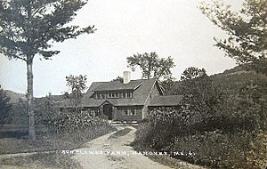
The area that is now Hanover was first settled in 1774. A man named Nathaniel Segar from Newton, Massachusetts, was one of the first to arrive. Later, in 1792, Phineas Howard bought a large piece of land here from Massachusetts. This land included a place called Howard Pond.
Because of Phineas Howard, the community became known as Howard's Gore. Later, it joined with a part of Bethel that was separated by the Androscoggin River. The new combined area was named Hanover. It was named by its German settlers after the House of Hanover, a royal family. Hanover officially became a town on February 14, 1843.
Early Life and Work
Hanover had very good soil, perfect for farming. In fact, it was known for having some of the best farms in Maine. Farmers grew many different crops, with hay being the most important.
The water flowing out of Howard Pond was used to power many businesses. At Hanover Village, there were 12 mills. These mills made things like flour, woolen cloth, furniture, and different kinds of lumber. They also produced sashes, blinds, doors, dowels, and rakes. Other businesses made leather, boots, and shoes.
By the early 1950s, most of these mills had closed down. Today, Hanover is a place where people live all year round. It is also a popular spot for vacation homes.
Where is Hanover Located?
Hanover covers about 7.56 square miles (19.58 square kilometers) in total. Most of this area is land, about 7.04 square miles (18.23 square kilometers). The rest is water, about 0.52 square miles (1.35 square kilometers).
The Androscoggin River forms the southern border of Hanover. The town is located southwest of Rumford. You can reach Hanover by following U.S. Route 2 and Maine State Route 5.
People in Hanover
The number of people living in Hanover has changed over the years. Here's a quick look at the population counts from different years:
| Historical population | |||
|---|---|---|---|
| Census | Pop. | %± | |
| 1850 | 266 | — | |
| 1860 | 257 | −3.4% | |
| 1870 | 188 | −26.8% | |
| 1880 | 203 | 8.0% | |
| 1890 | 212 | 4.4% | |
| 1900 | 214 | 0.9% | |
| 1910 | 196 | −8.4% | |
| 1920 | 165 | −15.8% | |
| 1930 | 170 | 3.0% | |
| 1940 | 178 | 4.7% | |
| 1950 | 211 | 18.5% | |
| 1960 | 240 | 13.7% | |
| 1970 | 275 | 14.6% | |
| 1980 | 256 | −6.9% | |
| 1990 | 272 | 6.3% | |
| 2000 | 251 | −7.7% | |
| 2010 | 238 | −5.2% | |
| 2020 | 286 | 20.2% | |
| U.S. Decennial Census | |||
Population in 2010
In 2010, there were 238 people living in Hanover. These people lived in 116 different homes. About 63 of these homes were families.
Most of the people in Hanover were White (96.6%). A small number were Native American (1.3%) or Asian (0.4%). Some people were from two or more races (1.3%). About 1.7% of the population was Hispanic or Latino.
The average age of people in Hanover was 50 years old. About 12.6% of the residents were under 18 years old. Many people were between 45 and 64 years old (38.2%). Also, 21.8% of the people were 65 years old or older. The town had slightly more males (51.7%) than females (48.3%).
See also
 In Spanish: Hanover (Maine) para niños
 | Ernest Everett Just |
 | Mary Jackson |
 | Emmett Chappelle |
 | Marie Maynard Daly |


