Harbor Gateway, Los Angeles facts for kids
Quick facts for kids
Harbor Gateway
|
|
|---|---|
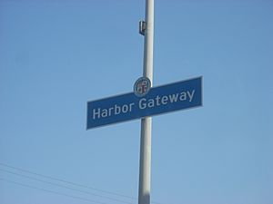
Harbor Gateway neighborhood sign
|
|
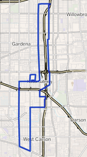
Harbor Gateway as outlined by the Los Angeles Times
|
|
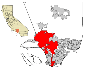
Los Angeles County with the City of Los Angeles in red. The Harbor Gateway is a two-mile wide north-south corridor that connects the Port of Los Angeles to the south with the rest of the city in the north (note the vertical red line).
|
|
| Country | United States |
| State | California |
| County | Los Angeles |
| City | Los Angeles |
The Harbor Gateway is a unique neighborhood in the southern part of Los Angeles. It's a long, narrow strip of land, about 5.14 square miles (13.3 square kilometers), that stretches from north to south. Because of its unusual shape, it's sometimes called "the Shoestring Strip."
This area became part of Los Angeles in 1906. Its main purpose was to create a direct connection between the city and the important port cities of Wilmington and San Pedro on the Pacific Ocean. The neighborhood got its current name, Harbor Gateway, in 1985.
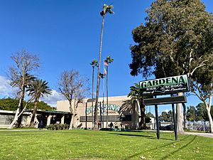
Today, Harbor Gateway is home to over 42,000 people. It's known for its diverse population and younger residents. A key spot in the community is Gardena High School. The neighborhood is divided into two parts by Artesia Boulevard, each with its own local council. It also has a large transportation center that helps people travel around southern Los Angeles County.
Contents
Exploring Harbor Gateway's Location
Harbor Gateway is a narrow strip of land that runs north to south. It's located between Vermont Avenue and Figueroa Street in its northern part. South of Interstate 405, it lies between Western Avenue and Normandie Avenue.
The city of Los Angeles acquired this land specifically to link San Pedro, Wilmington, Harbor City, and the important Port of Los Angeles with the rest of the city.
Neighboring Communities
Harbor Gateway is surrounded by several other communities:
- To the north: Broadway-Manchester
- To the east: Rosewood, Carson, and West Carson
- To the south: West Carson and Harbor City
- To the west: Athens and Gardena
- To the south and west: Torrance
Key Street Boundaries
The neighborhood's main street boundaries are:
- North: 120th Street
- West: Vermont Avenue (north of 182nd Street) and Western Avenue (south of 182nd Street)
- East: Figueroa Street (north of 182nd Street) and Normandie Avenue (south of 182nd Street)
- South: West Sepulveda Boulevard
There's also a smaller section in the southeast. It's bordered by 192nd Street to the north, Hamilton Avenue to the east, Del Amo Boulevard to the south, and railroad tracks to the west. This area includes the Holiday Inn Harbor Gateway. Another part of the neighborhood, between 177th and 182nd Streets, is home to Gardena High School.
Who Lives in Harbor Gateway?
In 2000, about 39,688 people lived in Harbor Gateway. This means there were around 7,720 people per square mile, which is similar to the average for Los Angeles. By 2008, the population was estimated to be 42,005. The average age of residents was 27, which is quite young for Los Angeles.
Harbor Gateway is known for its diverse population. In 2000, the community included:
Many residents were born outside the United States (40.8%). The most common birthplaces for these residents were Mexico and the Philippines. The average household income in 2008 was about $47,849. Most people (59.7%) rented their homes, while the rest owned them.
The Story of Harbor Gateway
Harbor Gateway was officially added to the city of Los Angeles on December 26, 1906. This was done to prepare for taking over the independent cities of Wilmington and San Pedro a few years later. The goal was to create the Port of Los Angeles. Because of its very thin shape, sometimes described as two shoelaces tied together, the area was known for many years as the "city strip" or "shoestring strip."
Before World War II, the strip was mostly open fields. After the war, factories were built, which attracted workers who needed places to live. Builders then filled these fields with small houses and duplexes. In the 1960s, Cuban immigrants settled here, followed by Mexican immigrants in the 1970s.
In 1985, the Los Angeles City Council officially renamed the area Harbor Gateway. However, even after the name change, many residents' mailing addresses still said Torrance or Gardena, not Los Angeles.
By 1989, Harbor Gateway was one of the fastest-growing areas in Los Angeles. Over the years, some older homes were replaced by many new apartment buildings, bringing more residents to the area. Along the 190th Street corridor, shiny new office buildings replaced old oil refineries and factories, making it a major spot for business development.
Local Government and Services
Harbor Gateway is served by two local groups called neighborhood councils. These councils help residents have a say in local decisions. The neighborhood is split into two parts for these councils: Harbor Gateway North and Harbor Gateway South, with Artesia Boulevard as the dividing line.
The Los Angeles County Department of Health Services runs the Torrance Health Center in Harbor Gateway, which provides healthcare services. The National Transportation Safety Board (NTSB), which investigates accidents, has its regional headquarters for aviation in Harbor Gateway.
Harbor Gateway's Economy
Harbor Gateway is a busy area for businesses, especially those involved in transportation. Many trucking, shipping, and logistics companies have their offices here.
Some other companies headquartered in Harbor Gateway include:
- National Stores (Fallas Paredes)
- Yoshinoya America
- Faraday Future
Roosevelt Memorial Park, a cemetery, is also located in Harbor Gateway, between Vermont and Normandie avenues.
Learning in Harbor Gateway
About 12.4% of adults in Harbor Gateway (aged 25 or older) had completed a four-year college degree by 2000. This is similar to the average for the city of Los Angeles.
Schools in the Area
Harbor Gateway is home to several schools, part of the Los Angeles Unified School District (LAUSD) or private:
- Gardena High School, LAUSD, 1301 West 182nd Street
- Moneta Continuation School, LAUSD, 1230 West 177th Street
- Magnolia Science Academy Santa Clara, LAUSD charter (no address given)
- One Hundred Thirty-Fifth Street Elementary School, LAUSD, 801 West 135th Street
- Gardena Elementary School, LAUSD, 647 West Gardena Boulevard
- Gardena Valley Christian School, private, 1473 West 182nd Street
- One Hundred Eighty-Sixth Street Elementary School, LAUSD, 1581 West 186th Street
- Halldale Elementary School, LAUSD, 21514 Halldale Avenue
- Environmental Charter Middle School, 812 West 165th Place
The northern part of the Gardena High School campus also has staff housing called Sage Park Apartments.
Local Libraries
The Los Angeles Public Library operates the Harbor Gateway-Harbor City Branch, providing books and resources for the community.
Parks and Fun in Harbor Gateway
The Rosecrans Recreation Center/CVS Playground is a great place for outdoor activities in Harbor Gateway. It's located on Vermont Avenue, south of 149th Street. This playground was built by a non-profit group called Boundless Playgrounds.
Getting Around: Public Transportation
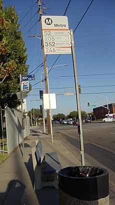
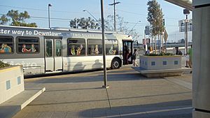
Harbor Gateway is a major hub for public transportation. The Harbor Gateway Transit Center is a very large station that serves many different bus lines.
Bus Services
- The Metro J Line (also known as the Metro Silver Line) is a special bus rapid transit line. It connects the El Monte Station, Downtown Los Angeles, and the Harbor Gateway Transit Center. Some trips even go all the way to San Pedro.
- The Metro Silver Line also runs on the Harbor Transitway (part of the I-110 freeway).
- The Harbor Gateway Transit Center is located at 731 West 182nd Street, Gardena, CA 90248.
- Nine Metro bus lines, including the Metro Silver Line, operate from this transit center to various places.
- Other bus companies also use the center:
- Torrance Transit lines 1, 4X, 6, and 13
- Gardena Transit lines 2, 4 (on school days), and 7X (on NFL game days)
See also
 | Kyle Baker |
 | Joseph Yoakum |
 | Laura Wheeler Waring |
 | Henry Ossawa Tanner |


