Harsimus facts for kids
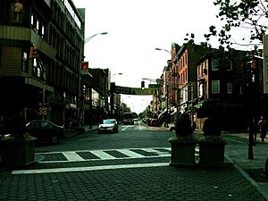
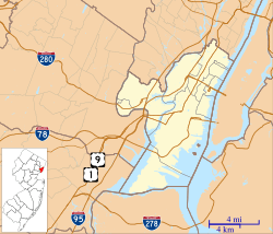
Harsimus (also known as Harsimus Cove) is a neighborhood in Downtown Jersey City, New Jersey. It's located in Hudson County, USA. This area stretches from the Harsimus Stem Embankment (also called the Sixth Street Embankment) in the north to Christopher Columbus Drive in the south. It's found between Coles Street and Grove Street, or even wider, up to Marin Boulevard.
Harsimus is surrounded by other neighborhoods. To the north is Hamilton Park, to the south is Van Vorst Park, to the west is the Village, and to the east is the Powerhouse Arts District. Newark Avenue has always been its main street. The name "Harsimus" comes from the Lenape people, specifically the Hackensack Indians, who lived here long ago. It means "Crow's Marsh." For many years, Harsimus was known as the "Horseshoe." This nickname came from its shape, which was created by train tracks coming together and by a political trick called gerrymandering. Gerrymandering is when voting districts are drawn in a strange way to give one political group an unfair advantage.
Early History of Harsimus
The name Harsimus comes from the Lenape language. It probably means "Crow's Marsh." Over time, people spelled it many different ways, like Aharsimus or Horsimus. In today's Lenape language, "ahas" means "crow."
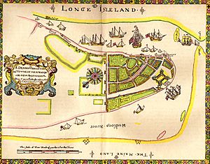
In 1629, a Dutch man named Michael Reyniersz Pauw received a special grant for all the land that is now Hudson County. He called this land Pavonia. However, he couldn't bring enough settlers to the area as required. So, the Dutch West India Company sold part of the land to his manager. This manager had built a home in 1634. He was the first of many Van Vorst family members who played important roles in developing Jersey City. A family home built in 1647 was taken down in 1967.
Settlement in the area faced challenges. There were conflicts with Native Americans in 1643, but the settlement continued to grow after a peace treaty in 1645. In 1655, the area was attacked again in a conflict known as the Peach Tree War. By 1660, Harsimus became part of Bergen, New Netherland, with its main village located at Bergen Square.
After the British took control from the Dutch, New York claimed ownership of the land along the Hudson River up to the high tide line. This meant that any docks built there would be under New York's control, which slowed down growth in New Jersey. The area of Paulus Hook was the first to become a city. The City of Jersey was officially formed several times, in 1820, 1829, and 1838.
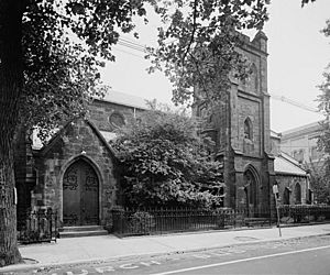
John Coles, a merchant from New York, was one of the first people to expand into Harsimus. In the 1830s, the Supreme Court decided where the border between New York and New Jersey would be, placing it in the middle of the river. After this, Harsimus grew with more shipping along the waterfront and homes further inland. The short-lived Van Vorst Township later joined with its neighbor. Many of the old buildings from this time are still standing. Some streets in the grid (a pattern of straight streets crossing each other) that were laid out then have been renamed.
Railroads and Political Power
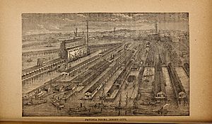
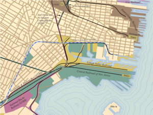
Harsimus changed a lot when the railroad industry grew. By 1870, much of the marshy land was filled in to build railyards. These yards stretched a quarter-mile from Henderson Street. Three raised train tracks were built: one from the Bergen Arches to the Erie Railroad Pavonia Terminal, the Harsimus Stem Embankment at 6th Street for the Pennsylvania Railroad (PRR), and another for its Jersey City Branch along Railroad Avenue (now Columbus Drive) to Exchange Place. These raised tracks and embankments separated different neighborhoods. A small water channel was created and is still called Harsimus Cove. Huge stockyards, where animals were kept before being shipped, filled the waterfront between the train stations.
Harsimus became somewhat isolated because of how its political voting districts were drawn. This created the "horseshoe" shape and gave the area its nickname. The community was made up of Catholic immigrants, many of them Irish, who worked for the railroad. Many immigrants arriving at Ellis Island also moved into the area, making the population grow. You can still see some of the Slavic culture in the area at the Ukrainian National Home.
To weaken the power of the Democratic Party, Republican leaders redrew the voting district. They made the "Horseshoe" its own district, so they could protect other areas from Democratic influence. In the 1910s, this "Horseshoe" area became the power base for the famous Mayor Frank Hague. He was a very powerful politician who controlled the Hudson County political machine. He influenced city, county, state, and even national politics for much of the first half of the 20th century. In 1941, a large fire happened on the waterfront in the Horseshoe area.
Modern Harsimus
In the late 1950s, container shipping (using large metal boxes to move goods) at Port Newark became more popular. This replaced the need for railroad ports along the waterfront. By the 1970s, these old ports were no longer used. This led to fewer people living in Harsimus and less economic activity.
Projects to improve the city led to the removal of old buildings along Grove Street. The raised PRR train tracks were also taken down. New housing projects were built for middle-income, low-income, and senior residents. A part of Grove Street was renamed Manila Avenue. This was done to honor the many Overseas Filipinos who live in the city. Henderson Street became Marin Boulevard, named after Luis Muñoz Marín, the first governor of Puerto Rico. This change reflected the growing number of Puerto Rican and Filipino residents. Railroad Avenue is now Columbus Drive, recognizing the large Italian population still in the area.
The changes did not affect the older blocks from the 1800s, which were not torn down. A movement to save historic buildings and new investments in real estate led to Harsimus being named a Historic District in 1987. It became a popular place for artists because it was easy to get to by public transport and rents were affordable. Some artists turned old buildings into places where they could live and work.
Zoning rules, like "WALDO" (Work and Live District Overlay), tried to protect and encourage an arts district where large warehouses still stood. However, these efforts were not very successful. Instead, the area has become the Powerhouse Arts District with many new residential highrise buildings.
East of Harsimus, the LeFrak Organization bought most of the unused land from the Erie-Lackawanna railroad. In the 1980s, they started building Newport, a large development centered around the Port Authority Trans Hudson (PATH) Newport Station. To the south, the PRR's old meatpacking area was also bought. The plans for these new developments did not extend the old city street grid to the waterfront. Instead, large parking decks and a strip mall were built. The first part of the Hudson-Bergen Light Rail opened in 2002. This included the Harsimus Cove Station, which is near the famous Hudson and Manhattan Railroad Powerhouse.
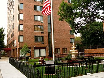
Grove Pointe is a residential building complex at 100 and 102 Christopher Columbus Drive. It is a 30-story building made of brick and stone with many windows. It was designed by DeWitt Tishman Architects and built by the Kushner Real Estate Group.
 | Madam C. J. Walker |
 | Janet Emerson Bashen |
 | Annie Turnbo Malone |
 | Maggie L. Walker |


