History of St Helens, Merseyside facts for kids
St Helens is a large town in Merseyside, England. It's the main administrative center for the Metropolitan Borough of St Helens. The town became an official borough in 1868, overseeing four smaller areas: Eccleston, Parr, Sutton, and Windle. In 1887, it became a larger "county borough," and then in 1974, it became the even bigger metropolitan borough.
St Helens is located in the southwest part of Lancashire, in North West England. It's about six miles (10 km) north of the River Mersey. This area was once home to the Celtic tribe called the Brigantes, who were later taken over by the Romans in the 1st century. While there's no direct proof of these groups in St Helens itself, the name Eccleston comes from words meaning "church," suggesting a possible link.
The first known settlements in the area were manors and parishes mentioned in the Domesday Book in the 12th century. These covered the areas that make up modern St Helens.
During the 18th and 19th centuries, St Helens grew into an important center for coal mining and glassmaking. Before this, there was also a cotton and linen industry, especially for making sails. Other industries included salt, lime, alkali production, copper smelting, and brewing.
The town is also famous for building parts of the Sankey Canal and for hosting the first steam locomotive competition, known as the Rainhill Trials.
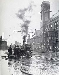
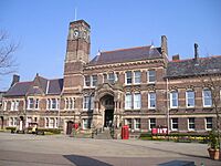
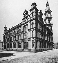
The St Helens area has 147 listed buildings (important historical buildings) and 12 scheduled monuments (protected historical sites). Some well-known ones include Windle Chantry (from the early 15th century), St Mary's Lowe House (called "The Poor Man's Cathedral" because it was built with money donated by working people), the red brick Gamble Institute (built in 1896, now the Central Library), the Beechams Clock Tower (built 1877), and The Quaker Friends Meeting House (used since 1678).
Contents
History
How St Helens Became a Town
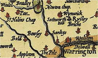
St Helens wasn't really a "town" until the mid-1800s. It grew quickly during the Industrial Revolution because many people moved there for work. Between 1629 and 1839, St Helens changed from a small group of homes around a chapel to a village with a bigger church. Eventually, it became the main town for the four original areas that make up modern St Helens.
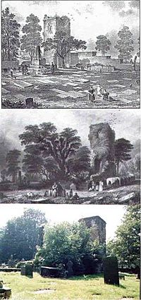
The name "St Helens" comes from a small chapel dedicated to St Elyn. The first mention of this chapel was in 1552. In 1558, a man named Thomas Parr left money to help keep the chapel going and to pay for a priest.
"[I give] money to help pay for a priest at St. Helen's Chapel in Hardshaw, and to keep God's service going there forever, if the money continues and the priest does his duty."
—William Farrer quoting Thomas Parr, A History of the County of Lancaster: Volume 3
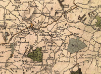
Old maps show the chapel was on Chapel Lane, where Church Street is today. This area was part of Hardshaw, which was a small settlement within the larger area of Windle. It was located where Windle, Parr, Sutton, and Eccleston met.
For a long time, the area was mostly farmland, with lots of marshy and boggy land. It was also covered by parts of the Mersey Forest. The land was mostly flat, which made it easy to move goods towards bigger towns like Warrington, Chester, and the growing city of Liverpool.
The name St Helens wasn't always spelled the same way. It was called St Hellins, St Helins, St Hellens, St Helyns, or St Elyns before it officially became a town in 1868.
Old Families and Lands
In 1139, the title "Earl of Derby" was created. The Earls owned a large area from Liverpool to Manchester, and north beyond Lancaster. These lands were mostly used for farming and raising animals.
The Stanley family later became the Earls of Derby in 1485. Their family home was in Knowsley, west of modern St Helens.
Townships and Manors
The Domesday Book from 1086 mentions several manors (large estates) in the area, but not "St Elyn" itself. Windle was recorded in 1201, Bold in 1212, and Parr in 1246. Sutton and Ecclestone were part of a larger area called the Widnes "fee," which was land owned by a knight or earl. Many of the original areas are named after the families who owned the land between the 11th and 18th centuries.
The Knights Hospitaller, a religious and military order, owned land in Hardshaw as early as 1292. This land was called Crossgate, near where Cross Street is now.
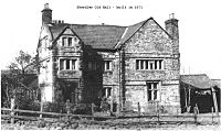
The Ecclestone family owned the Eccleston lands. Their family home was built in 1100, and they lived there until the 18th century.
The manor of Parr stayed with the Parr family until the early 15th century. Then, William Parr, whose sister Catherine Parr married King Henry VIII, sold the manor to the Byroms.
The large lands of Sutton Manor stretched across flat land towards the Mersey River. The Sherdley family, who lived in the area since 1276, owned much of this land.
Windle included Hardshaw, where the Chapel of St Elyn was located. The Windle family were lords of the manor before the Gerards took over.
"This tiny hamlet [in] Hardshaw including the chapel-of-ease, from which its name was taken, became the center of the town."
—Mike Fletcher, Black Gold & Hot Sand, 2002
In 1956, during construction work in the town center, old grain grinders and two ancient wells were found, showing that people lived there centuries ago.
The Chapel of St Elyn
In 1552, the chapel was described as having "only a 'challis and a lytle bell'." The chapel was important because it was located where the four areas of Eccleston, Parr, Sutton, and Windle met. It was also on major roads connecting towns like Liverpool, Ormskirk, and Lathom in Lancashire with towns south of the River Mersey like Warrington and Chester.
Because it was on a busy road, historians believe a village grew up around the chapel, eventually taking its name. By 1618, the original chapel had been torn down and rebuilt. A school was built later, and in 1679, the Friends Meeting House was built, which is now a protected historical building.
Religious Connections
The De Holland family, who were Lords of Sutton Manor, kept a strong connection to the Roman Catholic faith starting in 1321. Roger Holland was burned at the stake in 1558 for his Protestant beliefs during the time of Queen Mary. Thomas Holland, a local Jesuit priest, was arrested in 1642 for being a Catholic priest in England. Ravenhead Hall had a secret Catholic chapel during times when Catholics were persecuted in the 17th and 18th centuries.
Windle also has a connection to stories about witches. In 1602, two women were sent to Lancaster Castle for trial. A decade later, Isobel Roby was accused of causing trouble for a ship carrying Princess Anne of Denmark. She was executed in Lancaster in 1612, along with the Pendle and Samlesbury witches, during the religious witch-hunts of that time.
St Helens Becomes Important
By 1746, St Helens was important enough to be mentioned in Parliament. People were discussing extending the main road from Liverpool to Prescot to reach St Helens.
Many writers noted the fast growth of St Helens. In 1839, one encyclopedia said, "Saint Helen's, Lancashire, is in the area of Windle... The town has become important in recent years." By 1854, before it was officially a borough, another writer stated, "St Helens, originally a small village, is now a very thriving town." He added that the town "may be said to contain the four townships of Sutton, Parr, Windle and Eccleston."
Census records show that the population of the St Helens area was about 12,500 in 1801. By 1861, it had grown to between 37,631 and 55,523 people.
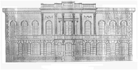
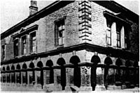
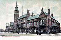
The first Town Hall was built in 1839. It was described as being in the "Italian style" and had a lock-up, a newsroom, and a large hall for courts and public events. A market hall was built next to the church in 1851. In 1852, the civil parish of St Helens was created.
In 1832, St Helens got a gas supply for lighting, and street lights were installed soon after. In 1845, money was raised to pay for the permanent upkeep of streets, lighting, and paving.
On February 2, 1868, Queen Victoria officially made St Helens a Municipal Borough. The first election for councillors happened on May 9 of that year. Twenty years later, in 1887, St Helens became a County Borough, which meant it had two representatives in Parliament.
In 1894, the Parish of St Helens was officially formed. This happened by combining the areas of Parr and Sutton, and taking parts of Eccleston and Windle.
St Helens Today: The Administrative Center
The modern Borough of St Helens includes areas that weren't traditionally part of the town. In 1972, when Merseyside was created, areas like Haydock, Newton-le-Willows, and Rainford, along with parts of Billinge-and-Winstanley and Ashton-in-Makerfield, became part of the borough. This means some people in these areas might see themselves as part of both the town and the wider borough of St Helens.
Industrial Development
Early Industries in St Helens
Before the mid-1700s, most industries in St Helens were small, home-based businesses like linen weaving. The landscape had many small digging and mining sites, mainly for clay and peat, but also for coal. Coal was the main reason St Helens grew so much, especially because it was needed for copper smelting and glassmaking.
Before 1700, most of the land was used for farming. Sutton was described as having "four plough-lands," which means about 480 acres (1.9 km²) of farmland. Even in 1901, much of Eccleston was still farmland, growing potatoes, oats, and wheat. However, there were also old quarries and mine shafts.
Two hundred years earlier, St Helens was full of shallow mining operations. These mines were often quickly abandoned because they would flood or collapse. People complained about the destruction of the land from these short-lived mines, but the demand for coal meant that shallow mining expanded quickly.
In 2009, the Council rejected a plan for a new open-pit coal mine, showing that the coal industry in the area was truly over.
Coal Mining
St Helens is located on the Lancashire Coalfield, so the town was built on coal. The original motto on the town's coat of arms was "Ex Terra Lucem," which means "From the Ground, Light." In the 1970s, local coal mines employed up to 5,000 men. During the peak of British coal mining in 1913, the St Helens miners' union had the most members in the region.
Coal seams were discovered in 1556 when digging a clay pit. This discovery led to a dispute between the landowners and their tenants, the Eltonheads. The discovery of coal was a huge boost for St Helens.
In the 18th century, coal allowed other industries to grow. It created a demand for moving raw materials both out of the town (like coal to Liverpool for ships and steel) and into the town (for processing).
The importance of transport links for St Helens' coal was clear in 1746 when Parliament discussed fixing and extending the main road after floods damaged it.
"because Prescot, being Three Miles nearer to Liverpoole than St Helens, Persons will naturally go to the former Place for Coals, if they can be supplied as well and as cheap there as at the latter"
—T.C. Barker quoting Witness John Eyes, Merseyside Town in the Industrial Revolution: St. Helens, 1750–1900
St Helens grew because it was on the South Lancashire Coalfield, and nearby cities like Liverpool and Chester needed coal but didn't have their own mines.
Sankey Canal
Because St Helens was far from the Mersey River, good land transport was very important. Liverpool needed a steady supply of coal for its factories and ship building. So, they first asked for the main road to be extended, and then they planned a canal system.
The idea was to make the Sankey Brook river easier to travel on, but they ended up building a completely new canal. The Sankey Canal opened in 1757 and was extended in 1775. It was used to transport coal from mines in Ravenhead, Haydock, and Parr to Liverpool. It also brought raw materials into St Helens. Over the next century, canal networks spread across Britain.
This transport revolution brought new businesses and job opportunities to the area. As a result, the population grew significantly. St Helens transformed from a few scattered homes in 1700 into a busy area with many mines, factories, and pottery makers by the early 1800s.
The Industrialists
New businesses were started by rich people from all over the country. The invention of James Watt's steam engine in the 1770s was a big help. Mines could now pump water from deeper levels, allowing them to dig for more coal. At the same time, machines for cotton mills and factories increased the demand for coal even more.
The local wealthy families moved out of the growing towns, which were filling up with working-class people. In their place came rich business owners like John Mackay, Michael Hughes, the Gambles, and later Thomas Beecham, Thomas Greenall, and the Pilkingtons. These people invested their money and helped St Helens grow into a modern market town between 1780 and 1830.
"if any... good colliers... will apply at Thatto Heath Colliery, they will meet with constant employ and the best encouragement."
—Mike Fletcher quoting John Mackay, Black Gold & Hot Sand, 200
Copper Industry
One of the first industries to benefit from the new transport was copper smelting. The Parys Mining company, led by Michael Hughes, rented land near the Sankey Canal in Ravenhead in 1779. Copper ore was brought from North Wales to St Helens via the Mersey River, right to where the coal was mined. About 10,000 tons of copper ore were processed here.
However, this boom didn't last. By 1783, many coal owners were struggling financially. The American War of Independence (1775–1783) caused problems for shipping coal, leading to the closure of several smaller industries. The mining industry recovered later, and some copper smelting returned when steam engines became more popular in the late 1800s.
Plate Glass
St Helens had plenty of coal, good local sand, and salt from Cheshire, which made glassmaking possible there since 1688. The glass industry grew even more when the King allowed the "British Cast Plate Glass Company" to be set up in Ravenhead in 1786. This made the region a leader in glass production.
Chemicals and Engineering
The Gamble family started lime and alkali businesses, which were needed by the glass industry and helped save money on imports. The growing demand for chemical processing also helped the nearby town of Widnes grow.
In 1830, the Liverpool and Manchester Railway passed through the southern edge of the town, further helping St Helens grow as an industrial center.
The Decline of Heavy Industry
The End of Coal Mining
Many coal mines in St Helens and the surrounding area, like Clock Face, Ravenhead, Sutton, Bold, Wood Pit (Haydock), Lyme Pit (Haydock), Old Boston (Haydock), and Lea Green, closed between the 1950s and early 1990s. By 1992, all the mines were shut down. Sutton Manor Colliery was the last to close in St Helens itself, on May 24, 1991. The decline of the coal industry was clear during the Miners' Strikes in the 1980s. St Helens, like many other UK towns, lost a major employer due to rising costs. Even though Sutton Manor Colliery was estimated to have 40 years of coal left, it still closed. The very last colliery in the wider St Helens area was Parkside, in Newton-le-Willows, which closed in 1992.
St Helens Since 1950
In the 2016 United Kingdom European Union membership referendum, St Helens voted to leave the European Union.
Industries in St Helens
Brewery Industry
Chemical Industry
Copper Industry
Engineering Industry
Glass Industry in St Helens
Mining Industry
Monuments and Buildings
The Metropolitan Borough of St Helens has 159 listed buildings and 12 scheduled monuments. These are important historical sites that are protected.
Transport
The Canal
The Sankey Canal was very important for transporting coal and other goods, helping St Helens grow as an industrial town.
The Railways
The Liverpool and Manchester Railway, which passed through St Helens, played a big role in connecting the town to other industrial centers and boosting its economy.
The Turnpike Roads
Early roads, known as turnpikes, were crucial for moving goods and people in and out of St Helens before canals and railways became widespread.
The Trolleybus
St Helens also had a system of trolleybuses, which were electric buses that got power from overhead wires.
|
See also
- Blackbrook, St Helens
- Bold, Merseyside
- Clock Face, Merseyside
- Eccleston, Merseyside
- Haydock
- Parr, St Helens
- Sutton, Merseyside
- Windle, St Helens


