History of the City of Burnside facts for kids
The City of Burnside is a local government area in Adelaide, Australia. Its history goes back over 200 years! Before Europeans arrived, the Kaurna people lived here. They spent winters near the River Torrens creeks and summers in the Adelaide Hills.
After the British settled South Australia in 1836, people started buying land east of Adelaide. The village of Magill was created in 1838. In 1839, a Scottish family, the Andersons, were the first official settlers in the area now called Burnside. They named it "Burnside" because their property was next to Second Creek. In Scots, "burn" means creek or stream.
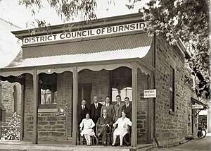
The village of Burnside was soon established. In 1856, the District Council of Burnside was officially formed. It separated from the larger East Torrens District Council. Early Burnside mainly focused on growing grapes for wine (viticulture), mining, and olive farms. Glen Osmond had lots of minerals. Vineyards were set up in Magill and Stonyfell.
The current council building was built in Tusmore in 1926. Burnside became a municipality in 1935. Because the area grew so much, Burnside was declared a city in 1943. In the 1960s, a community library and a swimming centre were built. Both were made even better between 1997 and 2001.
Contents
Early Villages in Burnside
Kensington and Magill's Beginnings
The village of Kensington started in May 1839. It was mostly a farming area. Kensington and nearby Norwood formed one of Adelaide's first local councils in 1853. Today, this area is the City of Norwood Payneham St Peters. Parts of Kensington, like Kensington Gardens and Kensington Park, are now part of Burnside.
The village of Makgill, later called Magill, began as a large estate. It was owned by two Scots, Robert Cock and William Ferguson. They met on the ship HMS Buffalo coming to the new colony. The estate was named after Mrs. Cock's trustee, David M. Makgill. Ferguson built the estate's main house in 1838. Soon, they needed money, so Magill became the first foothills village to be divided into smaller plots.
Glen Osmond and Mining
Glen Osmond grew because silver and lead were found there. Two Cornish immigrants discovered these minerals on the slopes of Mount Osmond. This discovery gave the colony valuable money from exports. At the time, South Australia's economy was new and struggling. Governor George Gawler visited the first mine, Wheal Gawler, which was named after him.
Wheal Gawler exported minerals overseas in the 1840s. It provided jobs for early Cornish and later German immigrants. The village had a strong Cornish and German feel. Mining slowed down after 1851. Many workers left for the Victorian gold rush in Victoria.
How Burnside Village Started
The Anderson family were the first to settle the land that became Burnside village in 1839. Peter Anderson named his property "Burnside" because it was next to Second Creek. They brought farming experience and money from Scotland. However, farming in Scotland was very different, and they struggled to adapt.
The Andersons moved away in 1847, selling their land. William Randell bought the land and decided to build a village there in 1849. He hired a planner, Nathan Hailes, to design the new village. The new village of Burnside was in a good spot. It was near two main roads, Burnside (now Glynburn) and Greenhill Roads. It also had Second Creek, which provided water.
Hailes advertised Burnside in 1850 as "Burnside the Beautiful." He highlighted its "perpetual running water, extensive and diversified view, rich garden soil and good building stone." It was also easy to get to Adelaide.
Burnside's Local Government Begins
Forming the District Councils
The villages that would become the Burnside District Council were first part of the District Council of East Torrens. This large area was created on May 26, 1853. The Governor appointed five councillors to run it. They met for the first time in Magill on June 12, 1853. Their first plans were to survey the area and collect taxes.
T. B. Penfold became the first District Clerk in January 1854. In 1855, the East Torrens council area had 3,705 people. This was more than the nearby Corporate Town of Kensington and Norwood. However, the large East Torrens council was not very stable. People were unhappy about how their money was spent. The councillors found it hard to manage such a big area.
So, on August 14, 1856, the area was split into three. The District Council of Payneham was formed in the north-west. The District Council of Burnside was created in a smaller, south-western part of East Torrens. East Torrens was divided again in 1858 when the District Council of Crafers separated.
Burnside: 1860s to 1900
Early Council Operations
The new Burnside District Council held its first meeting in Tusmore on August 19, 1856. The council started operating and doing its duties. These included managing small roads, giving out licenses for slaughterhouses and pubs, and stopping the spread of harmful weeds like the Scotch thistle. The council also had to encourage education.
Many roads and bridges were built after the council formed. Early residents were amazed by all the new construction. Sometimes, the council had to ask residents for money to help build bridges in their areas.
Schools and Learning
Schools and churches played a big part in Burnside's history. The first school opened in Magill in 1846. Magill Primary School grew in November 1855, with 38 boys and 29 girls. They learned many subjects from one teacher. By 1865, there were two teachers.
Glen Osmond Primary School started in October 1858. Burnside Primary School was built in 1872. These schools received many books from residents. People also used schools for lively discussions about the future of the state and region. These talks often drew large crowds.
Growth and Development
By 1871, Burnside had grown significantly. It was a mix of villages with 1,557 people. Glen Osmond was the largest village with 343 residents. The District Council built its first council chambers in December 1869.
Two villages, Beulah Park and Eastwood, grew quickly between 1870 and 1880. They provided homes for new immigrants and investments for wealthy Adelaide families. Parkside Hospital (now Glenside), a mental health hospital, was built in 1866. It was a beautiful building and an early architectural landmark in Burnside.
In 1881, Thomas Cooper started brewing South Australia's first branded beer, 'Coopers', in Leabrook. Stonyfell also saw economic growth. Its large quarry changed owners in 1867, and the Stonyfell Olive Co was founded in 1873. The late 1800s were a time of big development in Burnside. However, this growth stopped suddenly in the 1890s when a depression hit Australia.
Early Twentieth Century in Burnside
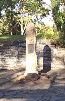
By the early 1900s, Burnside was becoming more like a city. There were still open fields, but the villages were steadily expanding. Areas like Toorak Gardens and Dulwich were opened for settlement and advertised as suburbs.
By 1920, the District Council had 17,000 people living in 4,000 houses. The South Australian Government passed new laws about local government, like the Town Planning Act 1920. These laws gave councils more responsibility as Adelaide grew.
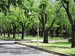
Burnside councillors suggested that the State Government buy and manage parks. A kiosk was opened at Waterfall Gully, and Morialta Conservation Park was created based on this advice. Burnside was praised by Adelaide newspapers for its tree planting efforts. The council was saving old trees and planting about 500 new ones each year.
A Burnside councillor, HES Melbourne, was very popular. He used his own money to buy land for parks because the council didn't have enough funds during the Great Depression. He managed the budget carefully and made sure trees were planted to beautify the city. Melbourne also oversaw the building of the Mount Osmond golf course.
Rules about development in the foothills, called the Hills Face Zone, were set up in the 1920s. The council had to follow strict guidelines. In 1928, grand new Council Chambers were built at the corner of Greenhill and Portrush Roads. These buildings are still used today. Floods hit Waterfall Gully in 1931.
Burnside continued to grow. In 1935, the District Council of Burnside became the Municipality of Burnside. By 1941, only a small amount of land was still used for farming.
Post-War Burnside to the 1970s
Becoming a City and War Memorials
In 1945, much of the land that became Cleland National Park was bought by the State Government. This was largely due to the efforts of Professor Sir John Burton Cleland. Most of this land, including Waterfall Gully, was combined in 1963 to create the park. In 1943, the Municipality of Burnside was officially named the City of Burnside.
Many people from Burnside fought in World Wars I and II. When they returned, they were honored with memorials. The Burnside War Memorial Hospital opened in April 1949 in Toorak Gardens. It was built in a house donated by a local resident. The hospital got its current name in 1956. Memorials to those who died can be found all over Burnside. There are memorials in Hazelwood Park, at schools and churches, and in parks. Like much of Australia, Burnside remembered the phrase "Lest We Forget" on many memorials.
Growth and Infrastructure
When Australia celebrated 50 years of Federation of Australia in 1951, Burnside residents joined in. In 1956, they celebrated 100 years of their own town. After the war, there was an economic boom and many babies were born. Burnside grew very quickly. Its population jumped from 27,942 in 1947 to 38,768 in 1961. As suburbs took over the remaining fields, a public ballroom was built in 1953. An Olympic Grandstand was built in Kensington Park in 1965. In 1963, the Cleland Conservation Park was established on Burnside's eastern border.
Burnside's roads were completely paved in the 1960s and 1970s. Plans were also made to replace the winding Mount Barker Road. One idea was the Burnside-Crafers Highway. This highway would have gone through Hazelwood Park and Beaumont, then around Waterfall Gully. The Burnside Council worked hard for this plan, even widening Linden Avenue. However, the plan was eventually rejected.
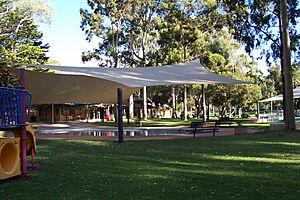
Burnside got a public library with 7,800 books in 1961. This became possible after the Libraries Act 1955 made it more affordable. The Burnside Swimming Centre opened in 1966. This swimming centre was a special project for the Mayor at the time, George Bolton. He had a big vision for Hazelwood Park, where the center was to be built.
Mayor Bolton faced a lot of public opposition in 1964 when he first announced the idea. Many older residents (15% of Burnside's population) were against it. They worried about noise and troublemakers. The cost was estimated at £75,000. Architects even resigned over the size of the project. Newspapers had fun covering the debate. A vote on March 24 failed, and the Sunday Mail headline read "Burnside Says NO to Swim Pool."
But Mayor Bolton didn't give up. He announced new plans in December. After a strong public campaign and small changes to the project, a vote in February 1965 strongly supported the idea. The Mayor won his battle! The center was named the George Bolton Swimming Centre in his honor when it opened.
In 1967, the Burnside Council set an ambitious goal: to set aside five hectares of parks for every 1,000 people. To achieve this, the council bought Hazelwood Park from the State Government. They also gained control of Beaumont Common in 1973 and parts of Mount Osmond. Before the council owned it, Hazelwood Park was going to be divided up for housing. The council managed to take ownership after talking with Premier Thomas Playford IV.
Burnside: 1980s to 2010s
A community center was built next to the council chambers in 1982, connecting to the library. The entire council complex was upgraded in 1996, along with the Burnside Swimming Centre. More upgrades happened in 2001, making a modern library and community center for residents.
Burnside created a new council logo in 1993. It used the colors green and purple. Green represented the many parks and reserves in Burnside. Purple represented the beautiful Jacaranda trees.
The suburbs of Skye and Auldana, located east of Burnside in the Adelaide Hills, became part of Burnside in 1999. Coopers Brewery moved out of Leabrook in 2001, relocating to Regency Park. The old Coopers site was turned into a retirement village.


