Islais Creek facts for kids
Quick facts for kids Islais Creek |
|
|---|---|

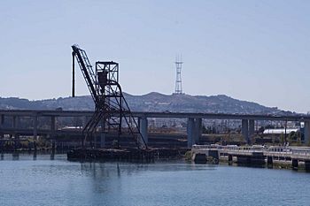
Islais Creek with an abandoned five-story-high copra crane, Interstate 280 and Sutro Tower in the background
|
|
| Country | United States |
| State | California |
| Counties | City and County of San Francisco |
| City | San Francisco |
| Physical characteristics | |
| Main source | Cesar Chavez Street Near Potrero Hill, City and County of San Francisco, California 1 ft (0.30 m) 37°44′51″N 122°23′16″W / 37.74750°N 122.38778°W |
| River mouth | San Francisco Bay Near Bayview-Hunters Point, City & County of San Francisco, California −10 ft (−3.0 m) 37°44′54″N 122°22′32″W / 37.74833°N 122.37556°W |
| Length | 1 mi (1.6 km) |
Islais Creek is a small creek in San Francisco, California. It was once known by other names like Du Vrees Creek and Islais Swamp. The name "Islais" comes from a Salinan Native American word meaning "wild cherries," which used to grow there.
Long ago, Islais Creek was a big, natural waterway. But when the California Gold Rush started, the area around the creek became busy with factories and businesses. This made the creek get very dirty. After the huge 1906 San Francisco earthquake, the city filled parts of the creek with earthquake debris. This made the creek much smaller than it used to be.
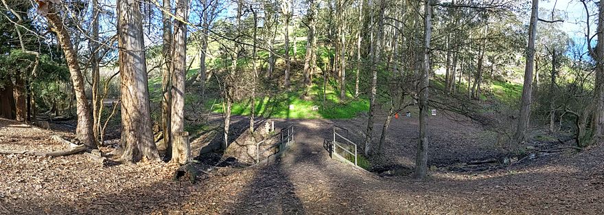
Today, most of Islais Creek flows underground in a large pipe called a culvert. However, you can still see parts of the original creek at Glen Canyon Park and near Third Street. Many groups are working hard to protect these remaining parts because they are important homes for wildlife.
Contents
Where Islais Creek Flows
The original Islais Creek was the biggest natural water body in San Francisco. It covered about 5,000 acres (7.813 sq mi; 20.234 km2). It had two main parts. One part started near Twin Peaks and flowed through Glen Canyon Park. The other part began near Cayuga Avenue.
These two parts joined together and flowed towards the San Francisco Bay. Another nearby creek, Precita Creek, also joined Islais Creek. In total, the creek stretched about 3.5 miles (5.6 km) from its start to the bay.
The mouth of the creek, where it met the bay, was nearly 2 miles (3.2 km) wide. It used to provide most of San Francisco's drinking water! But because of city growth, the area that drains into Islais Creek (its watershed) has shrunk by about 80%. Many San Francisco neighborhoods, like Bernal Heights and Potrero Hill, were once part of the creek's natural area.
In 2007, the San Francisco Public Utilities Commission started looking into "daylighting" parts of the creek. This means bringing the underground parts back to the surface. As of 2009, you can still see parts of the creek in Glen Canyon Park and a 1-mile (1.6 km) channel near Third Street.
History of Islais Creek
The story of Islais Creek goes back to the 1700s. The name Los Islais first appeared on maps in 1834. It was named after the Islay cherries that grew wild in the area. By 1850, farmers used the creek's water to help their crops grow.
When the California Gold Rush began, many people came to San Francisco. A railroad bridge was built over the creek in the 1860s. In 1883, a court case decided that Islais Creek was not a "navigable waterway," meaning large boats couldn't easily travel on it.
In 1871, the area along the creek became known as "New Butchertown." More than 100 slaughterhouses opened there. This made the creek very polluted. It became a dumping ground for garbage, sewage, and animal waste.
After the terrible 1906 San Francisco earthquake, the city decided to fill in parts of the creek with debris from the earthquake. This made the creek much smaller, to its current size. During World War II, the creek area was used for docking large tugboats. It also had the biggest copra (coconut meat) processing plant on the West Coast.
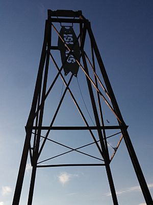
You can still see an old, five-story-high copra crane on the creek bank. This crane was used to move huge amounts of copra from ships to the plant until 1974. It is now a historic landmark. In the 1950s, Islais Creek was also home to the world's largest sardine canning industry.
The creek's condition slowly got better after a water treatment plant was built in 1970. Today, most of the creek flows underground in a culvert. Only small parts remain visible at Glen Canyon and near the bay.
Community Efforts and Parks
Many local groups have worked to improve Islais Creek and the areas around it. The Friends of Islais Creek, started in 1984, and a local person named David Erickson, wanted to build a park along the waterfront.
The idea for a park began in 1988 with a grant of $50,000. More money came from federal and local grants, and support from groups like the Sierra Club and the Port of San Francisco. The park was finished in 1998.
This park, called Muwekma Ohlone Park or Muwekma Ohlone Sanctuary, is next to Pier 80. It is named after the native people who lived there. The park has become an important home for many animals, including the Pacific tree frog and the Mission blue butterfly.
In 2001, something went wrong during construction for the Muni Metro T Third Street light rail line. Crews accidentally cracked an underground sewer pipe. This pipe carries over 80 million gallons of sewage every day! The sewage flooded the creek and Muwekma Ohlone Park. The park had to be dug up to fix the pipe. It cost a lot of money to repair and restore the wildlife habitat.
The remaining Islais Creek Park is located near Cargo Way and 3rd Street. It has signs with historical information, a short walking path, and public art made from an old copra loading crane. There is also a pier where small boats can dock. As of 2017, the copra crane is lying on its side, and its restoration project is on hold.
Water Quality and Safety
Islais Creek is part of a system that carries storm water, household sewage, and water from factories. Sometimes, if there's too much rain, the sewage can overflow into the creek. This can make the water unhealthy. Islais Creek has shown higher levels of certain metals, chemicals like PCBs, and bacteria compared to other parts of the San Francisco Bay.
Getting Around Islais Creek
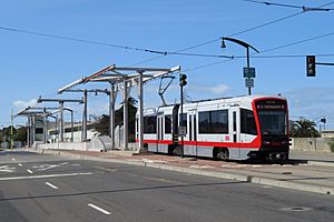
The Third Street Bridge is the main way to cross Islais Creek. It carries the T Third Street light rail line and Third Street itself. This bridge is a special type called a bascule-type drawbridge, which can open to let boats pass. In 2006, the Port of San Francisco extended Illinois Street across Islais Creek to help with traffic on Third Street. This crossing also uses a bascule bridge.
 | Leon Lynch |
 | Milton P. Webster |
 | Ferdinand Smith |


