Jefferson County, Oregon facts for kids
Quick facts for kids
Jefferson County
|
|
|---|---|
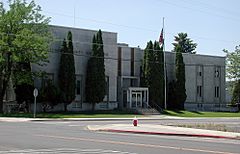
Jefferson County Courthouse in Madras
|
|
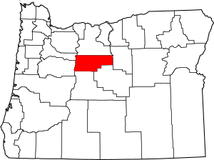
Location within the U.S. state of Oregon
|
|
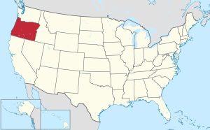 Oregon's location within the U.S. |
|
| Country | |
| State | |
| Founded | December 12, 1914 |
| Named for | Mount Jefferson |
| Seat | Madras |
| Largest city | Madras |
| Area | |
| • Total | 1,791 sq mi (4,640 km2) |
| • Land | 1,781 sq mi (4,610 km2) |
| • Water | 10 sq mi (30 km2) 0.6% |
| Population
(2020)
|
|
| • Total | 24,502 |
| • Estimate
(2023)
|
25,454 |
| • Density | 12/sq mi (5/km2) |
| Time zone | UTC−8 (Pacific) |
| • Summer (DST) | UTC−7 (PDT) |
| Congressional districts | 2nd, 5th |
Jefferson County is one of the 36 counties in the U.S. state of Oregon. In 2020, about 24,502 people lived there. The main city and county seat is Madras. The county is named after Mount Jefferson. This is the second tallest mountain in Oregon.
Contents
History of Jefferson County
Jefferson County was created on December 12, 1914. It was formed from a part of Crook County. The county's farms became successful thanks to two main things. First, a railroad was finished in 1911. This railroad connected Madras to the Columbia River. Second, new ways to water crops (irrigation projects) were developed in the late 1930s. The railroad was built even though two different companies were competing. They built tracks on opposite sides of the Deschutes River.
Madras became an official city in 1911. It has been the permanent county seat since 1916. Before that, Culver was the temporary county seat. A special group chose Culver after a long debate. They had trouble deciding between Culver, Metolius, and Madras.
In the 1990s, the nearby Deschutes County grew very quickly. Farmers in Jefferson County worried about this. They were concerned that their farmland might become too expensive. They feared their farms could be turned into resorts or golf courses.
Geography of Jefferson County
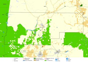
Jefferson County covers a total area of about 1,791 square miles. Most of this area, about 1,781 square miles, is land. Only about 10 square miles (0.6%) is water.
Neighboring Counties
Jefferson County shares borders with several other counties:
- Marion County (to the northwest)
- Wasco County (to the north)
- Wheeler County (to the east)
- Crook County (to the south)
- Deschutes County (to the south)
- Linn County (to the west)
Protected Natural Areas
Parts of these important natural areas are found in Jefferson County:
- Crooked River National Grassland
- Deschutes National Forest
- Mount Hood National Forest
- Willamette National Forest
People of Jefferson County
| Historical population | |||
|---|---|---|---|
| Census | Pop. | %± | |
| 1920 | 3,211 | — | |
| 1930 | 2,291 | −28.7% | |
| 1940 | 2,042 | −10.9% | |
| 1950 | 5,536 | 171.1% | |
| 1960 | 7,130 | 28.8% | |
| 1970 | 8,548 | 19.9% | |
| 1980 | 11,599 | 35.7% | |
| 1990 | 13,676 | 17.9% | |
| 2000 | 19,009 | 39.0% | |
| 2010 | 21,720 | 14.3% | |
| 2020 | 24,502 | 12.8% | |
| 2023 (est.) | 25,454 | 17.2% | |
| U.S. Decennial Census 1790–1960 1900–1990 1990–2000 2010–2020 |
|||
Population in 2010
In 2010, there were 21,720 people living in Jefferson County. These people lived in 7,790 households. About 5,646 of these were families. The population density was about 12 people per square mile. There were 9,815 housing units in total.
Most of the people were white (69.0%). About 16.9% were American Indian. People of Hispanic or Latino origin made up 19.3% of the population. Many people had German (15.0%), Irish (9.4%), or English (8.3%) backgrounds.
About 34.0% of households had children under 18. Most households (53.6%) were married couples. The average household had 2.68 people. The average family had 3.11 people. The average age of people in the county was 39.6 years old.
The average income for a household was $41,425. For families, it was $48,818. About 20.1% of all people lived below the poverty line. This included 33.6% of those under 18.
Communities in Jefferson County
Cities
Census-Designated Places
These are areas that are like towns but are not officially incorporated as cities:
- Camp Sherman
- Crooked River Ranch
- Warm Springs
Unincorporated Communities
These are smaller communities that are not part of any city:
- Ashwood
- Kilts
- Gateway
- Geneva
- Grandview
- Grizzly
- Horse Heaven
- Opal City
- Willowdale
Economy of Jefferson County
Farming is the main way people earn money in Jefferson County. Farmers grow many different crops. These include vegetable, grass, and flower seeds. They also grow garlic, mint, and sugar beets. About 60,000 acres of land are used for farming with irrigation.
The county also has large areas of rangeland. Until 2016, there were also industries related to wood products. The Warm Springs Forest Products Industry was a very large business. It was owned by the Confederated Tribes of Warm Springs. This industry was the biggest employer in the area.
Jefferson County gets about 300 days of sunshine each year. It also has low rainfall. This makes it a great place for outdoor activities. Many tourists visit for fishing, hunting, camping, boating, water-skiing, and looking for rocks.
The two biggest landowners in the county are the Forest Service and the Confederated Tribes of Warm Springs. The Forest Service manages 24% of the land. The Warm Springs Reservation owns and manages 21% of the land.
See also
 In Spanish: Condado de Jefferson (Oregón) para niños


