Jerome County, Idaho facts for kids
Quick facts for kids
Jerome County
|
||
|---|---|---|

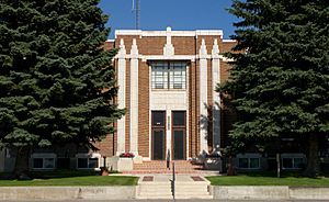
Jerome County Courthouse
|
||
|
||

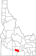
Location within the U.S. state of Idaho
|
||
 Idaho's location within the U.S. |
||
| Country | ||
| State | ||
| Founded | February 8, 1919 | |
| Seat | Jerome | |
| Largest city | Jerome | |
| Area | ||
| • Total | 602 sq mi (1,560 km2) | |
| • Land | 597 sq mi (1,550 km2) | |
| • Water | 5.0 sq mi (13 km2) 0.8% | |
| Population
(2020)
|
||
| • Total | 24,237 | |
| • Estimate
(2023)
|
25,479 |
|
| • Density | 40.26/sq mi (15.545/km2) | |
| Time zone | UTC−7 (Mountain) | |
| • Summer (DST) | UTC−6 (MDT) | |
| Congressional district | 2nd | |
Jerome County is a county located in the state of Idaho in the United States. In 2020, about 24,237 people lived there. The biggest city and the main government center is Jerome.
The county was officially created on February 8, 1919. It was formed from a part of Lincoln County. Jerome County might have been named after Jerome Hill, who helped develop an important irrigation project. It could also be named after his son-in-law or grandson, both named Jerome Kuhn. Jerome County is part of the Twin Falls area.
A very important historical site, the Minidoka Relocation Camp, is in Jerome County. This was one of ten camps where Japanese Americans were sent during World War II. It is located near the town of Hunt.
Contents
History of Jerome County
The towns and communities in Jerome County are quite new compared to other parts of Idaho. Even though the famous Oregon Trail and stagecoach routes passed nearby, the area was hard to reach. This was because of the deep Snake River Canyon, which is about 500 feet (150 meters) deep.
The canyon also made it difficult to get water for farming. These challenges meant that early settlers in Idaho didn't choose to live here. Also, when the railroad was built across Idaho in the 1880s, it went about 16 miles (26 km) north of where Jerome City is today.
Things started to change when a ferry began operating at Shoshone Falls in 1884. This made it easier to travel between the railroad and areas south of the Snake River.
Early Settlements and Water
One of the first settlements was Schodde, which had 24 people by 1900. A big change happened in 1905 with the completion of the Milner Dam and the Northside Canal. This brought much-needed water to the north side of the Snake River. With water available, farmers began to move into the region.
The towns of Eden and Hazelton were settled starting in 1905. The town of Jerome itself began to be settled on September 30, 1907. The Idaho Southern Railway reached Jerome in late 1908. By 1910, Jerome had grown to 970 residents and became an official village in 1909.
Eden and Hazelton also became official villages by 1920. Jerome County became Idaho's 43rd county on February 8, 1911.
Geography of Jerome County
Jerome County covers a total area of about 602 square miles (1,559 square kilometers). Most of this area, about 597 square miles (1,546 square kilometers), is land. Only a small part, about 5.0 square miles (13 square kilometers), is water.
Neighboring Counties
Jerome County shares borders with several other counties:
- Lincoln County to the north
- Gooding County to the west
- Twin Falls County to the south
- Cassia County to the southeast
- Minidoka County to the east
Population Growth
The population of Jerome County has changed over the years. Here's how it has grown:
| Historical population | |||
|---|---|---|---|
| Census | Pop. | %± | |
| 1920 | 5,729 | — | |
| 1930 | 8,358 | 45.9% | |
| 1940 | 9,900 | 18.4% | |
| 1950 | 12,080 | 22.0% | |
| 1960 | 11,712 | −3.0% | |
| 1970 | 10,253 | −12.5% | |
| 1980 | 14,840 | 44.7% | |
| 1990 | 15,138 | 2.0% | |
| 2000 | 18,342 | 21.2% | |
| 2010 | 22,374 | 22.0% | |
| 2020 | 24,237 | 8.3% | |
| 2023 (est.) | 25,479 | 13.9% | |
| U.S. Decennial Census 1790–1960, 1900–1990, 1990–2000, 2010, 2020 |
|||
In 2010, there were 22,374 people living in Jerome County. The population density was about 37.5 people per square mile. About 31.0% of the population was of Hispanic or Latino origin.
Important Roads
These are the main highways that pass through Jerome County:
Protected Areas
Towns and Communities
Cities
Unincorporated Community
Schools and Education
Jerome County is served by several school districts:
- Jerome Joint School District 261
- Minidoka County Joint School District 331
- Shoshone Joint School District 312
- Valley School District 262
The county is also in the area that supports the College of Southern Idaho.
See also
 In Spanish: Condado de Jerome para niños
 | Frances Mary Albrier |
 | Whitney Young |
 | Muhammad Ali |


