
Minidoka County, Idaho facts for kids
Quick facts for kids
Minidoka County
|
||
|---|---|---|

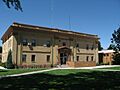
Minidoka County Courthouse
|
||
|
||

Location within the U.S. state of Idaho
|
||
 Idaho's location within the U.S. |
||
| Country | ||
| State | ||
| Founded | January 28, 1913 | |
| Named for | Dakota Sioux word meaning "a fountain or spring of water." | |
| Seat | Rupert | |
| Largest city | Rupert | |
| Area | ||
| • Total | 763 sq mi (1,980 km2) | |
| • Land | 758 sq mi (1,960 km2) | |
| • Water | 5.3 sq mi (14 km2) 0.7% | |
| Population
(2020)
|
||
| • Total | 21,613 | |
| • Density | 28.326/sq mi (10.937/km2) | |
| Time zone | UTC−7 (Mountain) | |
| • Summer (DST) | UTC−6 (MDT) | |
| Congressional district | 2nd | |

Minidoka County is a place in Idaho, a state in the USA. In 2020, about 21,613 people lived there. Its main town, called the county seat, is Rupert. Rupert is also the biggest city in the county.
Minidoka County is part of the larger Burley area.
The name Minidoka comes from the Dakota Sioux people. It means "a fountain or spring of water." The name was first used in 1883 for a railroad line called the Union Pacific's Oregon Short Line. This line was built in the middle of the Snake River Plain. The railroad line had a watering stop, and soon a small village named Minidoka grew up around it.
The Minidoka name was also given to a big water project. This project was started by President Theodore Roosevelt. It included building the Minidoka Dam, which was finished in 1904. The Minidoka National Historic Site is nearby and shares the name. Minidoka County was officially created on January 28, 1913. It was formed from a part of Lincoln County.
During World War II, there was a prisoner of war (POW) camp called Camp Rupert. It was located west of the town of Paul.
Contents
Geography of Minidoka County
Minidoka County covers about 763 square miles. Most of this area, about 758 square miles, is land. A small part, about 5.3 square miles, is water.
The county is part of the Magic Valley region. This area is found in the Snake River Plain. The southern part of the county has many farms with irrigation. The northern part is covered by lava rocks. The land is usually between 4,200 and 4,500 feet high. The Snake River forms the southern edge of the county.
Neighboring Counties
Minidoka County shares borders with these other counties:
- Cassia County to the south
- Jerome County to the west
- Lincoln County to the west
- Blaine County to the north and east
Protected Natural Areas
Parts of these special natural areas are found in Minidoka County:
Major Roads
These important roads pass through Minidoka County:
 Interstate 84
 US 30
US 30 State Highway 24
 State Highway 25
 State Highway 27
People of Minidoka County
| Historical population | |||
|---|---|---|---|
| Census | Pop. | %± | |
| 1920 | 9,035 | — | |
| 1930 | 8,403 | −7.0% | |
| 1940 | 9,870 | 17.5% | |
| 1950 | 9,785 | −0.9% | |
| 1960 | 14,394 | 47.1% | |
| 1970 | 15,731 | 9.3% | |
| 1980 | 19,718 | 25.3% | |
| 1990 | 19,361 | −1.8% | |
| 2000 | 20,174 | 4.2% | |
| 2010 | 20,069 | −0.5% | |
| 2020 | 21,613 | 7.7% | |
| 2023 (est.) | 22,480 | 12.0% | |
| U.S. Decennial Census 1790–1960, 1900–1990, 1990–2000, 2010–2020 2020 |
|||
In 2010, there were 20,069 people living in Minidoka County. There were 7,170 households, which are groups of people living together. The average family size was about 3 people. The average age of people in the county was 35.3 years old.
Most people in the county were white (80.2%). About 32.4% of the population was of Hispanic or Latino background. Many people had German (19.9%) or English (16.8%) ancestors.
Education in Minidoka County
Minidoka County has one school district. It is called Minidoka County Joint School District 331. The only public high school in the county is Minico High School, which is near Rupert.
The county is also in the area for the College of Southern Idaho. This means students from Minidoka County can attend this college.
Towns and Communities
Minidoka County has several cities and smaller communities.
Cities
Unincorporated Communities
These are smaller communities that are not officially cities:
- Jackson (also extends into Cassia County)
- Kimama (also extends into Lincoln County)
Ghost Towns
- Alturas, Idaho (mostly in Blaine County)
Images for kids
-
Minidoka County Courthouse
See also
 In Spanish: Condado de Minidoka para niños
