Jurong facts for kids
Quick facts for kids
Jurong
|
|
|---|---|
|
Commercial district and Regional centre
|
|
| Other transcription(s) | |
| • Chinese | 裕廊 Yùláng (Pinyin) Jū-lông (Hokkien POJ) |
| • Malay | Jurong (Rumi) جوروڠ (Jawi) |
| • Tamil | ஜூரோங் Jūrōṅ (Transliteration) |
|
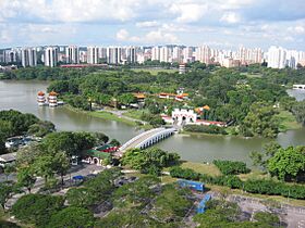
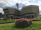
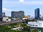
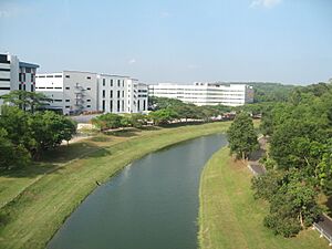
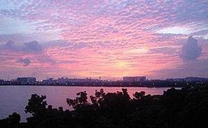
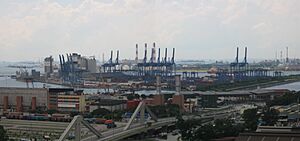
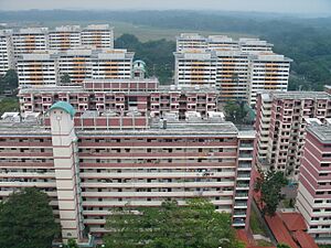
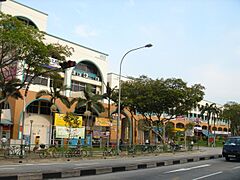
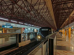
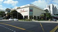
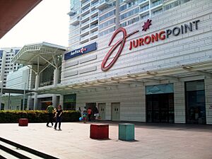
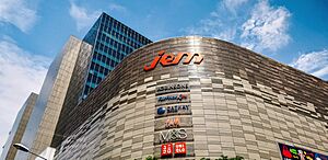
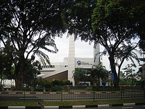
From top, left to right: Jurong Lake, Jurong Town Hall, Jurong East MRT station, IMM, Jurong Port.
|
|
| Country | |
| Region | West Region |
| Mainland composition |
Planning Areas
Jurong East
Jurong West Boon Lay Pioneer Western Islands (Jurong Island only) Western Water Catchment (southern parts) |
| Offshore islands |
3
Jurong Island
Pulau Damar Laut Pulau Samulun |
| CDC |
|
| Town councils |
|
| Constituencies |
|
| Demonym(s) |
|
| Postal district |
22
|
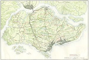
Jurong is a large area located in the southwest part of Singapore. It covers places like Jurong East, Jurong West, Boon Lay, and Pioneer. It also includes Jurong Island and some southern parts of the Western Water Catchment. In the past, it even included areas like Bukit Batok and Tuas.
Jurong also has several smaller islands, such as Pulau Damar Laut and Pulau Samulun. The coast of mainland Jurong faces the Selat Jurong strait. Jurong Island, the southernmost island, faces the Selat Pandan strait.
Jurong was developed in the late 1960s after Singapore became independent. It is very important for Singapore's economy, with many businesses, factories, and homes. This big development helped create a large industrial area in the country. Today, Jurong is one of the busiest industrial areas in Singapore. There are plans for Jurong to become Singapore's second main business district, known as the Jurong Lake District.
Contents
What's in a Name? The Story of Jurong
The name "Jurong" comes from Sungei Jurong, a river that flows into Jurong Lake. The lake itself was made by building a dam on the river.
The exact meaning of "Jurong" is debated, but it likely comes from several Malay words.
- It could be from "Jerung", which means shark.
- It might also come from "Jurang", meaning a gorge or valley.
- Another idea is that it comes from "Penjuru", which means "corner". This might refer to the land between Sungei Jurong and Sungei Pandan. This area was called Tanjong Penjuru by the local Malays, meaning "Cape Corner". Today, this area is known as Penjuru Crescent.
Jurong's Landscape: Then and Now
How Jurong Looked Long Ago
Natural Beauty
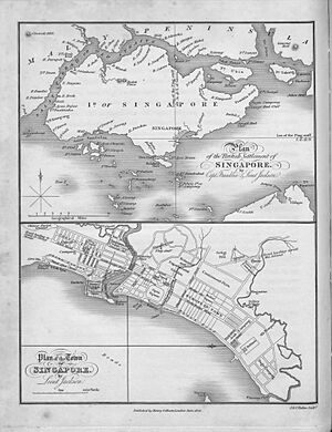
Early maps of Singapore, like one from 1828 by Lieutenant Philip Jackson, showed Jurong's natural features. He marked the two main rivers, Sungei Jurong and Sungei Pandan. He also noted islands that no longer exist today, such as Pulau Ayer Chawan, Pulau Butun, Pulau Pese, Pulau Sakra, and Pulau Saraya. These islands later joined together to form Jurong Island. Other landmarks like Pulau Damar Laut and Selat Sembilan (now Selat Jurong) were also on the map.
In 1848, another survey by John Turnbull Thomson described the rivers again. He called them "large creeks" with settlements nearby. Before the dam was built, Jurong Lake was once two streams. These streams roughly marked where Jurong East and West are today.
Before it was developed in the 1960s, Jurong was mostly untouched. It had many swamps along the coast, full of wildlife like mudskippers and horseshoe crabs. Inland, there were forests with tall dipterocarp trees. The land had low hills, but most of these were later flattened.
Commodore Perry, who visited Jurong in the 1850s, described it as:
Inland, the surface of the country is diversified with low hills and shallow valleys.
Modern Jurong's Environment
Nature Today
Today, only small parts of Jurong's original natural environment remain. These are mostly around the Pandan Reservoir and Sungei Pandan. There are still some mangrove swamps at the mouth of Sungei Pandan. These untouched areas are home to many animals and are popular with nature lovers and bird watchers.
Waterways
Jurong has two important rivers: Sungei Jurong and Sungei Pandan. They flow into Jurong Lake and Pandan Reservoir, respectively. Both rivers also connect to Selat Jurong, a strait south of mainland Singapore and north of Jurong Island.
Sungei Pandan has a branch called Sungei Ulu Pandan, which flows from Jurong East towards Clementi. Sungei Jurong flows out of Jurong Lake through a stream and the Jurong Canal. This canal also forms the border between Jurong East and Jurong West.
Highest Point
The highest point in Jurong is Jurong Hill. It is located near the industrial area, close to Jurong Bird Park.
Rocks and Land
Jurong has a special type of rock formation called the Jurong Formation. These sedimentary rocks were formed millions of years ago, during the late Triassic and early to middle Jurassic periods.
How Jurong is Divided Today
The name "Jurong" often refers to five main planning areas: Jurong East, Jurong West, Boon Lay, Pioneer, and Tuas. However, the government officially sees them as separate areas. These five areas together have 34 smaller sections called subzones.
The current boundaries of Jurong were set in the 1960s when the new town was planned. This plan combined land from older districts to make Jurong bigger.
Jurong's Journey Through Time
Early Days (Before 1819)
The earliest mention of Jurong dates back to 1595 in a Dutch journal about trade routes. It mentioned "Selat Sembilan" (now Selat Jurong), showing that the straits near Jurong were important for ancient trade.
Even before Sir Stamford Raffles arrived in 1819, small villages existed along Jurong's coast and on islands like Pulau Damar Laut. These villages were home to local Orang laut (sea people) and immigrants from nearby Malay lands.
Colonial Times (1819 to 1942)
First Settlements
After Singapore became a British colony, Jurong had a small population of Chinese and Malay immigrants living along its rivers. Most Chinese people were Hokkien-speaking, from China, while some Teochew people settled in western Jurong. The Malays and Orang Laut were mostly native to the land.
In 1848, John Turnbull Thomson described the people living along Sungei Jurong:
The Chinese here are numerous and there are also several Malay villages.
He also noted Chinese and Malays living along Sungei Pandan.
As the population grew, roads were needed. Between 1852 and 1853, the first parts of Jurong Road were built. This connected Jurong villages to Singapore Town. By 1936, the road reached all the way to Tuas.
American Visitors
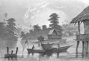
In 1853, US Navy Commodore Matthew C. Perry led a trip to Japan. On his way, his ships stopped in Singapore. Perry's crew anchored their ships along Selat Sembilan and Sungei Jurong.
Two artists on the trip, Wilhelm Heine and Eliphalet Brown, drew pictures of the villages along Sungei Jurong. One drawing shows a forest fire in the background, which was common in Jurong back then. It also shows the United States flag on a boat.
Early Businesses
Farming and Fishing
Before the 1960s, Jurong had many farms growing crops like pineapple, pepper, and nutmeg. These crops were important for people's income. Gambier was especially valuable, and many gambier farms were set up.
Rubber farming also became popular. By the early 1900s, rubber farms took over from gambier. A famous example is the farm owned by Chew Boon Lay, which later became the area known as Boon Lay Place.
Fishing was another important job, especially for the local Malay people. They fished in the rivers and along the coast. Many prawn farms were also set up along Sungei Jurong and Sungei Pandan. By the 1950s, about half of Singapore's prawn farms were in Jurong.
Factories and Production
Even before the big industrial growth in the 1960s, Jurong had some heavy industries, especially brick-making. Factories were built in areas like Yunnan because the soil had a lot of clay. Most of these factories closed down later, but the history of brick-making is still a big part of Jurong's story.
The first brick factories appeared in the 1920s. Jurong Brickworks, started in the 1930s, was one of the biggest brick makers in Singapore. It made over three million bricks every month in the 1970s! It closed in 2005.
Another old business is the Thow Kwang Dragon Kiln. Started by Chinese immigrants in the 1940s, this pottery maker still exists today. It has one of the last two traditional dragon kilns in Singapore.
World War II (1941–45)
Secret Training School
When the Japanese army invaded Thailand in 1941, it was clear they would soon attack Singapore. The British set up a secret training school in Singapore to train people to fight against the Japanese.
They chose a small, hidden island called Tanjong Balai, located at the mouth of Sungei Jurong. It had one bungalow and was hidden by thick rainforest. This became the Number 101 Special Training School. Here, people learned about sabotage, spying, and other skills to resist the Japanese.
When the Japanese invaded Singapore in February 1942, the school quickly closed. Today, Tanjong Balai island is part of Jurong Port due to land reclamation.
Modern Jurong (1960–Present)
Why Jurong Became Industrial
After World War II, Singapore faced many economic problems. Many people were unemployed, and the population was growing fast. The government needed to create jobs and strengthen the economy.
In 1959, the People's Action Party won the election. They promised more jobs and a stronger economy. Dr Goh Keng Swee, the finance minister, was put in charge of this big task.
Dr Goh believed that industrialization was the key. He imagined a major industrial town in Singapore with modern factories, shipyards, and chemical plants. His plan for Jurong was very ambitious.
The Jurong Industrial Estate
On July 4, 1960, the government announced plans to build a new industrial town in Jurong. The project cost $45.7 million. Planning and design started right away.
The United Nations sent Dr Albert Winsemius, a Dutch economic advisor, to help Singapore with its economic development. Another expert, Mr P. Schereschewsky, checked if Jurong was suitable for an industrial town.
In 1961, the Economic Development Board (EDB) was formed to lead Singapore's industrial growth. Construction work for Jurong's industrial estate began that same year. In 1962, Dr Goh Keng Swee laid the foundation stone for the National Iron and Steel Mills, the first factory in the new estate. Many people doubted the plan, calling it "Goh's Folly," but they were wrong. By 1963, 24 factories were built. In May 1965, Jurong Port started operating.
In 1968, the Jurong Town Corporation was created to manage Jurong's development. By then, 14.78 square kilometers of industrial land were ready, with 153 factories working and 46 more being built.
To find more space for new businesses, seven small islands off Jurong's coast were combined to create Jurong Island. This 30-square-kilometer island is now home to most of Singapore's oil, chemical, and petrochemical factories. Construction of Jurong Island began in the early 1990s. A causeway connects Jurong Island to mainland Singapore. Access to the island is very strict for security reasons.
Jurong's Towns
The first low-rise apartments in Jurong were built in Taman Jurong between 1963 and 1964. Other housing estates, like Boon Lay, also started to be built. At first, not many people wanted to live in Jurong because it was far and lacked facilities.
The development of Jurong East and West began in 1979. New towns like Taman Jurong, Boon Lay Place, Teban Gardens, and Yuhua were built. These areas became Jurong West New Town and Jurong East New Town.
In 1982, Jurong West New Town expanded further. The PIE was rerouted, and new areas like Yunnan and Pioneer began to develop. The MRT train line was extended to Boon Lay in 1990 and to Pioneer in 2009, making it easier for people to travel.
The Spyros Disaster
On October 12, 1978, a Greek oil tanker called Spyros exploded at Jurong Shipyard. More than 70 people died in this accident. It was one of the worst industrial accidents in Singapore since the country gained independence.
Getting Around and What to Do
Getting Around Jurong
By Road
Jurong is well-connected by major roads. The Kranji Expressway links it to northern Singapore, the Pan Island Expressway to eastern Singapore, and the Ayer Rajah Expressway to southeastern Singapore. Other roads like Clementi Avenue 6 and Jurong Town Hall Road also help connect Jurong to the rest of the island.
By MRT Train
Jurong has many MRT stations. Jurong East and Chinese Garden serve Jurong East. Lakeside, Boon Lay, and Pioneer serve Jurong West. Joo Koon, Gul Circle, Tuas West Road, and Tuas Link serve the industrial areas of Pioneer and Tuas.
In the future, a new 20-kilometer Jurong Region MRT line will make it even easier to travel around Jurong and to other parts of Singapore.
By Bus
Jurong has public bus services from five bus interchanges: Jurong East, Jurong Town Hall, Boon Lay, Joo Koon, and Tuas. There is also a bus depot called Soon Lee Bus Depot.
Shopping and Fun
Shopping Malls
The most famous shopping malls in Jurong are Jurong Point Shopping Mall in Pioneer and IMM in Yuhua.
Jurong Point Shopping Mall is the largest suburban mall in Singapore. It's easy to reach by bus and has stores for fashion, food, sports, and entertainment. It also has health centers. It is connected to Boon Lay MRT station and Boon Lay Bus Interchange.
IMM is the largest outlet mall in Singapore. It's close to Jurong East MRT station. It has a food court, furniture stores, a Popular Bookstore, and a Daiso store. There's also a Giant Hypermarket. You can walk to IMM from other malls like JCube and Westgate using the J-walk pedestrian network.
Other smaller shopping malls in Jurong include Hong Kah Point and Taman Jurong Shopping Centre.
Places to Visit
- Singapore Science Centre
- Snow City
- Singapore Discovery Centre
- Singapore Army Museum
- Jurong Bird Park (moved to Mandai in 2023)
- Jurong Lake Gardens
- ABC Waters @ Jurong Lake (a large man-made floating wetlands)
Learning in Jurong
Jurong Junior College was located in Jurong, between Hong Kah and Boon Lay, but it closed in 2019. Each area of Jurong has at least one primary school and one secondary school. For example, Shuqun Primary School was established in 1925 in Jurong West. Also, River Valley High School is located in Boon Lay, near Jurong Point.
 | John T. Biggers |
 | Thomas Blackshear |
 | Mark Bradford |
 | Beverly Buchanan |


