Kabinakagami Lake facts for kids
Quick facts for kids Kabinakagami Lake |
|
|---|---|

|
|
| Location | Algoma District, Ontario |
| Coordinates | 48°54′29″N 84°24′23″W / 48.90806°N 84.40639°W |
| Primary inflows | Kabinakagami River, Oba River |
| Primary outflows | Kabinakagami River |
| Basin countries | Canada |
| Max. length | 26 km (16 mi) |
| Max. width | 12 km (7.5 mi) |
| Surface area | 108 km2 (42 sq mi) |
| Average depth | 3 m (9.8 ft) |
| Max. depth | 15.2 m (50 ft) |
| Water volume | 0.324 km3 (0.078 cu mi) |
| Shore length1 | 202 km (126 mi) |
| Surface elevation | 316 m (1,037 ft) |
| Islands | Agamik Island, Birch Island, Blueberry Island, Burnt Island, Dog Island, John's Island, Moose Island, Twenty Pound Island |
| 1 Shore length is not a well-defined measure. | |
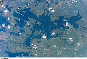
Kabinakagami Lake is a large and beautiful lake located in the northern part of Algoma District in Ontario, Canada. It's often called "Kaby" by locals. This lake is an important part of the Kabinakagami River system. All the water from the lake eventually flows into James Bay, which is a large body of water connected to Hudson Bay.
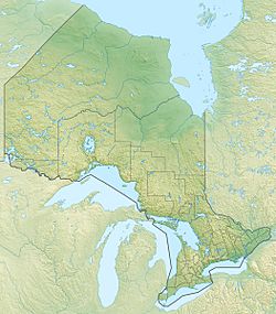
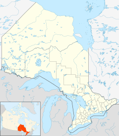
The lake is found in a wild, unorganized area of northern Ontario. It's about 17 kilometers (10 miles) southwest of a small settlement called Oba. It's also about 100 kilometers (62 miles) southwest of the town of Hearst.
How Water Flows Through Kabinakagami Lake
Kabinakagami Lake is like a big bathtub that collects water from several sources. The main rivers that flow into the lake are the Kabinakagami River itself and the Oba River. These are called the primary inflows.
Many smaller streams also bring water into the lake. These include:
- Bear Creek
- Stoney Creek
- Fairy Creek
- Ermine Creek
- Noisy Creek
- Five Mile Creek
After all this water enters the lake, it eventually flows out through the Kabinakagami River. This river then connects to the Kenogami River and the Albany River, finally reaching James Bay.
The lake has some interesting features, like Schist Bay in its northwest corner. There's also a spot called Rocky Point. The Kabinakagami River leaves the lake over an area known as the Big Rapids.
Connecting Waterways: Portages and Drainage Basins
Sometimes, people want to travel between different river systems. This is where portages come in handy. A portage is a path where you carry your canoe or boat over land from one body of water to another.
From Kabinakagami Lake, you can use a portage called the Five Mile Portage. This path leads south from Five Mile Bay to Esnagi Lake. Esnagi Lake is part of the Magpie River, which flows into Lake Superior. This connection is special because it links the water that flows to James Bay (part of the Hudson Bay drainage basin) with the water that flows to the Great Lakes and the Saint Lawrence River.
There's another way to reach James Bay from Kabinakagami Lake using the Oba River. You can take the Pine Portage from Pine Portage Bay to Pine Portage Lake. This helps you avoid some fast-moving parts of the river. From there, you can travel upstream on the Oba River to a place called the Albany Forks. From this point, the Mattawitchewan River flows downstream as part of the Missinaibi and Moose rivers, eventually reaching James Bay.
 | Aaron Henry |
 | T. R. M. Howard |
 | Jesse Jackson |


