Kendall, New York facts for kids
Quick facts for kids
Kendall, New York
|
|
|---|---|

View of Lake Ontario from the Lake Ontario State Parkway in Kendall
|
|

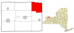
Location in Orleans County and the state of New York.
|
|

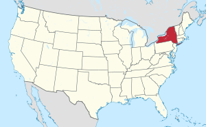
Location of New York in the United States
|
|
| Country | United States |
| State | New York |
| County | Orleans |
| Area | |
| • Total | 32.92 sq mi (85.26 km2) |
| • Land | 32.86 sq mi (85.11 km2) |
| • Water | 0.06 sq mi (0.16 km2) |
| Elevation | 328 ft (100 m) |
| Population
(2010)
|
|
| • Total | 2,724 |
| • Estimate
(2016)
|
2,638 |
| • Density | 80.28/sq mi (31.00/km2) |
| Time zone | UTC-5 (Eastern (EST)) |
| • Summer (DST) | UTC-4 (EDT) |
| ZIP code |
14476/14508
|
| Area code(s) | 585 |
| FIPS code | 36-39188 |
| GNIS feature ID | 0979114 |
Kendall is a town located in Orleans County, in New York State, United States. It is just west of the town of Hamlin. Kendall is in the northeast part of Orleans County. It is also northwest of the city of Rochester. In 2010, the population of Kendall was 2,724 people.
Contents
History of Kendall
Early Settlement and Growth
The area that is now Kendall was once part of a large piece of land called the Connecticut Tract. This tract was also known as the 100,000 Acre Tract. The very first settlers arrived in Kendall around the year 1812.
A big change happened when the Erie Canal opened in 1825. This canal made it much easier to transport goods like wheat and lumber. It also made it simpler for more people to move to the area.
Norwegian Immigrants in Kendall
In 1825, the first community of Norwegian immigrants in the United States was started in Kendall. These settlers chose to live together along the shore of Lake Ontario in the northeast part of the town. A famous Norwegian-American pioneer, Cleng Peerson, later helped start another settlement in Illinois in 1834.
Forming the Town of Kendall
The Town of Kendall was officially created from the Town of Murray. On April 7, 1837, about half of the Town of Murray became the new Town of Kendall. Before this, it was sometimes called "North Murray."
The area was slow to be settled at first because it had many swamps and forests. People even called it the "Black North" because of the bogs and thick woods. The town was named after Amos Kendall. He was the U.S. Postmaster General (the head of the postal service) under Presidents Andrew Jackson and Martin Van Buren.
Geography of Kendall
Location and Size
According to the United States Census Bureau, the town of Kendall covers about 33 square miles (85.26 square kilometers). Most of this area is land, with a small part being water.
Kendall is located right next to Lake Ontario on its northern side. The eastern border of the town is shared with Monroe County. This border is marked by New York State Route 272. The town of Hamlin is on the other side of this border.
Roads and Highways
The Lake Ontario State Parkway runs along the shore of Lake Ontario in Kendall. This parkway offers scenic views of the lake. Another important road is New York State Route 237, also known as Kendall Highway. This road runs north and south. It crosses New York State Route 18, which is called Roosevelt Highway, south of Kendall village.
Population Information
| Historical population | |||
|---|---|---|---|
| Census | Pop. | %± | |
| 1840 | 1,692 | — | |
| 1850 | 2,289 | 35.3% | |
| 1860 | 1,920 | −16.1% | |
| 1870 | 1,744 | −9.2% | |
| 1880 | 1,893 | 8.5% | |
| 1890 | 1,775 | −6.2% | |
| 1900 | 1,616 | −9.0% | |
| 1910 | 1,585 | −1.9% | |
| 1920 | 1,275 | −19.6% | |
| 1930 | 1,311 | 2.8% | |
| 1940 | 1,341 | 2.3% | |
| 1950 | 1,343 | 0.1% | |
| 1960 | 1,680 | 25.1% | |
| 1970 | 2,183 | 29.9% | |
| 1980 | 2,388 | 9.4% | |
| 1990 | 2,769 | 16.0% | |
| 2000 | 2,838 | 2.5% | |
| 2010 | 2,724 | −4.0% | |
| 2016 (est.) | 2,638 | −3.2% | |
| U.S. Decennial Census | |||
Population Changes Over Time
The population of Kendall has changed over the years. In 1840, there were 1,692 people living in the town. The population grew to 2,838 people by the year 2000. By the 2010 census, the population was 2,724.
How People Live in Kendall
In 2000, there were 979 households in Kendall. A household is a group of people living together in one home. Most of these households, about 68%, were married couples living together. About 37.5% of households had children under 18 living with them.
The average household had about 2.90 people. The average family had about 3.18 people.
Age Groups in Kendall
The population in Kendall is made up of people of all ages. In 2000, about 28.4% of the people were under 18 years old. About 27.9% were between 25 and 44 years old. About 10.9% of the population was 65 years old or older. The median age in Kendall was 38 years. This means half the people were younger than 38 and half were older.
Communities and Locations in Kendall
- Kendall - This is a small village, also called a hamlet. It is where the town government is located. You can find it on NY-237.
- Kendall Mills – This location is on the eastern border of the town, near NY-272. It used to be called "Webster Mills."
- Lomond Shore – This is a small community along the shore of Lake Ontario. It is close to the Lake Ontario Shore Parkway.
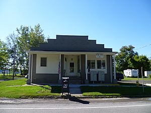
- Morton – This hamlet used to be known as "East Kendall" or "Clarks Corners." It is located right on the border with Monroe County. Morton has its own post office on NY-272 (County Line Road). Its ZIP code is 14508.
- Troutburg – This is another hamlet by Lake Ontario, on the eastern side of the town. It was once a port where boats could stop.
- West Kendall – This hamlet is located northwest of the main Kendall hamlet.
See also
 In Spanish: Kendall (Nueva York) para niños
 | Claudette Colvin |
 | Myrlie Evers-Williams |
 | Alberta Odell Jones |


