Kingsland, London facts for kids
Quick facts for kids Kingsland |
|
|---|---|
| London borough | |
| Ceremonial county | Greater London |
| Region | |
| Country | England |
| Sovereign state | United Kingdom |
| Post town | LONDON |
| Dialling code | 020 |
| Police | Metropolitan |
| Fire | London |
| Ambulance | London |
| EU Parliament | London |
| London Assembly |
|
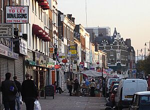
Kingsland was once a small village located around Kingsland High Street in London. This area was part of the Old North Road (now called the A10), especially near where it met Dalston Lane.
Today, Kingsland isn't really a separate village anymore. However, you can still see the old street layout. After the Dalston Junction train station opened in 1865, the area became known as Dalston. Dalston used to be a different small village located further east. Kingsland was historically part of Middlesex county, but now it's part of the London Borough of Hackney.
Contents
History of Kingsland
How Kingsland Got Its Name
The name Kingsland comes from the area being the hunting grounds for a Tudor royal home at Newington Green. So, it was the "King's Lands." Back then, the area was covered in thick forests. These forests stretched all the way from Shoreditch to Enfield Chase. Wild animals like bulls, stags, and boars roamed freely.
The forests quickly disappeared as the nearby City of London needed wood for building and fires. The cleared land was also used to dig up clay for making bricks. Many wells and springs were found in the area. A stream called Pigwell Brook (which is now gone) started on Kingsland Green. It flowed along where Graham Road is today before joining Hackney Brook.
Growth of the Village
Kingsland, Dalston, Newington, and Shacklewell were all small villages within the Parish of Hackney. They were grouped together for official records. In 1672, Kingsland had 28 households. But it grew quickly in the 1700s, especially along Kingsland Road. By 1724, Kingsland had five inns (like hotels or pubs), while Dalston only had two.
The road was very busy with lots of wagons pulled by horses. This made the road surface wear out quickly. In 1713, local parishes asked Parliament for permission to set up a Turnpike Trust. This trust would collect tolls (money) at gates to pay for road repairs. Gates were put up at Kingsland and Stamford Hill.
Kingsland was still very rural, with many market gardens (farms that grew food for sale) around the village. Big building projects started in 1807 along the main road. A new housing area was built on Lamb farm, south and west of the main junction. By 1831, buildings started to appear along Dalston Lane, connecting Kingsland and Dalston.
Famous Visitors and Hospitals
When he was young, Samuel Pepys, a famous diarist, lived in Kingsland for a while. He even wrote about shooting with a bow and arrows there in the 1600s.
Kingsland also had a special hospital called the 'Lock Hospital'. It was for people with leprosy, a serious skin condition. The City of London founded it in 1280. It was one of ten such hospitals located on the main roads leading out of the city. The hospital continued until 1559, which was when the last case of leprosy was recorded in London.
From 1549, St Bartholomew's Hospital managed the Lock Hospital. It started treating other infectious diseases too. The hospital was rebuilt in 1720 but closed in 1760. It had a chapel dedicated to St Bartholomew. Local people used this chapel for church services, saving them a long walk to the main parish church in Hackney. When the hospital closed, people asked to keep the chapel open. However, it was never repaired and was eventually taken down in 1846.
Kingsland Becomes Dalston
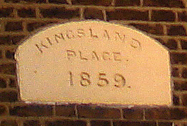
The main part of the Kingsland village was near the Dalston junction, where the road to Hackney left the main road. Today, only the name of the Kingsland Shopping Centre reminds us of this. You can still see the name Kingsland on some street signs and train stations. However, the area is no longer shown on road signs as a destination. The different parts of old Kingsland have now become part of nearby areas. For example, the part of Kingsland east of Kingsland Road is now called Queensbridge.
Before trains arrived around 1850, Kingsland was the more important village. That's why the main shopping street in modern Dalston is called Kingsland High Street. Also, Kingsland Road, not Dalston Road, stretches south from the junction. Dalston used to be a smaller village further east, where Dalston Lane and Cecilia Road meet.
The North London Railway opened in 1865. They named the junction and the new station Dalston Junction. This was a very important station because it connected directly to the City. Over time, the area around the station became known by the station's name, which is common in London.
Education
Transport and Nearby Areas
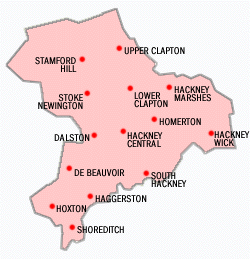
 |
Newington Green | Dalston | Hackney |  |
| De Beauvoir Town | London Fields | |||
| Hoxton | Shoreditch | Haggerston |
The closest London Overground train stations are Dalston Junction and Dalston Kingsland. Both of these stations opened in June 2010.
 | Selma Burke |
 | Pauline Powell Burns |
 | Frederick J. Brown |
 | Robert Blackburn |


