Lake Atna facts for kids
Quick facts for kids Lake Atna |
|
|---|---|
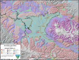
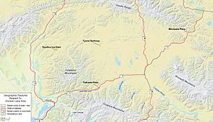
Map showing one of the possible extents (pale green) of ancient Lake Atna
|
|
| Location | Southcentral Alaska |
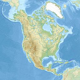
| Coordinates | 62°17′04″N 145°45′00″W / 62.28444°N 145.75000°W |
| Type | Proglacial lake |
| Part of | Copper River Basin |
| Primary outflows | Early: endorheic Later: Matanuska River, Susitna River, Tok River, and Copper River depending on period |
| Surface area | 8,900–24,000 km2 (3,400–9,300 sq mi) |
| Water volume | 2,300–6,000 km3 (550–1,440 cu mi) |
| Surface elevation | 975 m (3,199 ft) (maximum) |
Lake Atna (also called Lake Ahtna) was a huge ancient lake. It formed around 58,000 years ago in Southcentral Alaska. This happened during the last Ice Age, known as the Wisconsin glaciation. The lake was created when glaciers blocked rivers.
Lake Atna changed its size and shape many times. At its biggest, it was about half the size of modern-day Lake Ontario. It was surrounded by big mountain ranges. These included the Alaska Range to the north and the Wrangell Mountains to the east. The Chugach Mountains were to the south, and the Talkeetna Mountains to the west. Lake Atna might have caused some of the biggest floods ever. One of these floods might have even played a part in the big 1964 Alaska earthquake.
Contents
Discovering Ancient Lake Atna
In 1898, a scientist named Frank Charles Schrader explored the Copper River Basin. He worked for the United States Geological Survey (USGS). He found signs in the ground that a large body of water had once been there.
Later, in 1957, geologists Oscar J. Ferrians and H.R. Schmoll confirmed this idea. They found strong evidence of a large lake. This lake existed during the Ice Age. In 1965, another USGS geologist, D. J. Nichols, officially named it Lake Atna.
How Lake Atna Formed and Changed
Long ago, the land in this area was pushed up by Earth's forces. Rivers like the Copper River kept flowing through it. Before about 40,000 years ago, the area was free of ice and covered in spruce forests.
During the Ice Age, many glaciers grew and moved. They blocked the rivers flowing out of the Copper River Basin. This created a giant natural dam. Water then filled the basin, forming Lake Atna. This started at least 58,000 years ago.
The lake's highest water level reached about 975 meters (3,199 feet). You can still see old "strand lines" or shorelines today. These show where the water level stayed for long periods. Some of these levels were 914 meters (2,999 feet) and 750 meters (2,461 feet).
At first, the lake probably had no way for water to flow out. The glaciers were so big they completely trapped the water. Eventually, the lake drained away. This likely happened around 9,400 years ago. The water flowed out through the Copper River Valley.
Scientists are still studying how the land changed after the ice melted. The weight of the ice pushed the land down. When the ice melted, the land slowly bounced back up. This is called "isostatic rebound."
Giant Floods from Lake Atna
In 2005, a biologist named Michael Wiedmer found a pygmy whitefish. This fish was from Lake George, far from the Copper River Basin. Pygmy whitefish are known to live in lakes that are leftovers from Lake Atna. This made Wiedmer wonder if Lake Atna had once connected to Lake George.
He also saw huge, wavy hills in the Matanuska Valley. These hills looked like they were made by a powerful flood. This led him to research the idea of "megafloods" from Lake Atna.
Wiedmer's research showed that Lake Atna might have caused many megafloods. These floods happened when glacial dams broke. One huge flood may have come from a broken ice dam at Tahneta Pass. This dam was 61 meters (200 feet) tall.
This flood was incredibly powerful. It could have released up to 3.3 million cubic meters of water per second. That's like emptying 1,320 Olympic swimming pools every second! The water moved at speeds up to 57 meters per second (128 miles per hour). Over one week, it released 1,400 cubic kilometers of water. This created giant dunes, some 34 meters (112 feet) high. These dunes are still there today.
Other floods might have burst through the Susitna River. Some may have gone through Mentasta Pass into the Tok River. And some went down the Copper River itself. The Susitna River flood might have been even bigger. It could have released twice as much water as the Tahneta Pass flood.
What's Left of Lake Atna Today
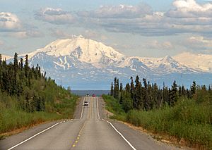
Today, you can find many types of soil and rock left behind by Lake Atna. These include glacial and lake deposits. The major rivers now flow through narrow valleys. These valleys have been cut deep into the old lake bed.
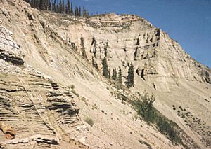
You can see layers of lake sediments in river bluffs. These are like giant pages in a history book. Several lakes today are remnants of Lake Atna. These include Tazlina Lake, Klutina Lake, and Tonsina Lake.
Much of the ground in the basin is permafrost. This means it's frozen all year round. The Matanuska Valley flood, about 17,000 years ago, left a thin layer of clay and silt near Anchorage. When the big 1964 Alaska earthquake hit, this layer collapsed. This caused huge landslides in Anchorage. These landslides led to buildings falling down.
 | Jessica Watkins |
 | Robert Henry Lawrence Jr. |
 | Mae Jemison |
 | Sian Proctor |
 | Guion Bluford |


