Lincolnville, Kansas facts for kids
Quick facts for kids
Lincolnville, Kansas
|
|
|---|---|

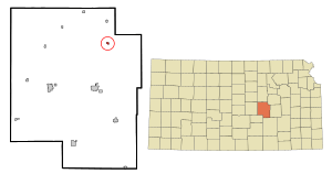
Location within Marion County and Kansas
|
|

|
|
| Country | United States |
| State | Kansas |
| County | Marion |
| Township | Clear Creek |
| Platted | 1872, 1887 |
| Incorporated | 1910 |
| Named for | Abraham Lincoln |
| Government | |
| • Type | Mayor–Council |
| Area | |
| • Total | 0.23 sq mi (0.58 km2) |
| • Land | 0.23 sq mi (0.58 km2) |
| • Water | 0.00 sq mi (0.00 km2) |
| Elevation | 1,424 ft (434 m) |
| Population
(2020)
|
|
| • Total | 168 |
| • Density | 730/sq mi (290/km2) |
| Time zone | UTC-6 (CST) |
| • Summer (DST) | UTC-5 (CDT) |
| ZIP code |
66858
|
| Area code | 620 |
| FIPS code | 20-41325 |
| GNIS ID | 2395715 |
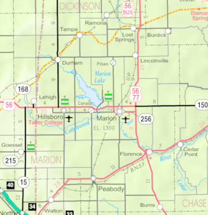
Lincolnville is a small city in Marion County, Kansas, United States. In 2020, about 168 people lived there. The city was named after Abraham Lincoln, who was the 16th president of the United States. You can find Lincolnville northeast of Marion. It is located near where U.S. Route 77 (also known as U.S. Route 56) meets 290th Street, right next to the Union Pacific Railroad tracks.
History of Lincolnville

Early Days in Kansas
For thousands of years, the Great Plains of North America were home to nomadic Native Americans. These groups moved around to hunt and gather food.
From the 1500s to the 1700s, France claimed a large part of North America. In 1762, after a war, France secretly gave this land to Spain.
The 1800s and Lincolnville's Start
In 1802, Spain gave most of the land back to France. Then, in 1803, the United States bought a huge area, including what is now Kansas. This was part of the Louisiana Purchase.
In 1854, the Kansas Territory was created. Kansas officially became the 34th U.S. state in 1861. Marion County, where Lincolnville is located, was formed in 1855.
The first settlers arrived in the area around 1860. A post office opened in Lincolnville on December 31, 1868. The first official map of Lincolnville was made in 1872. The city was named to honor President Abraham Lincoln.
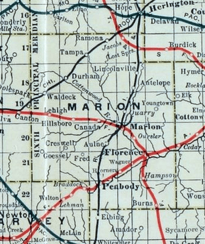
In 1887, a railroad line was built through Lincolnville. It connected Herington to Caldwell. Over the years, this railroad changed hands many times. Today, it is part of the Union Pacific Railroad. Many local people still call it the "Rock Island" railroad.
Geography and Climate
Lincolnville is located in the beautiful Flint Hills and Great Plains regions of Kansas. The city covers a total area of about 0.22 square miles (0.58 square kilometers), and all of it is land.
Local Climate
The weather in Lincolnville usually has hot, humid summers. The winters are generally mild to cool. This type of weather is known as a humid subtropical climate.
Fun Things to Do and See
Community Events
- Octoberfest: This fun event happens on the first Saturday in October.
Local Attractions
Lincolnville has two buildings that are listed on the National Register of Historic Places (NRHP). This means they are important historical sites.
- Bethel School: This historic school is about 5.25 miles east of Lincolnville on 290th Street.
- Island Field Ranch House: This ranch house is about 3.5 miles south of Lincolnville on U.S. Route 77.
People of Lincolnville (Demographics)
| Historical population | |||
|---|---|---|---|
| Census | Pop. | %± | |
| 1920 | 260 | — | |
| 1930 | 270 | 3.8% | |
| 1940 | 255 | −5.6% | |
| 1950 | 228 | −10.6% | |
| 1960 | 244 | 7.0% | |
| 1970 | 218 | −10.7% | |
| 1980 | 235 | 7.8% | |
| 1990 | 197 | −16.2% | |
| 2000 | 225 | 14.2% | |
| 2010 | 203 | −9.8% | |
| 2020 | 168 | −17.2% | |
| U.S. Decennial Census | |||
Population in 2020
The 2020 United States census showed that 168 people lived in Lincolnville. There were 78 households and 47 families. Most people (88.1%) were white. About 10.7% of the population was Hispanic or Latino.
About 23.1% of households had children under 18. The average household had 1.9 people. The average family had 2.5 people. The median age in the city was 47.0 years old. This means half the people were older than 47 and half were younger.
Population in 2010
In 2010, there were 203 people living in Lincolnville. There were 81 households and 54 families. Most people (95.6%) were White. About 5.4% of the population was Hispanic or Latino.
About 39.5% of households had children under 18. The median age was 36.8 years. About 30.5% of residents were under 18.
Education in Lincolnville
The Centre USD 397 public school district serves the community. The high school is part of T.E.E.N., which is a video teaching network. This network connects five area high schools.
- Centre School: This school is located at 2374 310th St, Lost Springs, KS. It is between Lost Springs and Lincolnville.
Media and News
Local News
- Marion County Record: This is the local newspaper from Marion.
- Hillsboro Free Press: This is a free newspaper for the wider Marion County area.
City Services (Infrastructure)
Transportation
The U.S. Route 77 highway runs along the east side of Lincolnville. The Union Pacific Railroad tracks are about five blocks west of the highway.
Utilities
- Internet: You can get fiber optics internet from TCT. Satellite internet is also available from companies like HughesNet and WildBlue.
- TV: Fiber optics TV is provided by TCT. Cable TV is available from Eagle Communications. You can also get satellite TV from DirecTV and Dish Network.
- Telephone: TCT provides telephone services using fiber optics.
- Electricity: Electricity for rural areas is provided by Flint Hills RECA.
See also
 In Spanish: Lincolnville (Kansas) para niños
 | Madam C. J. Walker |
 | Janet Emerson Bashen |
 | Annie Turnbo Malone |
 | Maggie L. Walker |

