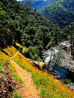
List of proposed national monuments of the United States facts for kids
A national monument is a special protected area in the United States. It can be created by the President of the United States using a special announcement called a presidential proclamation. The United States Congress can also create one through a law. The Antiquities Act of 1906 is a law that lets the president protect important places. These places can be historic sites, old structures, or areas with scientific value.
Contents
Why Protect Special Places?
In 2010, the United States Department of the Interior looked at many places. They made a list of 14 areas that would be great national monuments. These places were chosen because they have important history or amazing nature. You will see these places highlighted in bluish-green in the list below.
The department also thought about other special areas. Some of these places needed protection but couldn't become monuments right away. They also looked at how much it would cost to protect these important lands.
Working Together for Monuments
During the time President Biden has been in office, many groups have joined forces. These groups include people who care about nature, Native American communities, and Black organizations. They created a group called the "Monuments for All" campaign. This campaign supports President Biden's goals to protect more land and water.
These groups asked President Biden to create many new national monuments. Some of these were on the 2010 list but were not protected by a previous president. The campaign has already helped protect some important places. For example, Bears Ears National Monument and Grand Staircase-Escalante National Monument were restored after their sizes were cut. New monuments like Avi Kwa Ame National Monument and Castner Range were also created. The places still being pushed by this campaign are shown in blue in the list below.
Places That Could Become National Monuments
Here is a list of places that people want to protect as national monuments. These areas are special because of their history, nature, or cultural importance.
| Proposed Name | Photo | Location | Area Size | More Information |
|---|---|---|---|---|
| Bodie Hills | 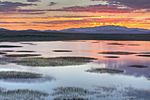 |
California | ||
| Birthplace of Rivers | 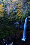 |
West Virginia Map |
122,000 acres (49,000 ha) | BirthplaceofRivers.org West Virginia Rivers Coalition |
| Douglas-Fir National Monument | Oregon | 530,000 acres (214,500 ha) | Friends of Douglas-Fir National Monument | |
| Expansion of Cascade-Siskiyou |
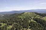 |
California | ||
| Greater Canyonlands | Upper Comb Wash in Greater Canyonlands |
Utah Map |
1,800,000 acres (730,000 ha) | Greater Canyonlands Coalition |
| Greater Grand Canyon Heritage | 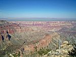 |
Arizona map |
1,700,000 acres (690,000 ha) | Greater Grand Canyon Watershed |
| Heart of the Great Basin | Nevada | |||
| Lesser Prairie Chicken Preserve | 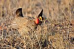 |
New Mexico | 58,000 acres (23,000 ha) | |
| Montana's Northern Prairie | Montana | 2,500,000 acres (1,000,000 ha) | ||
| Northwest Sonoran Desert | 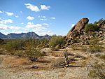 |
Arizona | 500,000 acres (200,000 ha) | |
| Otero Mesa | 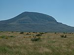 |
New Mexico | 1,200,000 acres (490,000 ha) | |
| Owyhee Canyonlands |  |
Oregon | 2,100,000 acres (850,000 ha) | Oregon Natural Desert Association |
| Owyhee Desert | 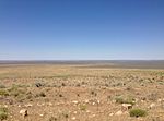 |
Oregon/Nevada | ||
| Range of Light | California | Approximately 1,427,750 acres | Unite the Parks | |
| San Rafael Swell | 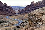 |
Utah | Utah Public Lands Initiative | |
| Sutton Mountain | Oregon | 66,000 acres | Oregon Natural Desert Association | |
| The Modoc Plateau |  |
California | 3,000,000 acres (1,200,000 ha) | Video by Los Angeles Times |
| Vermillion Basin | Colorado | |||
| Bahsahwahbee National Monument | Nevada | Video by Associated Press | ||
| Molok Luyuk (Expansion of Berryessa Snow Mountain National Monument) | California | Expand Berryessa | ||
| Chuckwalla National Monument | California | Protect Chuckwalla | ||
| Historic Greenwood/Black Wall Street National Monument | Oklahoma | Black Wall Street Coalition | ||
| 1908 Race Riot National Monument | Illinois | Springfield NAACP | ||
| Great Bend of the Gila National Monument | Arizona | Respect Great Bend | ||
| Dolores River Canyon National Monument | Colorado | Protect the Dolores | ||
| Sátittla and Medicine Lake Highlands National Monument | California | 200,000 acres | Protect Medicine Lake Highlands | |
| Kw'tsan National Monument | California | 390,000 acres | Fort Yuma Quechan Tribe | |
| Mimbres Peaks/Los Lunas National Monument | New Mexico | 245,000 acres | Protect Mimbres Peaks |
See also
- America's Most Endangered Places
- List of threatened historic sites in the United States
- List of national monuments of the United States
- List of national parks of the United States
- List of national memorials of the United States
- List of areas in the United States National Park System
- National Conservation Lands


