
List of recreational walks in Cheshire facts for kids
Cheshire is a beautiful county in England, known for its lovely countryside and charming towns. If you love exploring the outdoors, you'll be excited to know that Cheshire has over 1,864 miles (3,000 km) of public paths! These paths are perfect for walking and discovering new places. This article will tell you about some of the best recreational walks in Cheshire, whether they stay entirely within the county or stretch into other areas. Get ready to put on your walking shoes!
Contents
- Awesome Walking Trails in Cheshire
- Baker Way: Chester to Delamere Forest
- Bishop Bennet Way: Beeston to Wirswall
- Bollin Valley Way: Macclesfield to Partington
- Cheshire Ring: A Canal Adventure
- Crewe and Nantwich Circular Walk
- Dane Valley Way: Buxton to Northwich
- Delamere Way: Frodsham to Stockton Heath
- Eddisbury Way: Frodsham to Burwardsley
- Goyt Way: Etherow Country Park to Whaley Bridge
- Great English Walk: A Long Journey
- Gritstone Trail: Disley to Kidsgrove
- Ladybrook Valley Interest Trail: Disley to Cheadle
- Longster Trail: Helsby Hill to Chester
- Maelor Way: Bronygarth to Whitchurch
- Marches Way: Chester to Cardiff
- Middlewood Way: Macclesfield to Marple
- Midshires Way: Bledlow to Stockport
- North Cheshire Way: Hooton to Disley
- Peak District Boundary Walk: A Circular Journey
- Salter's Way: Rudheath to Jenkin Chapel
- Sandstone Trail: Frodsham to Whitchurch
- South Cheshire Way: Grindley Brook to Mow Cop
- Trans Pennine Trail: Coast to Coast
- Two Saints Way: Chester to Lichfield
- Weaver Way: Frodsham to Audlem
- Wirral Way: Exploring the Wirral Peninsula
- Images for kids
- See also
Awesome Walking Trails in Cheshire
Cheshire is home to many fantastic walking trails, each offering unique sights and experiences. Here are some of the most popular ones:
Baker Way: Chester to Delamere Forest
The Baker Way is a 13-mile (19 km) walk that starts at Chester railway station and ends at Delamere Forest railway station. It's a great way to explore the area between the historic city of Chester and the beautiful Delamere Forest.
Bishop Bennet Way: Beeston to Wirswall
This trail is 34 miles (55 km) long and connects Beeston to Wirswall. It's a longer walk, perfect for those who want to spend more time exploring the Cheshire countryside.
Bollin Valley Way: Macclesfield to Partington
Following the River Bollin, this 25-mile (40 km) path stretches from Macclesfield to Partington. It's a lovely walk alongside the river, offering peaceful views.
Cheshire Ring: A Canal Adventure
The Cheshire Ring is a circular walk that is 97 miles long. It follows six different canals, starting and ending near Dukinfield and Marple. It's a unique way to see the county's waterways and the boats that travel on them.
Crewe and Nantwich Circular Walk
This 29-mile (47 km) circular walk goes all the way around the towns of Crewe and Nantwich. It's a great way to see both urban and rural parts of this area.
Dane Valley Way: Buxton to Northwich
Stretching for 48 miles (77 km), the Dane Valley Way connects Buxton to Northwich. Part of this trail follows the River Dane, offering scenic views as it crosses between Derbyshire and Cheshire.
Delamere Way: Frodsham to Stockton Heath
The Delamere Way is 21 miles (33 km) long and takes you from Frodsham to Stockton Heath. As its name suggests, it passes right through the popular Delamere Forest.
Eddisbury Way: Frodsham to Burwardsley
This 16-mile (26 km) trail goes from Frodsham to Burwardsley. It's special because it connects with another famous path, the Sandstone Trail, allowing for even longer walking adventures.
Goyt Way: Etherow Country Park to Whaley Bridge
At 10 miles long, the Goyt Way links Etherow Country Park to Whaley Bridge. This trail also connects with the Midshires Way, giving walkers more options to explore.
Great English Walk: A Long Journey
The Great English Walk is a massive 583-mile (938 km) journey from Chepstow to Berwick-upon-Tweed. A part of this very long walk passes through Cheshire, specifically between the Shropshire border at Grindley Brook and the Staffordshire border near Congleton.
Gritstone Trail: Disley to Kidsgrove
This 35-mile (56 km) trail runs from Disley to Kidsgrove, which is in Staffordshire. Along the way, it passes through the beautiful Teggs Nose Country Park, known for its rugged landscapes.
Ladybrook Valley Interest Trail: Disley to Cheadle
The Ladybrook Valley Interest Trail is 12 miles (20 km) long and goes from Disley to Cheadle. It finishes at Lyme Park, a lovely estate owned by the National Trust.
Longster Trail: Helsby Hill to Chester
A shorter but equally enjoyable walk, the Longster Trail is 10 miles (16 km) long. It takes you from Helsby Hill all the way to the historic city of Chester.
Maelor Way: Bronygarth to Whitchurch
The Maelor Way is 24 miles (39 km) long and starts in Bronygarth, finishing in Whitchurch in Shropshire. It's a great way to explore the borderlands between Wales and England.
Marches Way: Chester to Cardiff
This impressive 200-mile (320 km) trail begins at Chester railway station and stretches all the way to Cardiff in Wales. It first follows the River Dee to Farndon and then continues through the border counties.
Middlewood Way: Macclesfield to Marple
The Middlewood Way is another 10-mile (16 km) trail, connecting Macclesfield to Marple. It's a popular route for walkers and cyclists alike.
Midshires Way: Bledlow to Stockport
This very long trail is 230 miles long, starting in Bledlow, Buckinghamshire, and ending in Stockport. It's a significant route that crosses many different counties.
North Cheshire Way: Hooton to Disley
The North Cheshire Way is 71 miles long and links Hooton to Disley. This trail is important because it connects three other major trails: the Wirral Way, the Sandstone Trail, and the Gritstone Trail.
Peak District Boundary Walk: A Circular Journey
This circular walk around Buxton is 190 miles long. The part of this trail that goes through Cheshire is between the Dane Valley near Wincle and past Lyme Park towards Whaley Bridge.
Salter's Way: Rudheath to Jenkin Chapel
The Salter's Way is a 25-mile (40 km) trail that goes from Rudheath (near Northwich) to Jenkin Chapel in Rainow.
Sandstone Trail: Frodsham to Whitchurch
One of Cheshire's most famous walks, the Sandstone Trail is 34 miles (55 km) long. It stretches from Frodsham to Whitchurch in Shropshire, offering amazing views from its elevated path.
South Cheshire Way: Grindley Brook to Mow Cop
This 32-mile (51 km) trail goes from Grindley Brook to Mow Cop. It's a useful path because it can connect the Sandstone Trail and the Gritstone Trail, allowing for longer, linked walks.
Trans Pennine Trail: Coast to Coast
The Trans Pennine Trail is a huge 207-mile (333 km) route that goes from Southport on the west coast to Hornsea on the east coast. It passes through Widnes in Cheshire on its way from Yorkshire to Merseyside.
Two Saints Way: Chester to Lichfield
This historic trail is 92 miles long and connects the cities of Chester and Lichfield.
Weaver Way: Frodsham to Audlem
The Weaver Way is 40 miles (65 km) long and follows the River Weaver, the Trent and Mersey Canal, and the Shropshire Union Canal. It goes from Frodsham to Audlem, offering lovely waterside views.
Wirral Way: Exploring the Wirral Peninsula
The Wirral Way is a circular trail around the Wirral. It includes parts of West Cheshire and passes by Hadlow Road railway station.
Images for kids
-
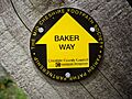
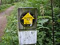
A waymarker for the Baker Way, showing the path's symbol.
-
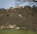
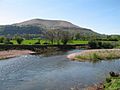
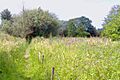
A view near Beeston, along the Bishop Bennet Way.
-
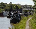
Narrowboats on a canal, part of the Cheshire Ring walk.
-
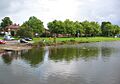
Nantwich Lake, a scenic spot on the Crewe and Nantwich Circular Walk.
-
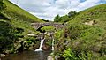
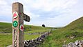
The Dane Valley Way at Three Shires Head, where three counties meet.
-
A waymarker for the Delamere Way, guiding walkers.
-

A signpost for the Eddisbury Way.
-
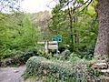
A path junction along the Goyt Way.
-

A stile on the Gritstone Trail, helping walkers cross fences.
-
A sign for The Longster Trail.
-
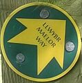
A distinctive marker for the Maelor Way.
-
The River Usk, part of the Marches Way route.
-

The Middlewood Way, seen from another trail.
-

A view from Pott Shrigley along the North Cheshire Way.
-
The Peak District Boundary Walk passing through Dam Dale.
-

A gate on the popular Sandstone Trail.
-
A sign for the South Cheshire Way near Crewe Green.
-
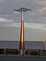
A sign for the Trans Pennine Trail in Hornsea, at the eastern end.
-
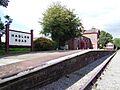
Hadlow Road Railway Station, a point of interest on the Wirral Way.


.jpg)


.jpg)


See also
- Long-distance footpaths in the UK
- List of parks and open spaces in Cheshire
