River Weaver facts for kids
Quick facts for kids River Weaver |
|
|---|---|
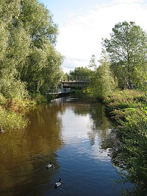
River Weaver at Nantwich
|
|
| Country | England |
| County | Cheshire |
| District | Cheshire East, Cheshire West and Chester, Halton |
| Physical characteristics | |
| Main source | near Peckforton, Cheshire 89 m (292 ft) 53°05′50″N 2°41′39″W / 53.0972°N 2.6941°W |
| River mouth | River Mersey Weston Point Docks, Runcorn, Cheshire 0 m (0 ft) 53°18′51″N 2°45′02″W / 53.3141°N 2.7505°W |
| Length | 71 mi (114 km) |
| Basin features | |
| Tributaries |
|
The River Weaver is a river in west Cheshire, northern England. It flows in a curved path. The lower parts of the river can be used by boats. In 1720, plans were approved to make the river easier to travel on. The work, which included eleven locks, finished in 1732.
An interesting rule was part of the law that allowed these changes. It said that any money earned from the river should be given to Cheshire County. This money was meant to improve roads and bridges. At first, the river did not make much money. It was not until 1775 that the first payments were made. Over time, trade grew a lot. By 1845, more than £500,000 had been given to the county.
The main product moved on the river was salt. When the Trent and Mersey Canal opened nearby in 1773, it first seemed bad for the salt trade. But it actually helped in the end. Salt could be dropped from the canal into barges on the river. In 1810, the Weston Canal made it easier to reach the River Mersey. This meant boats could get to deeper water.
Between 1870 and 1900, the river was completely rebuilt. The old locks were replaced with five much bigger ones. These new locks could handle large ships up to 1000 tonnes. When the Manchester Ship Canal opened, a new lock was built at Weston Marsh. This allowed boats to go straight into the ship canal.
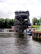
A famous part of the river is the Anderton Boat Lift near Northwich. It connects the Weaver to the Trent and Mersey Canal, which is about 50 feet (15 m) higher. It opened in 1875 to let canal boats reach the Weaver. It closed for safety in 1983 but was fixed and reopened in 2002. Many structures along the river are important historical sites. They are called Grade II listed buildings. These include the Hayhurst swing bridge and Northwich Town bridge. They are thought to be the first electric-powered swing bridges.
Contents
River Weaver's Path
The River Weaver is about 71 miles (114 km) long. It starts in the hills of west Cheshire, near Peckforton Castle. It flows south-east at first, getting water from smaller streams. The Llangollen Canal crosses it near the village of Wrenbury. After Wrenbury, it flows past Audlem and then turns north.
The Shropshire Union Canal crosses over the river on the Moss Hall aqueduct. The first big town on the river is Nantwich. This town had a watermill since the 1200s. Further north, the river passes under the Middlewich Branch of the Shropshire Union Canal. This aqueduct was designed by Thomas Telford and built in the 1820s. The river and canal run side-by-side for a few miles.
They separate near Winsford, where boats can no longer travel upstream. At Northwich, the river turns north-west. The river's path below Winsford has been changed many times. This was done to allow small ships to use it for trade. The river used to join the River Mersey at Weston Marsh. But since the Manchester Ship Canal was built in 1887, it now flows into the canal. Any extra water then goes into the Mersey through the Weaver sluices.
River History
The River Weaver flows through an area known for making salt. But the river was not deep enough for boats to reach the salt mines. Salt was carried by horses to a loading area called Pickering's wharf. From there, it was put onto barges. These barges used the outgoing tide to travel down the river.
By the early 1600s, coal was brought in to help make salt. As the salt business grew, people wanted to make the river better for trade. But some landowners worried about floods. Others who carried goods by land worried about losing their jobs. Because of this, plans to improve the river were rejected several times.
In 1720, a law was passed to improve the river. This law allowed work between Frodsham bridge and Winsford bridge. It set prices for tolls, which would be lowered once building costs were paid. Any profits would then be used to fix roads and bridges in Cheshire.
The work on the Weaver finished by 1732. It cost £15,885. Eleven wooden locks and weirs were built. The river was made better by digging out the bottom and building new channels. These channels had locks and weirs to manage the 50 feet (15 m) drop in height. Barges up to 40 tons could reach Winsford. These boats were often pulled by teams of men.
At first, the river did not make money. But by 1757, things improved. In 1758, the people in charge of the river paid off all the debt. They then decided to make the locks wider. Work started on new parts of the river. But in 1759, a salt mine collapsed at Northwich, cutting the river in half. A new law was passed in 1760 to help manage the river better. This law also said that all locks should be large enough for bigger boats.
The Weston Canal
Below Frodsham, boats carrying salt had to go through a tidal part of the river to reach the Mersey. From there, salt went to Liverpool or Manchester. But at certain times, the water was too shallow. Boats had to wait for days at Frodsham. In 1796, people suggested extending the river to Weston Point. The water there was deeper.
After some disagreements, a new law was passed in 1807. This allowed a new channel to be built from Frodsham to Weston Point. This project was very big and went over budget. Thomas Telford, a famous engineer, was asked to finish the work. The new channel, called the Weston Canal, was completed in 1810. It had a new lock and basin at Weston Point. This made it much easier for boats to reach the Mersey.
River Improvements
In the 1830s, new channels were built at Barnton, Crowton, and Aston Grange. Then, plans were made to build a second lock next to each original lock. The goal was to make the river 7.5 feet (2.3 m) deep everywhere. They also wanted to build double locks for 100-ton boats. By 1845, many locks were improved.
Trade was very good. In 1845, tolls brought in £38,363 from carrying 778,715 tons of goods. All these improvements were paid for by the tolls. Over £500,000 had been given to Cheshire County.
More improvements began in 1856 to make the river suitable for larger ships. Between 1870 and 1900, the river was completely rebuilt. The 12 locks from the 1830s were replaced by five much bigger ones. Most bridges were replaced with swing bridges. This allowed ships up to 1000 tons to use the river.
A connection between the river and the Trent and Mersey Canal was built from 1871 to 1875. This was the Anderton Boat Lift. It was designed by Edwin Clark. It used water power to lift boats up and down. The lift worked well, but the water fluid caused problems. A new design was built in 1906. This new lift used electric motors. It worked until 1983 when it closed for safety.
Even after the boat lift opened, some salt was still moved by chutes. From the mid-1800s, some salt trade moved to railways. Also, salt water was pumped through pipes. As salt trade went down, a chemical industry grew near Northwich. This became the main source of income for the river.
River Locks
The locks on the river often come in pairs. There are two lock chambers side-by-side. The larger lock often has extra gates. This means ships of different lengths can use it without wasting too much water. The biggest locks above the Anderton boat lift are 196 by 35 feet (60 by 11 m). Below it, they are 213 by 37 feet (65 by 11 m). The lock at Weston Point Docks is a bit narrower. The boat lift is for canal boats, not big ships. It can hold boats up to 72 by 14 feet (21.9 by 4.3 m).
River Connections
The Runcorn and Weston Canal opened in 1859. It made it easier for canal boats to reach the river. This canal connected to Runcorn Docks. From there, locks led to the Bridgewater Canal. This link was cut in 1966 when a new road bridge was built.
A big change happened when the Manchester Ship Canal opened in 1894. The tidal part of the river now flowed into the ship canal. A new ship lock was built at Weston Marsh. This gave a more direct way to the ship canal. The Weston Canal has not been used much since then.
The Anderton Boat Lift is now the usual way for leisure boats to get to the river. After it closed in 1983, people worked to get it fixed. It became a protected historical site in 1994. Work to fix it started in 1999. It reopened in 2002 and uses water power again. New fluids are used to stop the rust problems it had before.
British Waterways manages the river up to Winsford Bridge. Beyond this are Winsford Bottom Flash and Winsford Top Flash. These are shallow lakes. They formed because the ground sank from salt mining. Some canal boats can explore the Bottom Flash, but the water is shallow. The Winsford Flash Sailing Club uses the 90-acre (36 ha) lake for yacht racing.
Fun on the River
The River Weaver has different kinds of areas. Some parts are quiet and wooded. Others have many factories. Large commercial ships do not use the river much anymore. But the big locks are still there.
For people with leisure boats, most movable bridges are high enough to pass under. But the swing bridge at Newbridge is lower. Boats that need bridges to open must give notice. There is a salt museum in Northwich. It is now called the Weaver Hall Museum and Workhouse. There is also a visitor center at the Anderton boat lift.
Rowing is popular on the River Weaver. There are rowing clubs in Runcorn, Northwich, and Acton Bridge. Fishing is another popular activity. Several clubs rent fishing rights for different parts of the river. The river has many types of fish. These include bream, three types of carp, chub, dace, eels, perch, pike, roach, rudd, and tench. Fishing matches are held often on weekends.
The lower parts of the Weaver are used for sailing. The Weaver Sailing Club is based at Frodsham. They use a 2.5-mile (4.0 km) part of the river for training and racing small sailboats.
River Structures
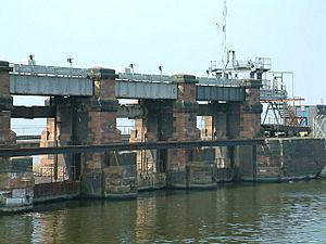
The river has many old and important structures. They are listed as historic buildings. At Vale Royal, an old lock from 1860 is now used to control water flow. A swing bridge crosses this channel. Another swing bridge, made of wood and iron, crosses a smaller lock. This lock used to be the large one. The new large lock has three sets of gates. It could hold four barges at once. The gates are opened by a water turbine. There is also a system to clean rubbish from the gates. The lock keeper's house is also a listed building. It was built in the 1850s.
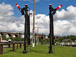
Below the locks, a five-arched red sandstone bridge crosses the valley. It was built in 1837 by Joseph Locke. It carried the Grand Junction Railway. Hunt's locks also have a pair of locks. The smaller one is from the 1860s, and the larger one is from the 1890s. Steel signals control boats going into the locks. Water turbines also move these gates. A walkway crosses the weir next to the locks. It has five cast iron arches and floodgates.
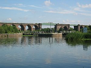
The Northwich railway bridge crosses both the lock channel and the weir stream. It was built in the 1860s. It has 48 round arches made of blue bricks and red sandstone. It is about 980 yards (900 m) long. It also crosses the River Dane. Hayhurst swing bridge carries the A5509 road. It was built in 1899. This bridge and Town bridge are thought to be the first electric swing bridges in Britain. Both were designed by J. A. Saner. They have a special floating part that helps carry most of the bridge's weight. Because of salt mining, the bridges can be adjusted if the ground sinks. Hayhurst bridge was fixed in 2004. Winnington bridge was built between 1908 and 1909. It replaced an earlier bridge that had problems.
Saltersford locks were built in 1874. They replaced an older lock. Water turbines control the gates. Acton swing bridge was built between 1931 and 1933. It is on an island in the middle of the river. J. A. Saner also designed this bridge. Dutton locks are similar to Saltersford locks. Dutton sluice, a water control gate, was built in the 1870s.
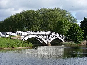
Where a small stream meets the main river, the walking path crosses it on Horse Bridge. It was designed by J. A. Saner in 1915. It is one of the oldest wooden structures made of layers of timber. It has two arches, both over 100 feet (30 m) long. Below the locks, Joseph Locke and George Stephenson built another railway bridge. It was finished in 1836. It has 20 arches. A party was held when it was finished because no workers died or were seriously hurt.
The weir at Frodsham was built in 1785. The main part is 49 yards (45 m) wide. There are also two sluices at the south end. The lock next to it was changed over time. But most boats used the Weston cut by the 1890s. So, this lock still has some of its original parts. It is no longer used. A bridge carries the A56 road over the channel. It was built in 1850. The A56 also crosses the main river on Sutton swing bridge. This bridge was built in the 1920s. It was fixed in 2013. Frodsham railway bridge was finished in 1850. It was built by Thomas Brassey.
Water Quality
The Environment Agency checks the water quality of rivers in England. They give each river an overall ecological status. This can be high, good, moderate, poor, or bad. They look at things like how many different kinds of bugs, plants, and fish are in the water. They also check the chemical status. This compares chemical levels to safe limits. Chemical status is either good or fail.
In 2019, the water quality of the River Weaver was:
| Section | Ecological Status | Chemical Status | Overall Status | Length | Catchment | Channel |
|---|---|---|---|---|---|---|
| Weaver (Source to Marbury Brook) | Moderate | Fail | Moderate | 8.1 miles (13.0 km) | 12.72 square miles (32.9 km2) | |
| Weaver (Marbury Brook to Barnett Brook) | Poor | Fail | Poor | 5.3 miles (8.5 km) | 4.02 square miles (10.4 km2) | |
| Weaver (Marbury Brook to Dane) | Poor | Fail | Poor | 39.5 miles (63.6 km) | 48.89 square miles (126.6 km2) | |
| Weaver (Dane to Frodsham) | Moderate | Fail | Moderate | 18.5 miles (29.8 km) | 23.66 square miles (61.3 km2) | heavily modified |
The river does not have good quality for a few reasons. These include water runoff from farms. Also, treated water from sewage plants goes into the river. Chemical status was good until 2016. Now it is "fail." This is mostly because of certain chemicals. These include flame retardants, mercury, and an insecticide called cypermethrin. These chemicals were not checked before 2019.
In August 2012, oxygen levels in the river were low. Thousands of fish died. The Environment Agency was told and added air to the water. They thought it was caused by natural algae. Algae can use up oxygen that fish need. It might also have been affected by a reaction between hydrogen peroxide and small amounts of soap. This reaction makes a foamy surface. The fishing club believes it will take many years for the fish to recover.
Points of Interest
| Point | Coordinates (Links to map resources) |
OS Grid Ref | Notes |
|---|---|---|---|
| Weston Point docks | 53°19′45″N 2°45′39″W / 53.3292°N 2.7609°W | SJ494816 | |
| Weston Marsh lock | 53°18′47″N 2°44′37″W / 53.3130°N 2.7436°W | SJ505798 | to Manchester Ship Canal |
| Sutton weir, Frodsham | 53°18′11″N 2°41′41″W / 53.3030°N 2.6947°W | SJ538786 | |
| Dutton locks | 53°17′16″N 2°37′19″W / 53.2877°N 2.6220°W | SJ586769 | |
| Salterford locks | 53°16′18″N 2°33′43″W / 53.2717°N 2.5619°W | SJ626751 | |
| Anderton Boat Lift | 53°16′24″N 2°31′50″W / 53.2732°N 2.5305°W | SJ647752 | to Trent and Mersey Canal |
| Hunt's locks | 53°15′08″N 2°31′02″W / 53.2523°N 2.5173°W | SJ655729 | |
| Vale Royal locks | 53°13′43″N 2°32′24″W / 53.2286°N 2.5401°W | SJ640703 | |
| Head of navigation, Winsford | 53°11′33″N 2°31′02″W / 53.1926°N 2.5172°W | SJ655662 | |
| Crossing under Trent and Mersey Canal | 53°07′37″N 2°30′09″W / 53.1270°N 2.5026°W | SJ664589 | |
| Nantwich weir | 53°03′51″N 2°31′28″W / 53.0643°N 2.5245°W | SJ649520 | |
| Crossing under Shropshire Union Canal | 52°59′43″N 2°31′04″W / 52.9953°N 2.5177°W | SJ653443 | |
| Crossing under Llangollen Canal | 53°01′40″N 2°36′48″W / 53.0277°N 2.6133°W | SJ589479 | Wrenbury-cum-Frith |
| Source at Peckforton | 53°02′19″N 2°41′02″W / 53.0385°N 2.6840°W | SJ536558 |
 | Delilah Pierce |
 | Gordon Parks |
 | Augusta Savage |
 | Charles Ethan Porter |


