Lomita, California facts for kids
Quick facts for kids
Lomita, California
|
|||
|---|---|---|---|
|
|||
| Nickname(s):
"The Friendly City"
|
|||

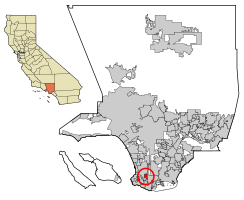
Location of Lomita in Los Angeles County, California
|
|||
| Country | |||
| State | |||
| County | Los Angeles | ||
| Incorporated | June 30, 1964 | ||
| Government | |||
| • Type | Council-Manager | ||
| Area | |||
| • Total | 1.91 sq mi (4.95 km2) | ||
| • Land | 1.91 sq mi (4.95 km2) | ||
| • Water | 0.00 sq mi (0.00 km2) 0% | ||
| Elevation | 95 ft (29 m) | ||
| Population
(2020)
|
|||
| • Total | 20,921 | ||
| • Density | 10,953/sq mi (4,226/km2) | ||
| Time zone | UTC−8 (Pacific) | ||
| • Summer (DST) | UTC−7 (PDT) | ||
| ZIP code |
90717
|
||
| Area code(s) | 310/424 | ||
| FIPS code | 06-42468 | ||
| GNIS feature IDs | 1660937, 2410859 | ||
Lomita is a city in Los Angeles County, California, United States. Its name comes from a Spanish word meaning "Little hill." In 2020, about 20,921 people lived there. This was a small increase from the 20,256 people counted in 2010.
Contents
History of Lomita

The first people to live in the Lomita area were the Gabrielino tribe. Later, the Spanish Empire explored this region. In 1542, Juan Rodríguez Cabrillo explored the Pacific Ocean for Spain. By 1767, this area became part of the Spanish Province of the Californias.
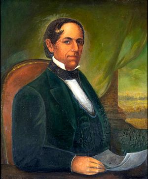
In 1784, the King of Spain gave a large piece of land, over 75,000 acres, to a soldier named Juan José Domínguez. This land was called Rancho San Pedro. Over time, the Domínguez family divided the land among themselves. They also sold parts of it to new settlers. The Domínguez family name is still important in the area. You can find the Dominguez Rancho Adobe historical landmark nearby.
Lomita officially became a city on June 30, 1964. This was done to stop nearby cities from taking over more land. It also helped control the building of tall apartment buildings. In October 1981, Lomita became a sister city with Takaishi, Osaka, Japan. This means they have a special friendship and cultural exchange.
Geography and Climate
Lomita is a city that covers about 1.9 square miles (4.95 square kilometers). All of this area is land.
The city was once much larger, about 7 square miles. But over the years, parts of it were taken by other cities. For example, an area once called "Lomita Fields" is now Zamperini Field, which is the Torrance Municipal Airport.
Lomita's Climate
Lomita has a semi-arid climate. This means it is generally dry but not a desert. It has hot summers and mild winters.
| Climate data for Lomita, California | |||||||||||||
|---|---|---|---|---|---|---|---|---|---|---|---|---|---|
| Month | Jan | Feb | Mar | Apr | May | Jun | Jul | Aug | Sep | Oct | Nov | Dec | Year |
| Record high °F (°C) | 91 (33) |
92 (33) |
96 (36) |
104 (40) |
100 (38) |
102 (39) |
109 (43) |
101 (38) |
111 (44) |
106 (41) |
98 (37) |
94 (34) |
111 (44) |
| Mean daily maximum °F (°C) | 66.0 (18.9) |
66.0 (18.9) |
67.0 (19.4) |
70.0 (21.1) |
71.0 (21.7) |
74.0 (23.3) |
77.0 (25.0) |
78.0 (25.6) |
78.0 (25.6) |
75.0 (23.9) |
70.0 (21.1) |
65.0 (18.3) |
71.4 (21.9) |
| Mean daily minimum °F (°C) | 46.0 (7.8) |
48.0 (8.9) |
49.0 (9.4) |
51.0 (10.6) |
55.0 (12.8) |
59.0 (15.0) |
62.0 (16.7) |
62.0 (16.7) |
61.0 (16.1) |
57.0 (13.9) |
50.0 (10.0) |
46.0 (7.8) |
53.8 (12.1) |
| Record low °F (°C) | 25 (−4) |
27 (−3) |
23 (−5) |
25 (−4) |
38 (3) |
36 (2) |
34 (1) |
44 (7) |
36 (2) |
28 (−2) |
29 (−2) |
27 (−3) |
23 (−5) |
| Average precipitation inches (mm) | 3.26 (83) |
3.91 (99) |
2.22 (56) |
0.76 (19) |
0.22 (5.6) |
0.07 (1.8) |
0.05 (1.3) |
0.02 (0.51) |
0.16 (4.1) |
0.62 (16) |
1.19 (30) |
2.09 (53) |
14.57 (369.31) |
| Source: The Weather Channel | |||||||||||||
People and Population
| Historical population | |||
|---|---|---|---|
| Census | Pop. | %± | |
| 1960 | 14,983 | — | |
| 1970 | 19,784 | 32.0% | |
| 1980 | 18,807 | −4.9% | |
| 1990 | 19,382 | 3.1% | |
| 2000 | 20,046 | 3.4% | |
| 2010 | 20,256 | 1.0% | |
| 2020 | 20,921 | 3.3% | |
| U.S. Decennial Census 1860–1870 1880-1890 1900 1910 1920 1930 1940 1950 1960 1970 1980 1990 2000 2010 2020 |
|||
Lomita was first counted as a separate place in the 1960 U.S. Census. It became a city in the 1970 U.S. Census.
| Race / Ethnicity (NH = Non-Hispanic) | Pop 2000 | Pop 2010 | Pop 2020 | % 2000 | % 2010 | % 2020 |
|---|---|---|---|---|---|---|
| White alone (NH) | 10,735 | 8,797 | 7,269 | 53.55% | 43.43% | 34.74% |
| Black or African American alone (NH) | 821 | 964 | 1,129 | 4.10% | 4.76% | 5.40% |
| Native American or Alaska Native alone (NH) | 92 | 76 | 57 | 0.46% | 0.38% | 0.27% |
| Asian alone (NH) | 2,241 | 2,850 | 3,456 | 11.18% | 14.07% | 16.42% |
| Native Hawaiian or Pacific Islander alone (NH) | 102 | 112 | 128 | 0.51% | 0.55% | 0.61% |
| Other race alone (NH) | 44 | 60 | 133 | 0.22% | 0.30% | 0.64% |
| Mixed race or Multiracial (NH) | 759 | 745 | 1,078 | 3.79% | 3.68% | 5.15% |
| Hispanic or Latino (any race) | 5,252 | 6,652 | 7,691 | 26.20% | 32.84% | 36.76% |
| Total | 20,046 | 20,256 | 20,921 | 100.00% | 100.00% | 100.00% |
Population in 2020
The 2020 United States census showed that Lomita had 20,921 people. This means there were about 10,942 people per square mile. The population was made up of different groups. About 41.3% were White, 5.8% African American, and 16.8% Asian. About 36.8% of the population were Hispanic or Latino.
Most people (99.2%) lived in homes. There were 8,273 households. About 29.2% of these homes had children under 18. The average household had 2.51 people. The average age of people in Lomita was 41.3 years.
In 2023, the average household income in Lomita was estimated to be $92,920. The average income per person was $44,522. About 12.2% of the people lived below the poverty line.
Population in 2010
In 2010, Lomita had 20,256 people. The population density was about 10,601 people per square mile. The racial makeup included 59.2% White, 5.3% African American, and 14.4% Asian. About 32.8% of the people were Hispanic or Latino.
Most people (99.2%) lived in households. There were 8,068 households. About 30.7% of these homes had children under 18. The average household size was 2.49 people. The average age was 39.6 years.
In 2010, the average household income was $60,398. About 12.2% of the population lived below the poverty line.
City Government and Services
Lomita gets its fire protection from the Los Angeles County Fire Department. McCormick Ambulance provides ambulance services. The Los Angeles County Sheriff's Department (LASD) has a station in Lomita. The Los Angeles County Department of Health Services runs the Torrance Health Center nearby. This center serves Lomita residents.
In the California State Legislature, Lomita is part of the 26th Senate District and the 66th Assembly District. In the United States House of Representatives, Lomita is in the 43rd Congressional District. The United States Postal Service has a post office in Lomita at 25131 Narbonne Avenue.
Politics
Lomita has changed its political leanings over the years. In the 1980s, the city mostly supported Republican candidates for president. However, in more recent years, Lomita has become a city that mostly supports Democratic candidates. The city has supported the Democratic candidate in the last seven presidential elections. The percentage of votes for the Democratic candidate has increased in each election since 1988.
| Year | Democratic | Republican | Third Parties |
|---|---|---|---|
| 2016 | 55.93% 4,529 | 37.67% 3,050 | 6.40% 518 |
| 2012 | 55.43% 4,352 | 41.67% 3,272 | 2.90% 228 |
| 2008 | 54.41% 4,433 | 43.26% 3,525 | 2.33% 190 |
| 2004 | 50.77% 3,106 | 48.07% 2,941 | 1.16% 71 |
| 2000 | 49.13% 2,775 | 45.79% 2,586 | 5.08% 287 |
| 1996 | 44.62% 2,573 | 40.38% 2,329 | 15.00% 865 |
| 1992 | 39.47% 2,575 | 34.15% 2,228 | 26.38% 1,721 |
| 1988 | 38.44% 2,496 | 60.10% 3,902 | 1.46% 95 |
| 1984 | 30.20% 1,927 | 68.45% 4,367 | 1.35% 86 |
| 1980 | 31.08% 1,892 | 59.38% 3,615 | 9.54% 581 |
| 1976 | 46.33% 2,721 | 51.27% 3,011 | 2.40% 141 |
| 1972 | 35.04% 2,505 | 60.51% 4,325 | 4.45% 318 |
Fun Places to Visit
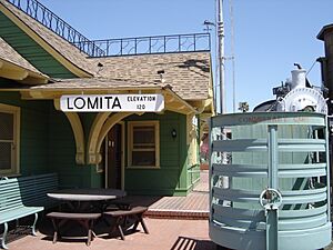
The Lomita Railroad Museum is a special place in Lomita. It opened in 1966 and is all about the time when steam engines were popular. Irene Lewis, who started the museum, and her husband Martin, used to sell kits for model steam engines. Their engines even appeared in movies like "The Greatest Show on Earth" (1952) and "Von Ryan's Express" (1965).
Mrs. Lewis was so inspired that she earned a mechanical engineering degree later in life. She built the museum to show off her amazing work. When it was built, it was the first museum of its kind west of Denver. The museum looks like the old Greenwood Station in Wakefield, Massachusetts. Mrs. Lewis gave the museum to the City of Lomita in 1967 to honor her late husband.
At the museum, you can see a 1901 Baldwin Locomotive, a special Southern Pacific tender, a 1910 Union Pacific caboose, and a 1949 Santa Fe caboose. There's also a full-size copy of a 1920s water tower, built in 2000. The museum also has a small public park. In the park, you can find a 1913 Union Pacific boxcar and a 1923 Union Oil tank car. The museum is open Friday through Sunday, from 10 AM to 5 PM.
Education
Students in Lomita attend schools within the Los Angeles Unified School District (LAUSD). This area is part of Board District 7.
Elementary schools that serve Lomita include:
- Eshelman Avenue Elementary School
- Lomita Math/Science Magnet (Kindergarten is for local students, grades 1-5 are for magnet students)
- President Avenue Elementary School (grades 1–5) (located in Los Angeles)
For a couple of years before 1991, Lomita tried to leave the LAUSD, but they stopped their efforts.
Nishiyamato Academy of California, a Japanese elementary and junior high school, is also located in Lomita. This school opened in April 1993. It was started by Ryotaro Tanose, a former Japanese politician. It is a sister school to the Nishiyamato Gakuen Junior and Senior High School in Japan.
Famous People from Lomita
Many interesting people have connections to Lomita, including:
- Ted Lilly, a pitcher for the Los Angeles Dodgers
- Nikki Hornsby, a musician
- Deane McMinn, a figure skating judge and team manager for U.S. Figure Skating
- Erv Palica, a Major League Baseball pitcher
- Chad Qualls, a pitcher for the Colorado Rockies
- Jim Thorpe, a famous Native American athlete
- Edward O. Thorp, a mathematics professor, author, and hedge fund manager
- Milo Aukerman, a punk rock musician
See also
 In Spanish: Lomita para niños
 | Toni Morrison |
 | Barack Obama |
 | Martin Luther King Jr. |
 | Ralph Bunche |


