Lookout Pass facts for kids
Quick facts for kids Lookout Pass |
|
|---|---|
| Elevation | 4,710 ft (1,436 m) |
| Traversed by | |
| Location | Shoshone County, Idaho / Mineral County, Montana, U.S. |
| Range | Coeur d'Alène Mountains, Bitterroot Range, Rocky Mountains |
| Coordinates | 47°27.3′N 115°41.7′W / 47.4550°N 115.6950°W |
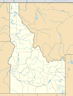
Lookout Pass is a mountain pass in the Rocky Mountains of the northwestern United States. It's a special spot because it sits right on the border between the states of Idaho and Montana. A big highway, Interstate 90, crosses over this pass. It's quite high up, reaching an elevation of 4,710 feet (about 1,436 meters) above sea level.
Contents
What Makes Lookout Pass Special?
Lookout Pass is located in the Coeur d'Alene Mountains, which are part of the larger Bitterroot Range. It marks the eastern edge of a region in northern Idaho called the Silver Valley. If you're driving east on Interstate 90 into Montana, Lookout Pass is known as "Exit 0." This means it's the very first exit you'll see in Montana on that highway!
Where is it Located?
The pass separates two towns: Mullan in Shoshone County, Idaho, and Saltese in Mineral County, Montana. It's also the highest point on Interstate 90 between the big cities of Seattle and Missoula.
A Time Zone Border
Lookout Pass is more than just a state border; it's also a time zone border! Northern Idaho is in the Pacific Time Zone, but Montana is in the Mountain Time Zone. So, when you cross the pass, you might need to change your clock! If you keep driving east on I-90, you won't reach a higher elevation until you're past Deer Lodge.
Fun at Lookout Pass: Skiing!
A popular place for winter fun, the Lookout Pass Ski and Recreation Area was started in 1935. It's located right on the eastbound side of the highway and actually sits on both sides of the state border. The border line follows the mountain ridge, and at the pass, it runs briefly east to west. This means Idaho is on the north side, and Montana is on the south side.
Trails and History
Long ago, the Northern Pacific Railway used to have train tracks that crossed Lookout Pass. Even though the trains don't run there anymore, the old railway path is still used today as a rail trail. This means people can walk or bike along the historic route.
Old Railroads and New Trails
Another railroad, the Chicago, Milwaukee, St. Paul and Pacific Railroad (often called "The Milwaukee Road"), also ran nearby. It used the St. Paul Pass Tunnel, which is south of Lookout Pass. This tunnel is about 1.66 miles (2.67 kilometers) long and was finished in 1908. Today, this tunnel is part of a famous rail trail called the Route of the Hiawatha. It's a very popular trail for biking and exploring.
The Mullan Road
Even older than the railroads was the historic Mullan Road, built in 1860. This road crossed the Bitterroot Mountains near Lookout Pass, at a spot called Mullan Pass. This older pass is about 3 miles (4.8 kilometers) east-northeast of Lookout Pass and is even higher, at 5,168 feet (1,575 meters).
 | Frances Mary Albrier |
 | Whitney Young |
 | Muhammad Ali |


