Loyalsock Township, Pennsylvania facts for kids
Quick facts for kids
Loyalsock Township, Pennsylvania
|
|
|---|---|
|
Township
|
|
|
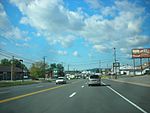
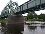
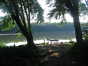
From top: Golden Strip; Railroad bridge over Loyalsock Creek
|
|
| Nickname(s):
Sock Township, Sock, The Sock
|
|
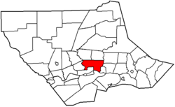
Location within Lycoming County
|
|
| Country | |
| State | |
| County | Lycoming |
| Settled | 1768 |
| Incorporated | 1786 |
| Area | |
| • Total | 21.50 sq mi (55.67 km2) |
| • Land | 21.15 sq mi (54.78 km2) |
| • Water | 0.34 sq mi (0.89 km2) |
| Elevation | 1,770 ft (524 m) |
| Population
(2020)
|
|
| • Total | 11,561 |
| • Density | 521.03/sq mi (203.50/km2) |
| Time zone | Eastern (EST) |
| • Summer (DST) | EDT |
| Area code(s) | 570 |
| FIPS code | 42-081-45224 |
Loyalsock Township is a community located in Lycoming County, Pennsylvania, United States. It's known as a "township," which is a type of local government area. In 2020, about 11,561 people lived here. It's part of the larger Williamsport area and is the second-biggest community in Lycoming County by population, right after Williamsport itself.
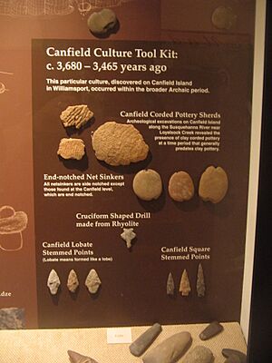
This area was first settled in 1768 and became an official township in 1786. It sits on the north side of the West Branch Susquehanna River. You can often find old Native American items in parks near the river. Experts have discovered over 1,500 pieces of Native American pottery, tools, and other artifacts here. Some of these are on display in big cities like Philadelphia and New York City, but most can be seen in local museums in nearby Williamsport.
Contents
Exploring Loyalsock Township's Past
Loyalsock Township was created in February 1786 from a larger area called Muncy Township. This happened nine years before Lycoming County was even formed! Originally, the township was bordered by the West Branch Susquehanna River to the south, Loyalsock Creek to the east, and Lycoming Creek to the west.
Life During the American Revolutionary War
During the American Revolutionary War, communities in the Susquehanna valley, including what would become Loyalsock Township, faced attacks. These attacks came from people loyal to the British (called Loyalists) and Native American groups who were allies with the British. After a big battle and massacre in 1778 near what is now Wilkes-Barre, many settlers in the West Branch Susquehanna valley became very scared. This event was called the "Big Runaway."
People left their homes and farms, taking their animals and a few belongings on rafts down the river. They fled south to safer towns like Muncy and Sunbury. The attackers then burned the abandoned homes and fields. Some settlers bravely returned later, but they had to flee again in 1779 during the "Little Runaway." A military effort called Sullivan's Expedition helped make the area safer, encouraging people to move back after the war ended.
Early Industries: The McKinney Iron Works
Between 1825 and 1830, Isaac and William McKinney built the McKinney Iron Works in the western part of Loyalsock Township. They started with a forge, which is a place where metal is heated and shaped. Later, they added an iron furnace in 1836 and a rolling mill in 1841. Iron ore was brought from another county down the river and up Lycoming Creek to their factory. However, their business didn't last, and the iron works was mostly destroyed by a flood in 1865.
The Underground Railroad and Daniel Hughes
Daniel Hughes was an important person in the Underground Railroad in Loyalsock Township. The Underground Railroad was a secret network that helped enslaved people escape to freedom. Daniel Hughes owned a barge (a flat-bottomed boat) on the Pennsylvania Canal. He used it to transport lumber down the river. On his way back up the river, he would hide runaway slaves in the bottom of his barge. He then gave them shelter at his home near Williamsport before they continued their journey north to freedom, often in Canada.
Loyalsock Township Today
Today, the flat area between Williamsport and Montoursville is a busy place with many homes and a shopping area. This shopping area is known as the "Golden Strip" along East Third Street. The northern and western parts of the township are less crowded but still have many family homes and small businesses. The population of Loyalsock Township has continued to grow over the years.
Geography and Weather in Loyalsock Township
Loyalsock Township is located in the south-central part of Lycoming County. It shares borders with several other communities. To the southeast, it borders Montoursville, and to the east, it borders Fairfield Township. These eastern borders are formed by Loyalsock Creek, which flows into the West Branch Susquehanna River at the township's southeastern corner.
The township is bordered by the West Branch Susquehanna River and Williamsport to the south. Lycoming Creek forms the western border of the township. The most populated part of the township is in the south, where you'll find communities like Faxon and Kenmar.
Loyalsock Township is about 85 miles north of Harrisburg, which is Pennsylvania's capital. It's also about 160 miles northwest of Philadelphia.
According to the United States Census Bureau, the township covers a total area of about 21.5 square miles (55.7 square kilometers). Most of this area, about 21.15 square miles (54.8 square kilometers), is land. The rest, about 0.34 square miles (0.89 square kilometers), is water.
Local Weather Patterns
| Climate data for Williamsport Regional Airport, Pennsylvania (1981–2010 normals, extremes 1895–present) | |||||||||||||
|---|---|---|---|---|---|---|---|---|---|---|---|---|---|
| Month | Jan | Feb | Mar | Apr | May | Jun | Jul | Aug | Sep | Oct | Nov | Dec | Year |
| Record high °F (°C) | 70 (21) |
71 (22) |
87 (31) |
96 (36) |
96 (36) |
104 (40) |
106 (41) |
103 (39) |
102 (39) |
93 (34) |
83 (28) |
70 (21) |
106 (41) |
| Mean daily maximum °F (°C) | 34.2 (1.2) |
38.0 (3.3) |
47.9 (8.8) |
60.9 (16.1) |
71.5 (21.9) |
79.7 (26.5) |
83.6 (28.7) |
81.6 (27.6) |
73.5 (23.1) |
62.0 (16.7) |
49.9 (9.9) |
38.1 (3.4) |
60.1 (15.6) |
| Mean daily minimum °F (°C) | 19.3 (−7.1) |
21.4 (−5.9) |
28.6 (−1.9) |
38.9 (3.8) |
47.9 (8.8) |
57.6 (14.2) |
61.9 (16.6) |
60.7 (15.9) |
53.1 (11.7) |
41.5 (5.3) |
33.3 (0.7) |
24.3 (−4.3) |
40.7 (4.8) |
| Record low °F (°C) | −20 (−29) |
−18 (−28) |
−5 (−21) |
8 (−13) |
28 (−2) |
36 (2) |
43 (6) |
38 (3) |
28 (−2) |
19 (−7) |
3 (−16) |
−15 (−26) |
−20 (−29) |
| Average precipitation inches (mm) | 2.70 (69) |
2.34 (59) |
2.97 (75) |
3.24 (82) |
3.66 (93) |
3.92 (100) |
4.34 (110) |
3.86 (98) |
4.16 (106) |
3.42 (87) |
3.74 (95) |
2.93 (74) |
41.28 (1,048) |
| Average snowfall inches (cm) | 10.5 (27) |
8.8 (22) |
6.9 (18) |
1.1 (2.8) |
0 (0) |
0 (0) |
0 (0) |
0 (0) |
0 (0) |
0.1 (0.25) |
1.7 (4.3) |
6.9 (18) |
36.0 (91) |
| Average precipitation days (≥ 0.01 in) | 11.0 | 9.7 | 11.5 | 11.6 | 13.3 | 11.9 | 11.4 | 10.3 | 10.0 | 10.3 | 11.0 | 10.8 | 132.8 |
| Average snowy days (≥ 0.1 in) | 7.4 | 5.6 | 3.5 | 0.7 | 0 | 0 | 0 | 0 | 0 | 0.1 | 1.3 | 5.3 | 23.9 |
| Source: NOAA | |||||||||||||
Understanding the Population of Loyalsock Township
| Historical population | |||
|---|---|---|---|
| Census | Pop. | %± | |
| 1890 | 769 | — | |
| 1900 | 2,567 | 233.8% | |
| 1910 | 4,765 | 85.6% | |
| 1920 | 5,498 | 15.4% | |
| 1930 | 8,949 | 62.8% | |
| 1940 | 9,698 | 8.4% | |
| 1950 | 10,071 | 3.8% | |
| 1960 | 10,103 | 0.3% | |
| 1970 | 9,765 | −3.3% | |
| 1980 | 9,987 | 2.3% | |
| 1990 | 10,019 | 0.3% | |
| 2000 | 10,876 | 8.6% | |
| 2010 | 11,026 | 1.4% | |
| 2020 | 11,561 | 4.9% | |
| 2021 (est.) | 11,506 | 4.4% | |
| U.S. Decennial Census | |||
In 2000, there were 10,876 people living in Loyalsock Township. These people lived in about 4,501 households. The average household had about 2.25 people.
The population included people of all ages. About 20.7% of the residents were under 18 years old. About 29.4% were 65 years old or older. The average age of people in the township was 47 years.
Getting Around Loyalsock Township
Main Roads and Highways
 - Interstate 180
- East Third Street
- Washington Boulevard
- Four Mile Drive
- Northway Road
- Lycoming Creek Road
- Warrensville Road
- Poco Farm Road
- Bloomingrove Road
The southern part of Loyalsock Township is crossed by Interstate 180. This major highway has two exits (Exits 25 and 23) that lead into the township. I-180 goes west about 4 miles to Williamsport. It also goes southeast about 25 miles to Interstate 80 near Milton. U.S. Route 220 also runs along I-180 through the township.
The township has several other important roads. East Third Street starts in Williamsport and goes to the eastern border with Montoursville. Northway Road begins at I-180 and goes north. Four Mile Drive stretches from Williamsport to Warrensville Road. This road has both businesses and homes, and it's where Donald E. Schick Elementary School and Divine Providence Hospital are located.
Travel by Air and Rail
The Williamsport Regional Airport (KIPT/IPT) is located in the neighboring community of Montoursville. As of late 2021, there were no commercial airline services from this airport.
The Lycoming Valley Railroad runs along the West Branch Susquehanna River, which forms the southern border of the township.
Economy: Jobs in Loyalsock Township
Top Employers in the Area
| # | Employer | # of Employees |
|---|---|---|
| 1 | Loyalsock School District | 209 |
| 2 | Loyalsock Township | 189 |
| 3 | Liberty Mutual | 111 |
| 4 | Valley Farms Dairy | 83 |
| 5 | UPMC Susquehanna Divine Providence | 49 |
Education: Learning in Loyalsock Township
The Loyalsock Township School District includes a high school, a middle school, and an elementary school. These schools are known for their good test scores and well-prepared teachers.
The schools in the district are:
- Donald E. Schick Elementary (formerly Four Mile Elementary)
- Loyalsock Township Middle School
- Loyalsock Township High School
The school district's mascot is a lancer, and the school colors are maroon and white. In 2021, the boy's varsity basketball team won the PIAA Class AAA State Championship, which is a big achievement!
Notable People from Loyalsock Township
Here are some well-known people who have lived in or are from Loyalsock Township:
- Pat Daneker, a former Major League Baseball pitcher
- Bob Farley, a former MLB outfielder
- Dylan Rockoff, a singer
- Jeff Wheeland, a politician
- Tom Woodruff Jr., an actor
- Gene Yaw, a politician
See also
 In Spanish: Municipio de Loyalsock para niños
 | Emma Amos |
 | Edward Mitchell Bannister |
 | Larry D. Alexander |
 | Ernie Barnes |


