Malinche (volcano) facts for kids
Quick facts for kids La Malinche |
|
|---|---|
| Matlalcueye | |
 |
|
| Highest point | |
| Elevation | 4,461 m (14,636 ft) |
| Prominence | 1,920 m (6,300 ft) |
| Listing |
|
| Geography | |
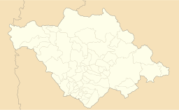
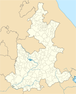
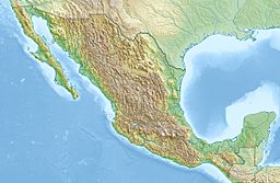
| Location | Tlaxcala / Puebla, Mexico |
| Parent range | Cordillera Anahuac |
| Geology | |
| Mountain type | stratovolcano |
| Volcanic arc/belt | Trans-Mexican Volcanic Belt |
| Last eruption | 1170 BCE ± 50 years |
| Climbing | |
| Easiest route | hiking trail |
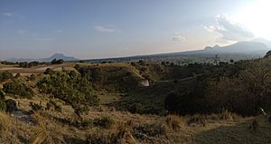
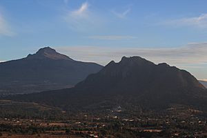
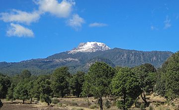
La Malinche, also known as Matlalcueye or Malintzin, is an active volcano in Mexico. It has been sleeping for about 3,100 years. This amazing mountain is found in the states of Tlaxcala and Puebla.
The top of La Malinche is officially 4,461 metres (14,636 ft) above sea level. However, many people think it's closer to 4,440 metres (14,567 ft) when measured with GPS. It is the highest point in Tlaxcala. It's also the fifth-highest peak in Puebla and the sixth-highest in all of Mexico. In North America, it ranks as the 23rd highest mountain.
La Malinche is quite tall compared to nearby cities. It rises 1,908 metres (6,260 ft) above Huamantla. It's 2,461 metres (8,074 ft) above Villa Vicente Guerrero. From Tlaxcala, it's 2,221 metres (7,287 ft) tall. And from Puebla, it's 2,299 metres (7,543 ft) high. The summit is about 22.4 kilometres (13.9 mi) from Tlaxcala and 28.3 kilometres (17.6 mi) from Puebla. It's also 118 kilometres (73 mi) away from Mexico City. The weather near the top is cold, but the lower parts of the mountain are mild.
The Tlaxcaltec people called this peak Matlalcueitl. This name means "Lady of the Blue Skirt." They believed she was a goddess of rain and song. She was like their version of the goddess Chalchiuhtlicue. The Spanish explorers first called it Sierra de Tlaxcala, which means "Tlaxcalan Range." The name Malinche or Malintzin became popular later, in the 1600s. This name honors the woman who helped Hernán Cortés as an interpreter. She played a key role during the Spanish conquest of the Aztec Empire.
Contents
Where is La Malinche Located?
La Malinche is found inside the Parque Nacional La Malinche. This park sits on the border between the Tlaxcala and Puebla states. The volcano is part of a larger chain of volcanoes called the Trans-Mexican Volcanic Belt.
The park is the fifth largest of Mexico's 85 peaks. It covers a huge area of 458.52 square kilometres (177.04 sq mi). About two-thirds of this land is in Tlaxcala, and one-third is in Puebla. The park is roughly 24 kilometres (15 mi) wide.
How La Malinche Formed
La Malinche is an active stratovolcano. This type of volcano is built up by many layers of hardened lava and ash. It started forming a very long time ago, about 30 to 35 million years ago. Since then, it has grown bigger through many eruptions. The last eruption is thought to have happened around 3,100 years ago.
It doesn't look like a perfect cone-shaped volcano. Instead, it has several smaller peaks around it. Some of these side peaks include Tlachichihuatzi (4,100 metres (13,500 ft)), Xaltonalli (3,890 metres (12,760 ft)), and Chicomecanoa (3,650 metres (11,980 ft)). La Malinche also has two very steep slopes. One is Barranca Axaltzintle to the northeast, which might be an old crater. The other is Barranca Axal to the south-southeast. La Malinche stands mostly by itself, separate from other mountain ranges. Some nearby hills and mountains are El Pinal (3,280 metres (10,760 ft)), El Tintero (2,920 metres (9,580 ft)), Cuatlapanga (2,900 metres (9,500 ft)), Huintitépetl (2,890 metres (9,480 ft)), and Xalapasco (2,750 metres (9,020 ft)).
Plants, Animals, and Climate
The lower slopes of La Malinche are used for farming, mainly growing corn. Higher up, you'll find forests with different types of trees. These include alders, various kinds of oak, Montezuma pines, and sacred firs. As you go even higher, the trees give way to zacatonal, which is a type of grassland.
The very top of the mountain gets snow for part of the year. It's known as the coldest place in Tlaxcala. On the lower slopes, the weather is mild all year. However, it rains a lot during the summer months. The soil on La Malinche is made of crushed volcanic rock and sand. Underneath this, there's a layer of clay and sand called tepetate. The dark, spongy forest soils were formed from volcanic ash.
Many streams flow down from La Malinche in all directions. They create small valleys that fill up quickly when heavy rains happen. At the base of the mountain, many springs appear. Some of these springs have fresh, drinkable water. Others are thermal water springs, heated by the volcano's warmth deep inside.
Legends of La Malinche
Like other famous Mexican volcanoes such as Popocatépetl and Iztaccíhuatl, La Malinche has its own legends. These stories explain how the mountain came to be.
The most famous legend tells of a young woman named Matlalcueye. She was engaged to a warrior named Cuatlapanga. Cuatlapanga had to go to a faraway battle. He was gone for so long that Matlalcueye became very sad and eventually died of heartbreak. When the warrior finally returned, badly hurt, he heard the sad news. He went to cry at her grave and also passed away. The legend says he turned into a small mountain. Matlalcueye then became the huge volcano, with the smaller Cuatlapanga by her side.
Another legend about the mountain talks about a reptilian monster. This creature supposedly lived inside the mountain. It would come down during the rainy season to take children. It would carry them up the mountain to eat them. The story says that eventually, the beast was killed. Its head was placed above the entrance of a house in Puebla. This house is said to still stand today at 201 East Third Street in the city's historic area.
Fun Activities at La Malinche
The park has a special resort area at 3,080 metres (10,105 ft) called "Centro Vacacional Malintzin." Here, you can find cabins and places to camp. It's a great spot to get used to the high altitude before climbing the volcano. The resort also has sports facilities, a restaurant, and a gift shop. Outside the resort, there's a small convenience store and a restaurant that sells local snacks called "antojitos." On weekends, you can even ride horses and llamas!
A road goes past the resort area and continues partway up the mountain, winding back and forth. A hiking trail to the summit starts at the resort. It crosses the road several times at the beginning. The trail then goes into a forest of pine trees around 3,400 metres (11,155 ft). The tree line, where trees stop growing, is at 3,900 metres (12,795 ft). From here, you can see what looks like the summit for the first time. After the tree line, a very steep grassy section begins. The ridge starts at 4,200 metres (13,780 ft) and leads to the true summit, which is just behind the "false" summit you saw earlier. The last 100 meters or so involve a bit of scrambling, which means using your hands to climb over rocks.
Above the tree line, it's often very cold and windy, so warm clothes are a must. If it has snowed recently (which happens a few times from December to March), you will need Crampons (spikes for your boots) and an ice axe. Otherwise, the climb is challenging but doesn't require special climbing skills. Fit hikers can reach the top from the resort in 3–4 hours. However, it's best to plan for 5–6 hours, including breaks. It's always a good idea to start early in the morning and be back down before sunset. The local police will tell hikers not to go above the tree line after 2 p.m.
There are also more difficult routes to the summit. These start from nearby towns like Huamantla, Ixtenco, San Juan Tepulco, and San Miguel Canoa. A film called Canoa by director Felipe Cazals was made about an event that happened in San Miguel Canoa.
See also
 In Spanish: La Malinche (volcán) para niños
- List of mountain peaks of North America
- List of mountain peaks of Mexico
- List of volcanoes in Mexico
- List of Ultras of Mexico
 | Ernest Everett Just |
 | Mary Jackson |
 | Emmett Chappelle |
 | Marie Maynard Daly |


