Marblehead, Ohio facts for kids
Quick facts for kids
Marblehead, Ohio
|
|
|---|---|
|
Village
|
|

|
|

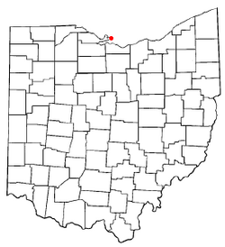
Location of Marblehead, Ohio
|
|

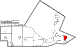
Location of Marblehead in Ottawa County
|
|
| Country | United States |
| State | Ohio |
| County | Ottawa |
| Township | Danbury |
| Area | |
| • Total | 4.16 sq mi (10.77 km2) |
| • Land | 3.17 sq mi (8.21 km2) |
| • Water | 0.99 sq mi (2.56 km2) |
| Elevation | 594 ft (181 m) |
| Population
(2020)
|
|
| • Total | 865 |
| • Density | 272.87/sq mi (105.35/km2) |
| Time zone | UTC-5 (Eastern (EST)) |
| • Summer (DST) | UTC-4 (EDT) |
| ZIP code |
43440
|
| Area code(s) | 419 |
| FIPS code | 39-47502 |
| GNIS feature ID | 2399252 |
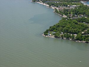
Marblehead is a small village in Ottawa County, Ohio, United States. In 2020, about 865 people lived there. It is located at the very end of the Marblehead Peninsula. This peninsula separates Lake Erie from Sandusky Bay.
Marblehead is a very popular place for tourists. Many people visit in the summer months. It is part of an area called "Vacationland." This area also includes nearby Sandusky and the Lake Erie Islands. People love Marblehead for its beautiful lake views and easy access to the islands by ferry. It's also great for fishing. The Cedar Point amusement park is close by, too.
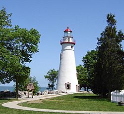
The village is home to the Marblehead Lighthouse. This lighthouse is the oldest one still working on the American side of the Great Lakes. It is part of the Marblehead Lighthouse State Park. Marblehead also has a United States Coast Guard station. Near Marblehead, in Sandusky Bay, is Johnson's Island. This island was a prison camp for Confederate officers during the Civil War.
Marblehead is also important for its limestone production. Limestone is a type of rock used in building. It is dug up from quarries nearby. Then, it is moved by conveyor belt to a loading dock. From there, it is loaded onto large ships called lake freighters. These ships carry the limestone across the Great Lakes.
Contents
Exploring Marblehead's Location and Landscape
Marblehead is a village with a total area of about 4.31 square miles (11.16 square kilometers). Most of this area, about 3.31 square miles (8.57 square kilometers), is land. The rest, about 1.00 square mile (2.59 square kilometers), is water.
Weather and Seasons in Marblehead
Marblehead has a climate with four clear seasons: spring, summer, fall, and winter. This is common for places near the Great Lakes. Lake Erie helps to make the weather milder. For example, fall temperatures are often warmer than inland areas. Spring temperatures tend to be cooler. In winter, Lake Erie usually freezes over. This means the lake has less effect on the winter weather.
The warmest month in Marblehead is July. The average temperature is about 73.2°F (22.9°C). January is the coldest month. The average temperature then is about 24.6°F (-4.1°C). February is usually the driest month. It gets about 1.7 inches (44 mm) of rain. June is the wettest month. It gets about 3.7 inches (94 mm) of rain on average.
| Climate data for Marblehead, Ohio [Historical Weather Data (1982-2012)] | |||||||||||||
|---|---|---|---|---|---|---|---|---|---|---|---|---|---|
| Month | Jan | Feb | Mar | Apr | May | Jun | Jul | Aug | Sep | Oct | Nov | Dec | Year |
| Mean daily maximum °F | 31.8 | 34.2 | 43.9 | 56.3 | 67.8 | 78.1 | 82.4 | 80.8 | 74.1 | 62.4 | 48.9 | 36.7 | 58.1 |
| Daily mean °F | 24.6 | 26.6 | 36.0 | 47.5 | 58.6 | 68.9 | 73.2 | 71.8 | 64.8 | 53.2 | 41.7 | 30.2 | 49.8 |
| Mean daily minimum °F | 17.6 | 19.0 | 28.0 | 38.7 | 49.6 | 59.7 | 64.2 | 62.8 | 55.6 | 44.2 | 34.5 | 23.9 | 41.5 |
| Average precipitation inches | 1.9 | 1.7 | 2.6 | 3.1 | 3.3 | 3.7 | 3.5 | 3.5 | 3.1 | 2.2 | 2.8 | 2.6 | 34 |
| Mean daily maximum °C | −0.1 | 1.2 | 6.6 | 13.5 | 19.9 | 25.6 | 28 | 27.1 | 23.4 | 16.9 | 9.4 | 2.6 | 14.5 |
| Daily mean °C | −4.1 | −3.0 | 2.2 | 8.6 | 14.8 | 20.5 | 22.9 | 22.1 | 18.2 | 11.8 | 5.4 | −1.0 | 9.9 |
| Mean daily minimum °C | −8.0 | −7.2 | −2.2 | 3.7 | 9.8 | 15.4 | 17.9 | 17.1 | 13.1 | 6.8 | 1.4 | −4.5 | 5.3 |
| Average precipitation mm | 49 | 44 | 66 | 79 | 85 | 94 | 89 | 88 | 78 | 56 | 72 | 66 | 866 |
People and Population in Marblehead
| Historical population | |||
|---|---|---|---|
| Census | Pop. | %± | |
| 1900 | 997 | — | |
| 1910 | 1,172 | 17.6% | |
| 1920 | 1,048 | −10.6% | |
| 1930 | 1,027 | −2.0% | |
| 1940 | 915 | −10.9% | |
| 1950 | 867 | −5.2% | |
| 1960 | 858 | −1.0% | |
| 1970 | 726 | −15.4% | |
| 1980 | 679 | −6.5% | |
| 1990 | 745 | 9.7% | |
| 2000 | 762 | 2.3% | |
| 2010 | 903 | 18.5% | |
| 2020 | 865 | −4.2% | |
| U.S. Decennial Census | |||
In 2010, there were 903 people living in Marblehead. These people lived in 417 households. About 285 of these were families. The village had about 272.8 people per square mile (105.3 per square kilometer). There were 942 homes in total.
Most of the people in Marblehead were White (98.7%). A small number were African American (0.2%), Native American (0.1%), or Asian (0.3%). Some people were from other races (0.1%) or from two or more races (0.6%). About 1.7% of the population was Hispanic or Latino.
In 2010, about 18% of households had children under 18 living with them. Most households (60.2%) were married couples. About 15.8% of households had someone living alone who was 65 years old or older. The average household had 2.17 people. The average family had 2.57 people. The average age in the village was 55.7 years old.
Marblehead's Economy and Tourism
Marblehead's economy is strong because it is right on the lake. Fishing, boating, and tourism are very important jobs for many people. Marblehead and the areas around it are known as "Vacationland." This is because so many tourists visit.
Big attractions like Cedar Point amusement park, Put-in-Bay, and Kelleys Island bring many visitors. Marblehead is the main port for the Kelleys Island Ferry. This ferry takes people and cars to Kelleys Island. Other popular spots nearby include Lakeside Chautauqua and Bay Point Resort. Many people from Toledo, Cleveland, and Columbus own summer homes in Marblehead. They visit during the tourist season.
Mining limestone is also a big part of Marblehead's economy. The Lafarge Quarry is located on the peninsula. It mines limestone and moves it to the Marblehead loading dock. This makes Marblehead a major producer of limestone in the area.
Schools and Learning in Marblehead
Marblehead is served by the Danbury Local School District. This district also serves nearby Danbury Township. The district has three schools:
- Danbury Elementary School
- Danbury Middle School
- Danbury High School
The village also has a library. It is called the Marblehead Peninsula Branch of the Ida Rupp Public Library System.
Media and News in Marblehead
Marblehead is part of the Sandusky and Lake Erie Islands radio market. It is also part of the Toledo TV market.
You can listen to local news and sports on WPCR - PortClintonRadio.com. This is an internet radio station. It shares live local sports, weather, and fishing reports.
For print news, Marblehead is served by The Beacon and the Port Clinton News-Herald. These newspapers cover Ottawa County. The village is also covered by the Sandusky Register, which is the biggest newspaper in the region.
See also
 In Spanish: Marblehead (Ohio) para niños
 | Aurelia Browder |
 | Nannie Helen Burroughs |
 | Michelle Alexander |


