McFaulds Lake facts for kids
Quick facts for kids McFaulds Lake |
|
|---|---|
| Location | Kenora District, Ontario |
| Coordinates | 52°46′06″N 86°03′26″W / 52.76833°N 86.05722°W |
| Part of | James Bay drainage basin |
| Primary outflows | Unnamed stream to Attawapiskat River |
| Basin countries | Canada |
| Max. length | 6 kilometres (3.7 mi) |
| Max. width | 2.4 kilometres (1.5 mi) |
| Surface elevation | 158 metres (518 ft) |
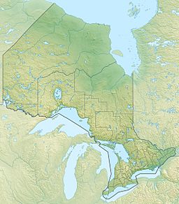
McFaulds Lake is a lake in Ontario, Canada. It's in the northwestern part of the province, in a place called the Kenora District. This lake is part of a big water system that eventually flows into James Bay. Water flows into McFaulds Lake from two small streams. The main stream flowing out of the lake goes into the Attawapiskat River. This river then carries the water all the way to James Bay.
Discovering McFaulds Lake's Geology
McFaulds Lake sits in a special area called the Northern Ontario Ring of Fire. This region has a lot of geological activity. Over time, this activity has created many valuable minerals. These minerals are found deep under the ground, hidden beneath a swampy area called muskeg. Some of the minerals found here include nickel, copper, platinum, palladium, chromite, vanadium, diamond, and gold.
Mining Exploration Near the Lake
Because of all these valuable minerals, many mining companies are interested in the area around McFaulds Lake. Since 2002, about 20 companies have started looking for minerals here. They often work together in partnerships. While they have found many minerals, they haven't started digging them out yet.
First Nations and Mining
Local First Nations communities are also involved in the mining exploration. These communities include the Webequie First Nation and the Marten Falls First Nation. They play an important role in how these projects move forward.
 | John T. Biggers |
 | Thomas Blackshear |
 | Mark Bradford |
 | Beverly Buchanan |


