York city walls facts for kids
Quick facts for kids York city walls |
|
|---|---|
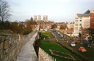
View of the city, looking north-east from the city wall, near the railway station. The brown spire at left in the middle distance is the Oratory Church of Saint Wilfrid, and the three towers of York Minster are visible behind
|
|
| Type | Fortification |
| Location | York, England |
| Area | 2.11 miles (3.40 kilometres) |
| Built | 13th-14th century |
| Original use | Urban defence |
| Restored | 19th century |
| Current use | Open as a museum |
| Architectural style(s) | Medieval, Gothic Revival |
| Owner | City of York Council |
| Website | www.york.gov.uk/CityWalls |
|
Listed Building – Grade I
|
|
| Official name: Bootham Bar City Wall from Bootham Bar to Layerthorpe, Monk Bar, Robin Hoods Tower | |
| Designated | 14 June 1954 |
| Reference no. | 1259293 |
| Official name: York Minster Cathedral Precinct: including Bootham Bar and the length of City Walls extending round the precinct up to Monk Bar | |
| Designated | 8 October 1937 |
| Reference no. | 1017777 |
| Official name: City Walls, gates, posterns, moats, mounds, Bayle (or Baile) Hill, St Leonard's Hospital and Merchant Taylor's Hall, Aldwark | |
| Designated | April 1922 |
| Reference no. | 1004910 |
| Lua error in Module:Location_map at line 420: attempt to index field 'wikibase' (a nil value). | |
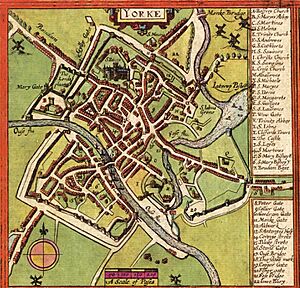
The York City Walls are ancient defensive walls that surround the city of York in England. People have been building walls around York since Roman times. Today, York has more miles of its old city walls still standing than any other city in England.
These walls are also known as the Bar Walls. Sometimes, people call them the Roman walls, but this isn't quite right. Most of what you see today was built much later, and the path of the walls has changed a lot since Roman times. The walls are usually about 13 feet (4 meters) high and 6 feet (1.8 meters) wide. They are the longest town walls in England.
Contents
History of York's Walls
Roman Walls: The Beginning
The first walls were built around 71 AD by the Romans. They built a large fort, called a castra, covering about 50 acres (21.5 hectares) near the River Ouse. These walls were part of the fort's defenses.
Today, you can still see parts of these Roman walls. Their foundations and path make up about half of the current city walls. For example:
- There's a section in the Museum Gardens, including the Multangular Tower.
- Parts of the walls between Bootham Bar and Monk Bar follow the old Roman line.
- Near the Merchant Taylors' Hall, you can see the lower parts of the Roman wall.
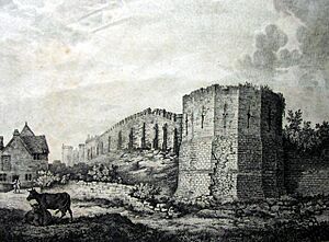
The Multangular Tower
The Multangular Tower in the Museum Gardens is the best-preserved part of the Roman walls. It was one of eight similar towers built for defense. While the main Roman walls were likely built by Septimius Severus, the Multangular Tower was probably added later by Constantine the Great around 310–320 AD.
This tower has ten sides, making it look very strong and unique. It stands almost 30 feet (9 meters) tall. The walls are thick, made of rubble and mortar with smooth ashlar stone blocks on the outside. About 15 feet (4.5 meters) up, the wall gets a bit thinner. The top 11 feet (3.3 meters) were rebuilt in the 13th century, and you can see narrow openings called arrowslits there.
After the Romans: Medieval Defenses
The Danes took over York in 867. By then, the Roman defenses were in bad shape. The Danes tore down most of the Roman towers, but they kept and repaired the Multangular Tower and the walls.
Most of the walls you see today were built much later, between the 13th and 14th centuries. These walls go all the way around the medieval city. From the old Roman walls, the medieval wall stretches to Layerthorpe Bridge. After this bridge, the King's Fishpool, a swamp created by the Normans' damming of the River Foss, protected the city. Because of this natural barrier, no walls were built in that area.
In the Middle Ages, the city's defense also included a rampart (a raised bank of earth) under the walls and a deep ditch around them. This ditch was once 60 feet (18.3 meters) wide and 10 feet (3 meters) deep. Today, most of the ditch has been filled in, so the ground around the walls is higher than it used to be.
The walls start again at the Red Tower, a brick building that has been repaired many times. They continue south and west around the Walmgate area, ending at another tower called Fishergate Postern. This tower is near York Castle, which had its own walls and a moat (a deep, wide ditch, often filled with water).
A short section of wall on the west side of Tower Gardens ends at Davy Tower, another brick tower by the River Ouse. This section originally connected to the castle walls.
Across the Ouse, the walls pick up again at Skeldergate. They go past Baile Hill, turn right, and head north-west. Near the railway station, they turn right again, going north-east, and finish at Barker Tower on the Ouse. Barker Tower used to be connected to Lendal Tower by a chain across the river. A small piece of wall then leads to the Museum Gardens, the Multangular Tower, and the original Roman wall line.
The walls were repaired during the English Civil War and later during the Jacobite risings because people worried about invasions.
In the Victorian period, the walls were restored after they had fallen into disrepair. The Victorians made the wall-walk wider and extended it in some places, like where you can see views of the cathedral. Before, some parts might have only had narrow ledges. They also rebuilt the battlements (the notched top parts of the wall) and sometimes the very tops of the walls. Some small holes, called musket loops, from the 17th century, where muskets could be fired, are still visible. Most of the stone blocks with gaps between them, called merlons, that you see along the walls were added by the Victorians. However, a few older ones still remain. One notable addition was the Robin Hood Tower, built in 1889.
Today, the walls are a protected historic site, known as a scheduled ancient monument and a Grade I listed building.
The Bars: Gates of York
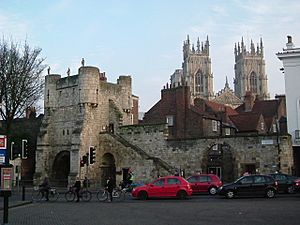
The walls have four main gatehouses, called 'bars'. These gates controlled traffic in medieval times. They were used to collect tolls (money for using the road) and were important defensive spots during wars.
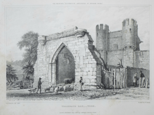
Bootham Bar
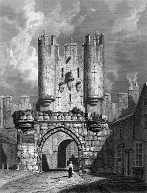
Most of Bootham Bar was built in the 14th and 19th centuries. However, it also has some of the oldest stonework, dating back to the 11th century. It stands near where a Roman gate once was. Its name, "barram de Bootham," means "bar at the booths," referring to nearby market stalls. It was the last of the bars to lose its barbican (an outer defensive work), which was removed in 1835.
Monk Bar
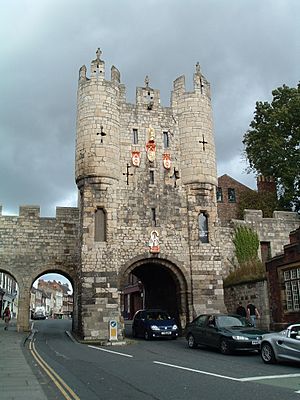
This gatehouse has four floors, making it the tallest and most detailed of the four main bars. It was built in the early 14th century. It was designed to be like a small, self-contained fort, with each floor able to be defended on its own. It replaced an older 12th-century gate. Monk Bar used to house a museum and still has its portcullis (a heavy, vertically closing gate) that can be lowered.
Walmgate Bar
Walmgate Bar was mostly built in the 14th century, but its inner gateway is from the 12th century. Its most special feature is its barbican, which is the only one still standing on a town gate in England. It also has its original portcullis and new 15th-century oak doors. On the inside, an Elizabethan house, built in 1584, extends over the gateway. People lived in this house until 1957.
The Bar has been repaired many times. It was damaged in 1648 after being hit by cannons during the 1644 Siege of York in the English Civil War. It was also damaged in 1489 when rebels burned it during riots over taxes.
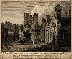
Micklegate Bar
The name Micklegate comes from an Old Norse phrase meaning "great road." This four-story gatehouse was the traditional ceremonial entrance for kings and queens entering the city. A tradition, started by Richard II in 1389, says that monarchs must touch the state sword when they enter this gate.
The lower part of the gate was built in the 12th century, and the upper floors in the 14th. Its original barbican was removed in 1826. At least six kings and queens have passed through this gate. Because of its importance, the heads of traitors were sometimes displayed on its defenses in the past.
People lived in the upper two floors of the Bar until the 20th century. Today, these living quarters are a museum called the City Walls Experience at Micklegate Bar. The Bar was fully restored in late 2017.
Minor Bars: Smaller Gates
Besides the four main bars, there are two smaller ones.
Fishergate Bar
This Bar was first built around 1315. It was bricked up after riots in 1489 but was reopened in 1827. Today, it allows people to walk through the walls between the Fishergate area and George Street.
Victoria Bar
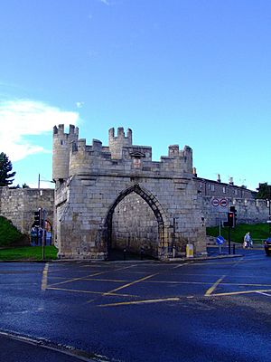
As its name suggests, Victoria Bar was added to the walls in the 19th century. It opened in 1838 to create a direct path between Nunnery Lane and Bishophill. During its construction, workers found the remains of an even older gateway underneath it. This was likely a small entrance from early medieval times that was later blocked up.
See also
- List of town walls in England and Wales
- History of York
- Eboracum
- Museum Gardens
- Siege of York


