Mo'orea facts for kids
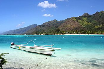
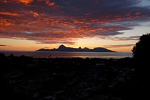
View of Moʻorea
|
|
 |
|
| Geography | |
|---|---|
| Location | Pacific Ocean |
| Coordinates | 17°32′S 149°50′W / 17.533°S 149.833°W |
| Archipelago | Society Islands |
| Area | 134 km2 (52 sq mi) |
| Highest elevation | 1,207 m (3,960 ft) |
| Highest point | Mont Tohiveʻa |
| Administration | |
|
France
|
|
| Overseas collectivity | French Polynesia |
| Administrative subdivision | Windward Islands |
| Commune | Moʻorea-Maiʻao |
| Capital city | ʻĀfareaitu |
| Largest settlement | Pao Pao–Maharepa (4,244 inhabitants) |
| Demographics | |
| Population | 16,191 (Aug. 2007 census) |
| Pop. density | 121 /km2 (313 /sq mi) |
| Official name: Lagon de Moʻorea | |
| Designated: | 15 September 2008 |
| Reference #: | 1834 |
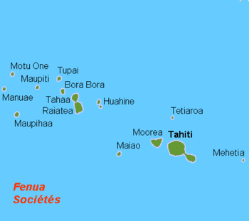
Moʻorea (also spelled Moorea) is a beautiful volcanic island in French Polynesia. It's part of the Society Islands, located about 17 kilometers (10.5 miles) northwest of Tahiti. The name Moʻorea comes from the Tahitian language and means "yellow lizard." Long ago, it was also known as ʻAimeho or Eimeo. Early European visitors sometimes called it York Island or Santo Domingo.
Contents
History of Moʻorea
Who lived in Moʻorea first?
Archaeologists believe that people first settled the Society Islands, including Moʻorea, around 200 CE. These early settlers likely came from islands like Samoa and Tonga.
The island was divided into nine main areas, each with its own groups of families. Society was organized with leaders who held both political and religious power. Important families on Moʻorea often married into families from the nearby island of Tahiti. These connections sometimes led to strong friendships, but also to conflicts.
Scientists have studied the Opunohu Valley for many years to understand how Moʻorean society changed over time. They found that as more people lived on the island, they changed the environment, which then led to changes in how society was organized.
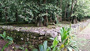
Early on, before 1000 CE, people cleared land for farming. Later, between 1000 and 1650 CE, they built terraces on hillsides for farming and simple stone buildings like the Marae Tapauruʻuru. The remains of different types of houses show that society became more organized with different levels of importance.
From 1650 to 1788 CE, a group called the Marama tribe took control of the Opunohu Valley. They united all the other groups under their rule. During this time, more people lived on the island, and they built large religious structures called marae, which looked like step pyramids.
When did Europeans arrive?
The first European to see Moʻorea was Pedro Fernandes de Queirós in 1606. Later, in the 18th century, English explorers Samuel Wallis and James Cook visited. Captain Cook first landed on Tahiti before coming to Moʻorea. He landed in ʻŌpūnohu Bay, and later, another bay was named Cook's Bay in his honor. A Spanish sailor, Domingo de Bonechea, visited in 1774 and called the island Santo Domingo.
The island was also visited by the United States Exploring Expedition in 1839.
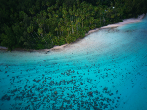
Charles Darwin, a famous scientist, was inspired by Moʻorea when he saw it from Tahiti. He described it as a "picture in a frame," referring to the coral reef that surrounds the island. This observation helped him develop his ideas about how coral atolls form.
In 1967, the Moʻorea Airport was finished, making it easier for people to travel to the island.
Geography of Moʻorea
Moʻorea was formed by a volcano about 1.5 to 2.5 million years ago. It's thought that the island's beautiful bays were once river valleys that filled with water as sea levels rose.
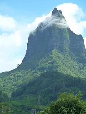
The island is about 16 kilometers (10 miles) wide. On its north side, there are two large, almost identical bays. The western one is called ʻŌpūnohu Bay. The eastern one is Cook's Bay, also known as Pao Pao Bay. The highest point on the island is Mount Tohivea, which is in the center of Moʻorea. You can see it clearly from both bays and even from Tahiti. There are also hiking trails in the mountains.
What is Moʻorea's climate like?
Moʻorea is in the Earth's tropical zone. This means it has a warm and very humid climate, which helps the island's plants grow lush and green. The average temperature stays around 28 to 30 °C (82-86 °F) throughout the year. The wettest months are from December to February, while July to September are drier. There's usually a steady wind that helps keep temperatures comfortable.
How many people live in Moʻorea?
In 2017, Moʻorea had a population of 17,718 people. These residents live in different areas like Afareaitu, Haʻapiti, Paopao, Papetōʻai, and Teavaro. Moʻorea, along with a smaller island called Maiʻao, forms a single local government area called Moʻorea-Maiʻao.
What are the famous bays of Moʻorea?
One of the most famous sights on Moʻorea is Cook's Bay. It's a deep blue bay where cruise ships often anchor. With white sailing yachts and the 830-meter-high Mount Mouaputa in the background, it's a very popular spot for photos. Next to it is Opunohu Bay, which was used for filming parts of the 1984 movie The Bounty.
A winding road connects these two bays. In the Opunohu Valley, ancient Polynesians built many worship platforms called marae. You can still find the remains of these religious sites along the road, and some are marked for visitors. Marae Titiroa is surrounded by banyan trees and was rebuilt in the 1960s. The road also leads to the Belvédère lookout, which offers amazing views of Mount Rotui, Cook Bay, and Opunohu Bay.
What plants and animals live in Moʻorea?
Moʻorea's flora (plants) are similar to those on Tahiti because the islands are close and have similar climates and soil. Along the coast, where many people live, you'll find plants that humans have introduced or changed. However, in the untouched parts of the island's interior, there are still many original plant communities.
The University of California, Berkeley has a research center on Moʻorea called Gump Station. Scientists there study the amazing variety of life in the tropics and how human activities affect the environment. From 2008 to 2010, the Moʻorea Biocode project tried to identify and record every visible plant, animal, and fungus on the island. They collected samples, photos, and genetic information for over 5,700 species!
Originally, there were no land mammals on the Society Islands. Early Polynesian settlers brought dogs, pigs, and chickens for food, as well as the Polynesian rat. Later, Europeans introduced goats, cows, sheep, and horses. The native land animals are mostly insects, land crabs, snails, and lizards.
Sadly, some unique species that lived only on Moʻorea have disappeared. For example, many Polynesian tree snails were wiped out after the rosy wolf snail was brought to the island in 1977. However, some of these snails have been reintroduced to the island. The Moorea reed warbler, a type of songbird, was last seen in the 1980s and is now extinct. Another bird, the Moorea sandpiper, is only known from two specimens found in 1777.
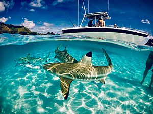
There are no animals on Moʻorea that are dangerous to humans. However, you might find sand fleas on the beach and mosquitoes inland. The ocean around Moʻorea is full of life! In the lagoon and on the coral reef, you can see over 500 types of coral fish, along with many mollusks, starfish, and crustaceans. Beyond the reef, there are sharks, rays, swordfish, and sea turtles. From July to October, humpback whales pass by the island, and tourists can go on tours to watch them and dolphins.
Politics and Government
Moʻorea is part of the commune (municipality) of Moʻorea-Maiʻao. This commune is part of the Windward Islands administrative area within French Polynesia. The main village on Moʻorea is ʻĀfareaitu. The largest village is Pao Pao, located at the bottom of Cook's Bay, and the second largest is Maharepa.
Economy and Tourism
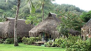
Moʻorea is one of the most popular places for tourists to visit in French Polynesia. It has several fancy resorts and is especially popular for honeymoons. Some travel guides have even called it "the most beautiful island in the world."
Tourism has been the main source of income for Moʻorea since the 1960s. The first luxury hotel, the Bali Shark Hotel, was built in 1961. Since then, more and more tourists have visited, and Moʻorea now has many hotels. Most hotels are on the north and northwest coasts. Many beaches on the northwest coast belong to hotels and are not open to everyone. However, there is a public beach in Temaʻe, near the airport.
Cruise ships also visit Moʻorea. For tourists, a traditional Polynesian village called Tiki Village has been rebuilt on the west coast. Here, visitors can watch dance performances, see Polynesian crafts being made, and buy souvenirs.
Moʻorea also hosts two international sporting events: the Moʻorea Marathon in February and the Aitoman Triathlon in October.
What is grown in Moʻorea?
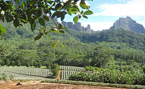
In the past, coffee was grown on Moʻorea, but it's not profitable anymore. Now, farmers mainly grow pineapples and Tahitian vanilla for export. Some small family farms still make copra (dried coconut meat) in the traditional way. For local use and hotels, people grow breadfruit, yams, taro, sweet potatoes, bananas, coconuts, and other tropical fruits. Fishing is also important, though it's becoming less common.
Research and Study Centers
The University of California, Berkeley has a research station on Moʻorea called the Richard B. Gump South Pacific Research Station. This station is also home to the Moʻorea Coral Reef Long Term Ecological Research Site (MCR LTER), which studies long-term changes in the coral reef ecosystem.
The French École pratique des hautes études (EPHE) and the Centre national de la recherche scientifique (CNRS) also have a research station at the end of ʻŌpūnohu Bay. This center studies island environments and monitors coral reefs and fish populations throughout French Polynesia.
Religion in Moʻorea
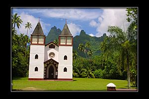
Most people on Moʻorea are Christian. This is because European missionaries came to the island long ago. Both the Catholic Church and various Protestant groups have churches on the island. The Catholic Church has four churches and a religious center, all managed by the Archdiocese of Papeʻete, which is based on Tahiti.
Near Afareaitu, you can find Moʻorea's oldest worship platform, the Marae Umarea. It was built around 900 CE with large coral slabs right by the lagoon.
Transportation to Moʻorea
You can travel to Moʻorea from Papeʻete, the capital of Tahiti, by ferry. Several ferries go to the Vaiʻare wharf in Moʻorea every day. Moʻorea's Temaʻe Airport also has flights connecting to the international airport in Papeʻete and other Society Islands. There is one main road that goes all the way around the island.
See also
 In Spanish: Moorea para niños
- List of volcanoes in French Polynesia
- Society Islands
- Windward Islands (Society Islands)
 | Aaron Henry |
 | T. R. M. Howard |
 | Jesse Jackson |


