Mount Erebus (Canada) facts for kids
Quick facts for kids Mount Erebus |
|
|---|---|

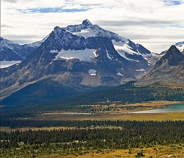
Mount Erebus behind outlier Outpost Peak
|
|
| Highest point | |
| Elevation | 3,112 m (10,210 ft) |
| Prominence | 722 m (2,369 ft) |
| Parent peak | Mount Fraser (3313 m) |
| Listing | Mountains of Alberta |
| Geography | |
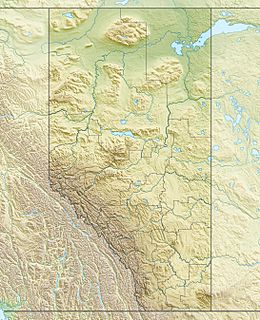
| Location | Jasper National Park Alberta, Canada |
| Parent range | Park Ranges Canadian Rockies |
| Topo map | NTS 83D/09 |
| Geology | |
| Age of rock | Cambrian |
| Type of rock | Sedimentary rock |
| Climbing | |
| First ascent | 1924 by L. Coolidge, G. Higginsnon, J.E. Johnson, A. Streich |
Mount Erebus is a mountain that stands 3,112-metre (10,210-foot) tall. It is found near the beautiful Tonquin Valley in Jasper National Park, Alberta, Canada. This area is very popular for mountain lovers!
Mount Erebus is made of sedimentary rock. This type of rock forms from layers of sand, mud, and tiny bits of plants and animals that get pressed together over a very long time. The rock in Mount Erebus was formed during the Cambrian period, which was hundreds of millions of years ago. Later, huge forces pushed these rocks upwards and eastwards, creating the mountain we see today.
The closest higher mountain to Mount Erebus is Mount Fraser, which is about 4.0 km (2.5 mi) to the northwest. The Continental Divide, which separates rivers flowing to the Pacific Ocean from those flowing to the Atlantic or Arctic oceans, is about 3 km (1.9 mi) to the west. Other nearby peaks include Angle Peak to the southeast and The Ramparts to the north. The northern part of Mount Erebus ends at a smaller peak called Outpost Peak.
Contents
History of Mount Erebus
How Mount Erebus Got Its Name
The name "Mount Erebus" was given to the mountain in 1916 by Morrison P. Bridgland. He was a Dominion Land Surveyor, which means he was a person who measured and mapped land for the government. Bridgland named many mountains in Jasper Park and the Canadian Rockies.
He was very impressed by the dark cliffs on the northeast side of Mount Erebus. The word erebus comes from ancient Greek and means darkness. Bridgland also knew about a famous ship called HMS Erebus and the Franklin's lost expedition, which was a journey that went missing. It's interesting that Mount Erebus is located near the Tonquin Valley, which is also named after another ship, Tonquin, that had a sad ending.
First Climbers and Official Name
The first time anyone successfully climbed Mount Erebus was in 1924. The climbers were L. Coolidge, G. Higginsnon, J. E. Johnson, and their guide, A. Streich.
The mountain's name became official in 1935. This happened when the Geographical Names Board of Canada approved it.
Climate and Glaciers
Weather Conditions on Mount Erebus
Mount Erebus is in a subarctic climate zone. This means it has very cold winters with lots of snow, and mild summers. Temperatures can drop below −20 °C (−4 °F) (which is −4 °F (−20 °C)), and with the wind chill, it can feel even colder, sometimes below −30 °C (−22 °F) (or −22 °F (−30 °C)).
Glaciers and Water Flow
Because of the cold climate, Mount Erebus has glaciers. The Fraser Glacier is on its northwest side, and the Eremite Glacier is on its northeast side.
If you want to climb Mount Erebus, the best months to do so are usually July and August, when the weather is more favorable. The water from the melting snow and ice on Mount Erebus flows into the Astoria River and the Whirlpool River. Both of these rivers then flow into the larger Athabasca River.
 | Misty Copeland |
 | Raven Wilkinson |
 | Debra Austin |
 | Aesha Ash |


