Mount Whiteface facts for kids
Quick facts for kids Mount Whiteface |
|
|---|---|
 |
|
| Highest point | |
| Elevation | 4,019 ft (1,225 m) |
| Prominence | 590 ft (180 m) |
| Listing | White Mountain 4000-Footers |
| Geography | |
| Location | Grafton County, New Hampshire, U.S. |
| Parent range | Sandwich Range |
| Topo map | USGS Mount Tripyramid |
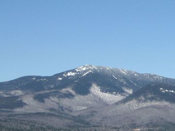
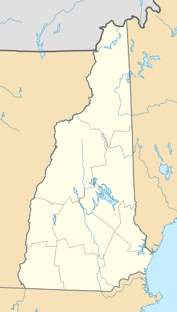
Mount Whiteface is a tall mountain in New Hampshire, standing at 4,019 ft (1,225 m). It is located in Grafton County. This mountain is part of the Sandwich Range, which is a section of the larger White Mountains.
Mount Whiteface has other mountains nearby. To its northwest is Mount Tripyramid. To its northeast is Mount Passaconaway. Mount Whiteface is also on the eastern edge of the Sandwich Range Wilderness area. East of Whiteface, Passaconaway, and Mt. Wonalancet, you can find a special natural area called The Bowl. This area is a natural bowl-shaped valley that has never been logged.
The water from Mount Whiteface flows into the Saco River. This river eventually reaches the Gulf of Maine in Saco, Maine. Water from the south side of Whiteface flows into the Whiteface River. This then joins other rivers like the Cold River, Bearcamp River, and Ossipee River, all leading to the Saco River. The east side of the mountain drains into the Wonalancet River, then the Swift River, and finally the Bearcamp River. Water from the north side goes into Downes Brook, then another Swift River, and eventually the Saco River.
The very top of Mount Whiteface is covered in trees. It's found along the Rollins Trail. This true summit is about .3 miles (0.5 km) north of a huge granite cliff. Many hikers reach the open area at the top of this cliff. They might not realize the actual summit is a bit further north. The summit is a popular spot for climbers, especially in winter. Many prefer to use the Blueberry Ledge trail to reach the top.
Contents
Exploring Mount Whiteface: A Look at Its History
Mount Whiteface has a rich history, especially concerning how people have explored and used its trails over the years.
Early Trails and Exploration
People have been building paths to the summit of Mount Whiteface for a long time.
- In the 1850s, the first official trail to the summit was built. It was called the McCrillis trail.
- In 1871, the US Coast Survey set up a special signal station on the summit. This helped them with mapping and surveying the area.
- In 1875, a famous poet named Lucy Larcom visited the summit. She was so inspired that she wrote a poem about her experience there.
- In 1895, Thomas S. Wiggin created another path to the summit. This new trail, known as the Wiggin trail, branched off from the Dicey's Mill Trail.
- In 1899, Gordon H. Taylor marked out the Blueberry Ledge Trail. This trail became very useful for people who enjoyed snowshoeing in the winter.
Protecting The Bowl Natural Area
The Bowl is a special natural area near Mount Whiteface. It has been protected for many years.
- In 1914, The Bowl was officially added to the White Mountain National Forest (WMNF). This helped to protect its unique environment.
- In 1931, The Bowl was given an even more special status. It was named a Research Natural Area. This means it's a place where scientists can study nature without human interference.
Creating the Sandwich Range Wilderness
Protecting the wild areas around Mount Whiteface has been an important goal.
- In 1984, the United States Congress created the Sandwich Range Wilderness. This important act included Mount Whiteface and helped to preserve its natural beauty and wildlife.
Recent Changes on the Mountain
Sometimes, things on the mountain change over time.
- In 2002, two camps, Camp Shehadi and Camp Heermance, were removed. They had become too old and damaged to be used safely.
 | Selma Burke |
 | Pauline Powell Burns |
 | Frederick J. Brown |
 | Robert Blackburn |


